DOGAMI Interpretive Map Series
[Go back] | Publications Center | DOGAMI Home
Publication Preview
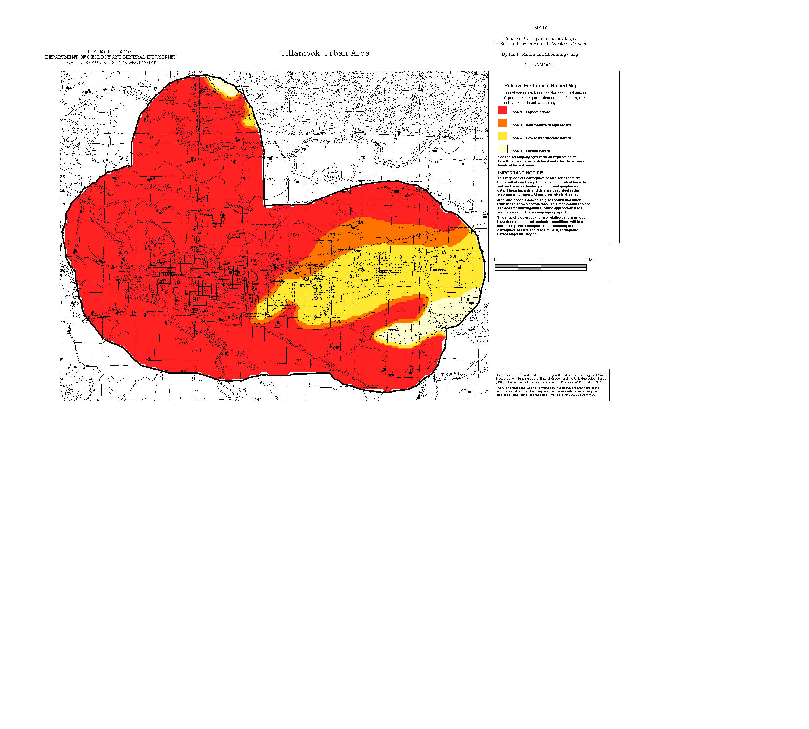
 IMS-10, Relative earthquake hazard maps for selected coastal communities in Oregon: Astoria-Warrenton, Brookings, Coquille, Florence-Dunes City, Lincoln City, Newport, Reedsport-Winchester Bay, Seaside-Gearhart-Cannon Beach, Tillamook, by Ian P. Madin and Zhenming Wang, 1999, 25 p., 1:24,000. Zip file contains explanatory text, metadata, map sheets, and GIS files.
readme.txt (accompanies CD-ROM version of publication)
metadata.txt
explanatory text (pdf)
Maps (jpg format):
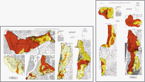
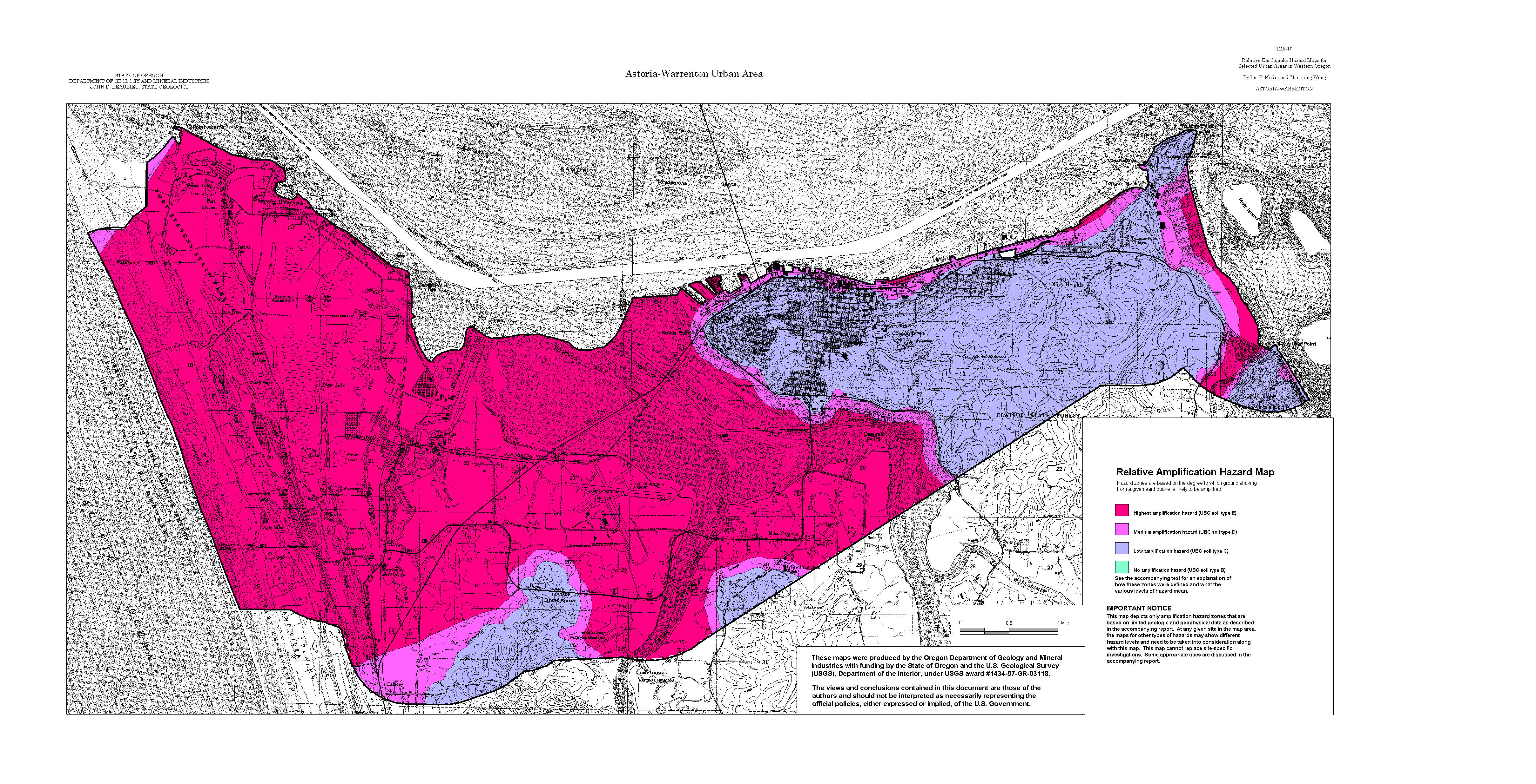
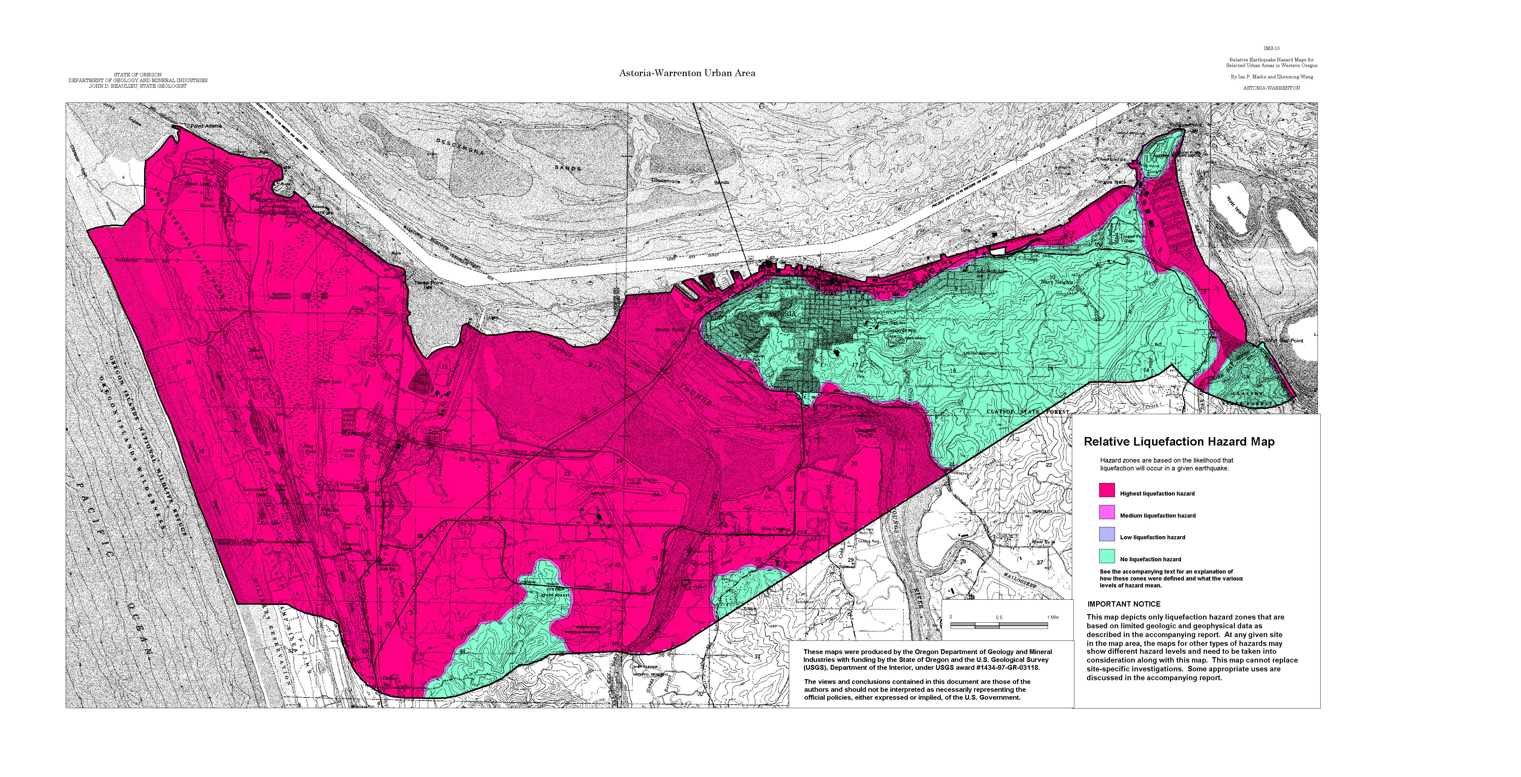
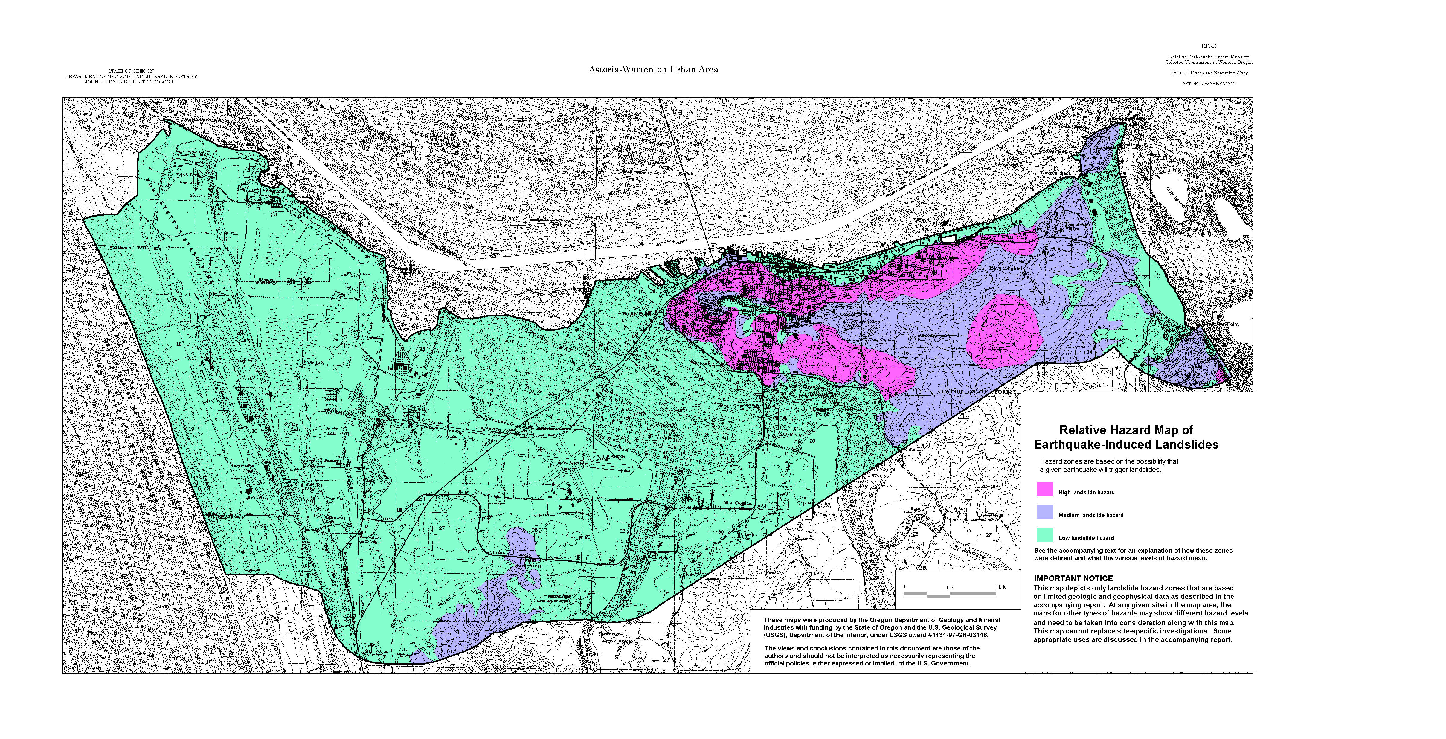
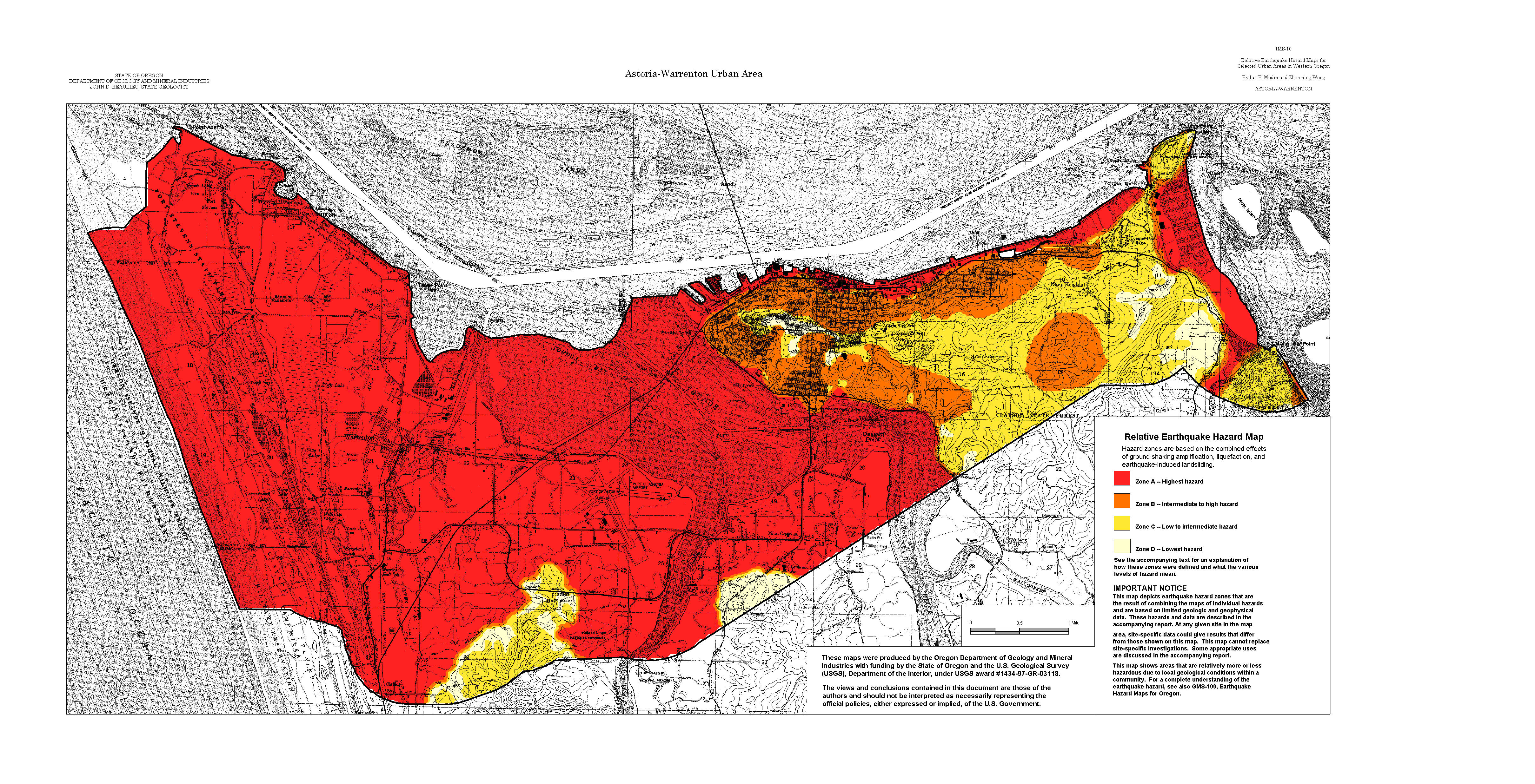
Astoria-Warrenton: Amplification, Liquefaction, Landslide, Relative Hazard
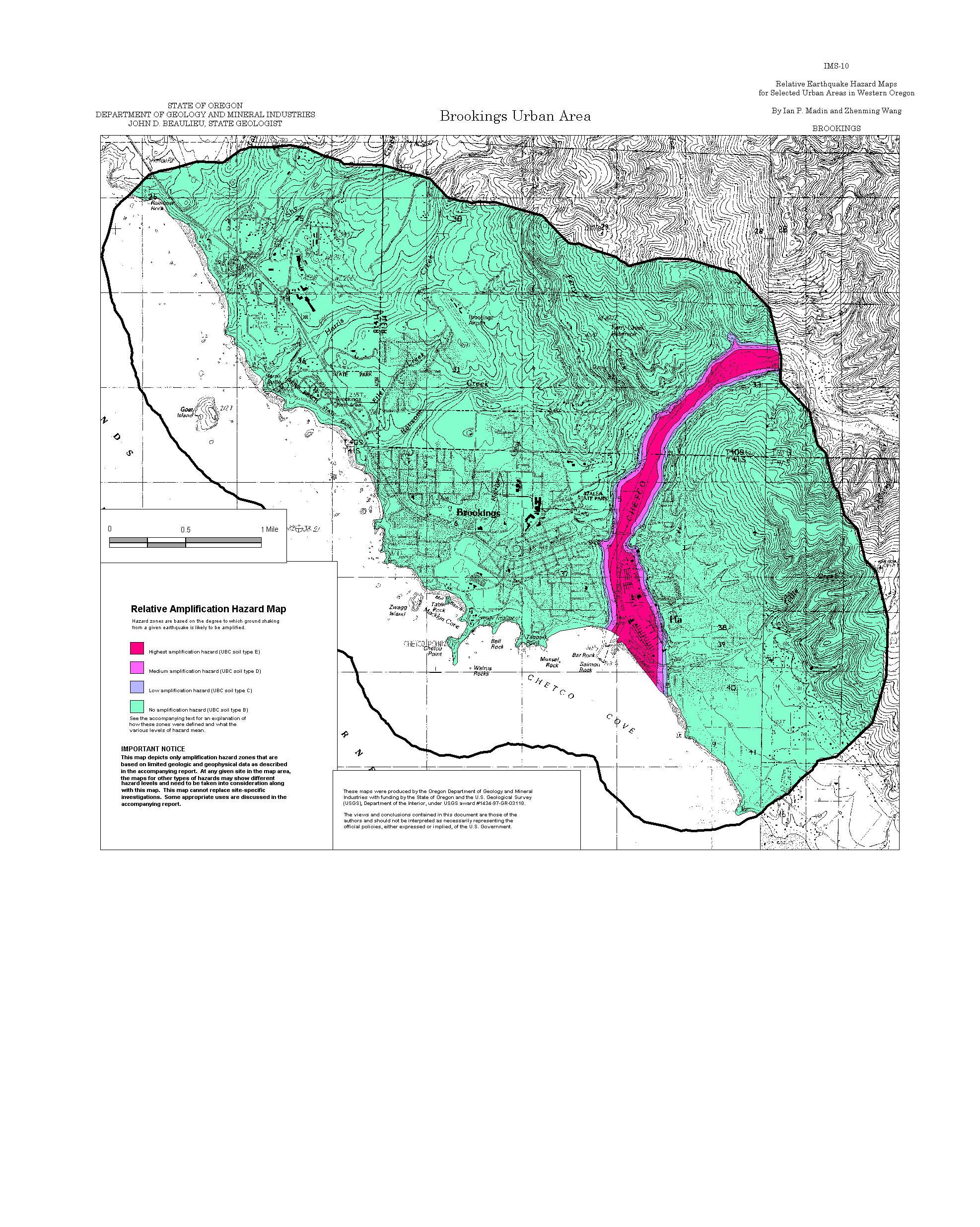
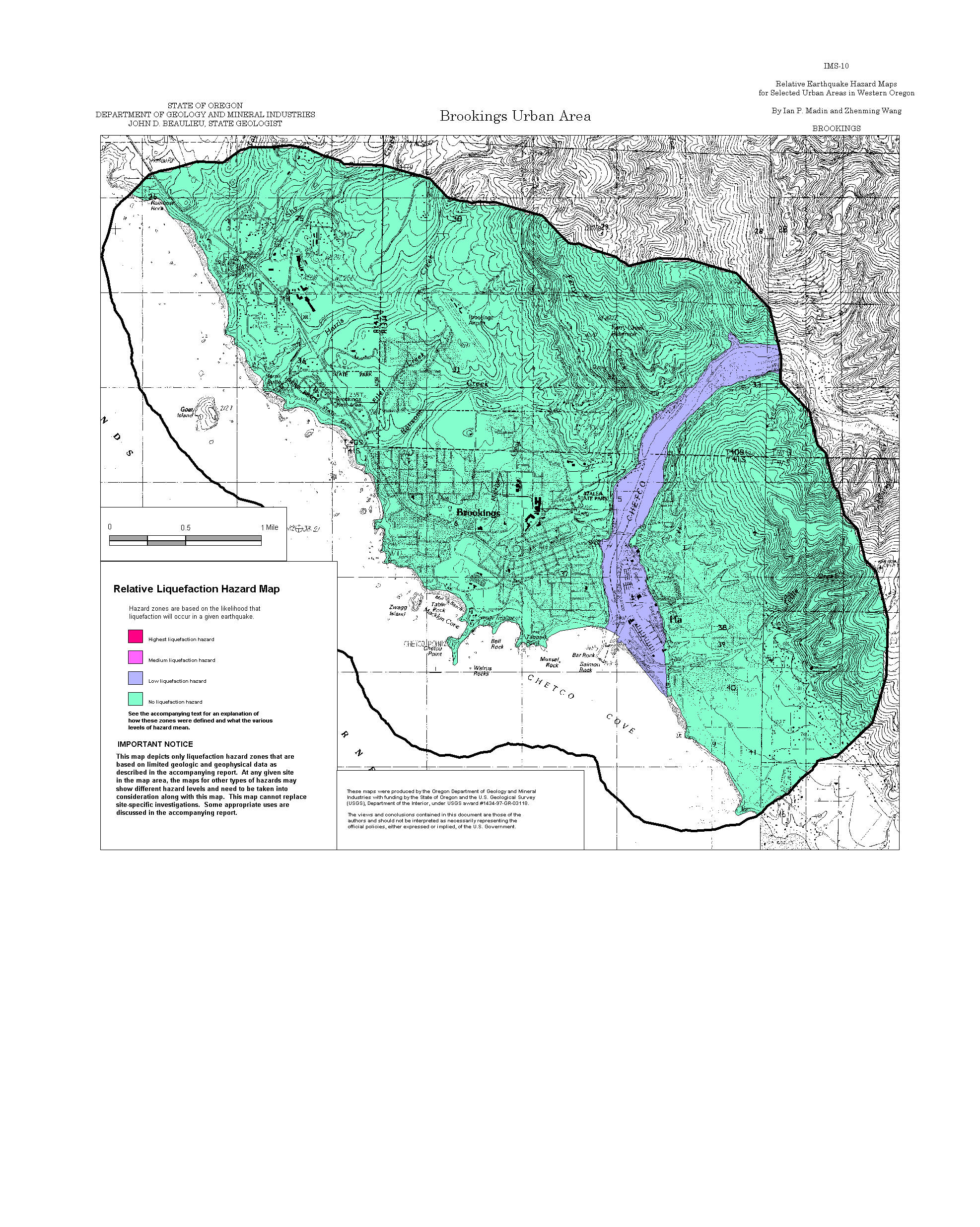
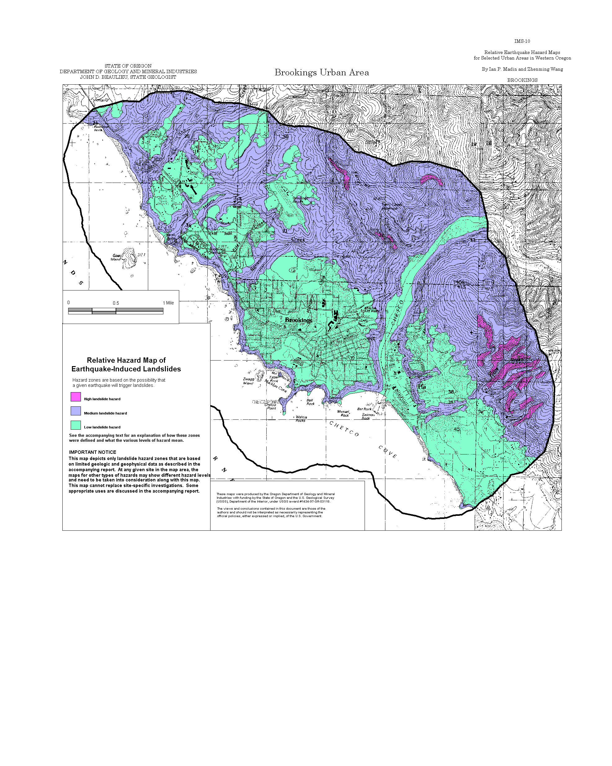
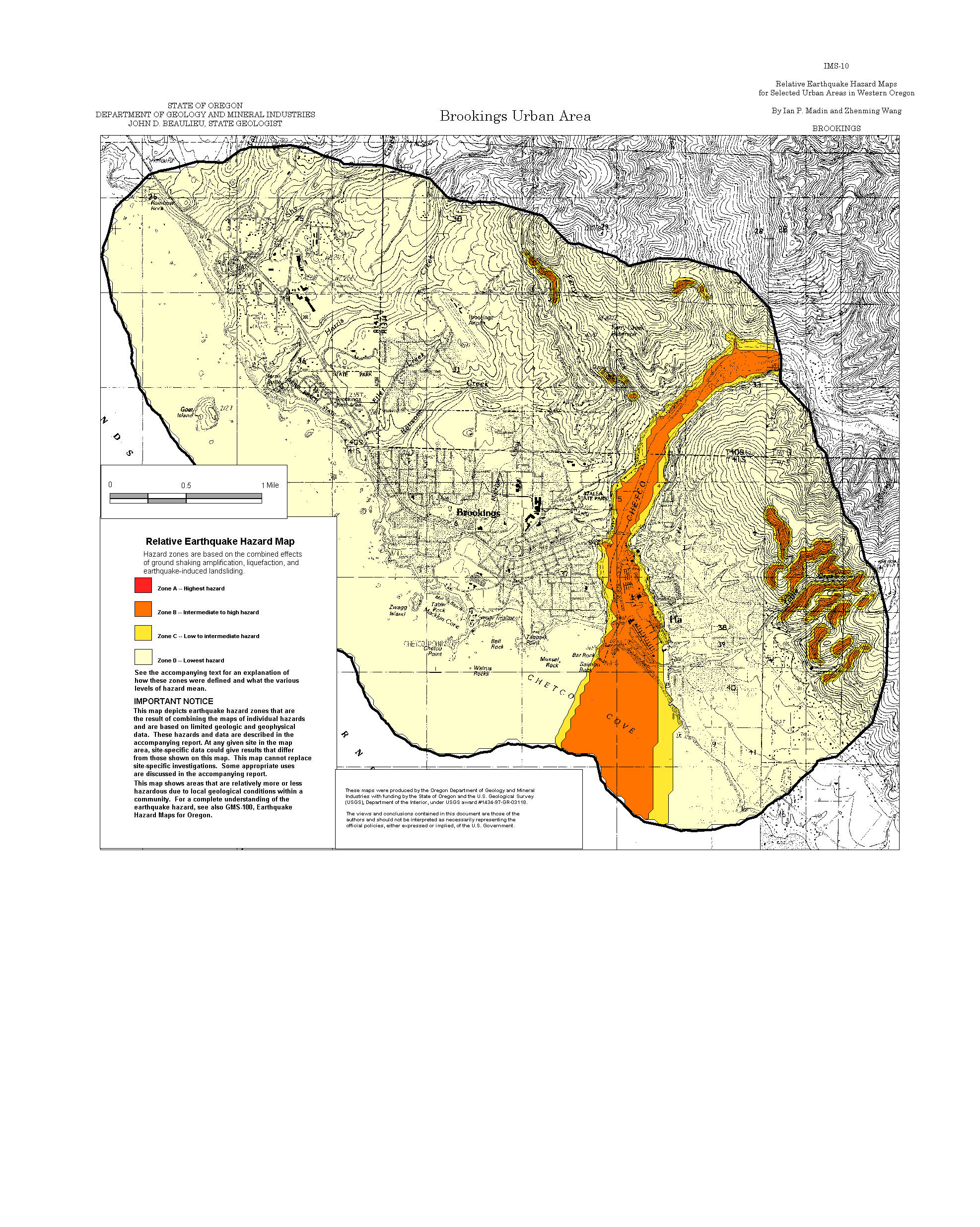
Brookings: Amplification, Liquefaction, Landslide, Relative Hazard
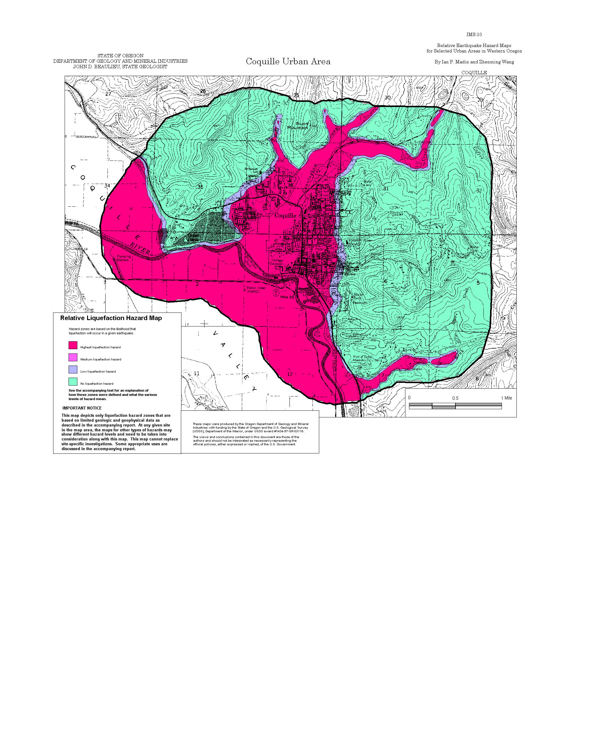
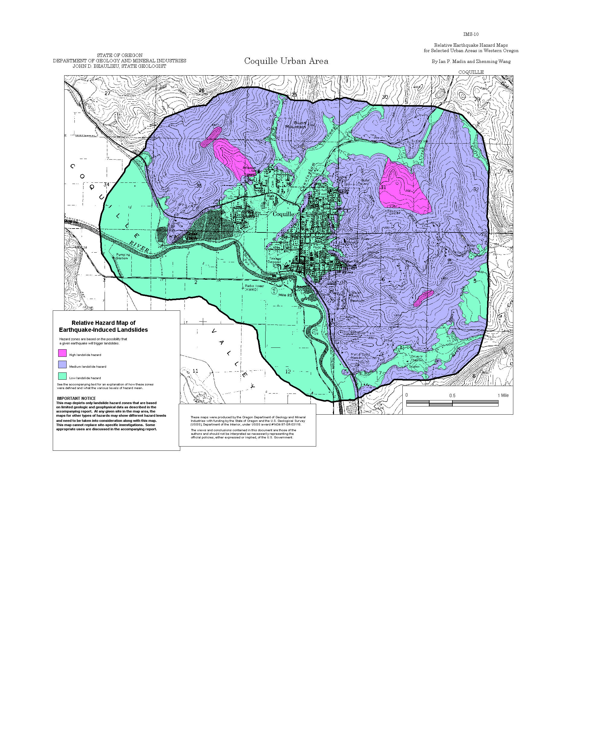
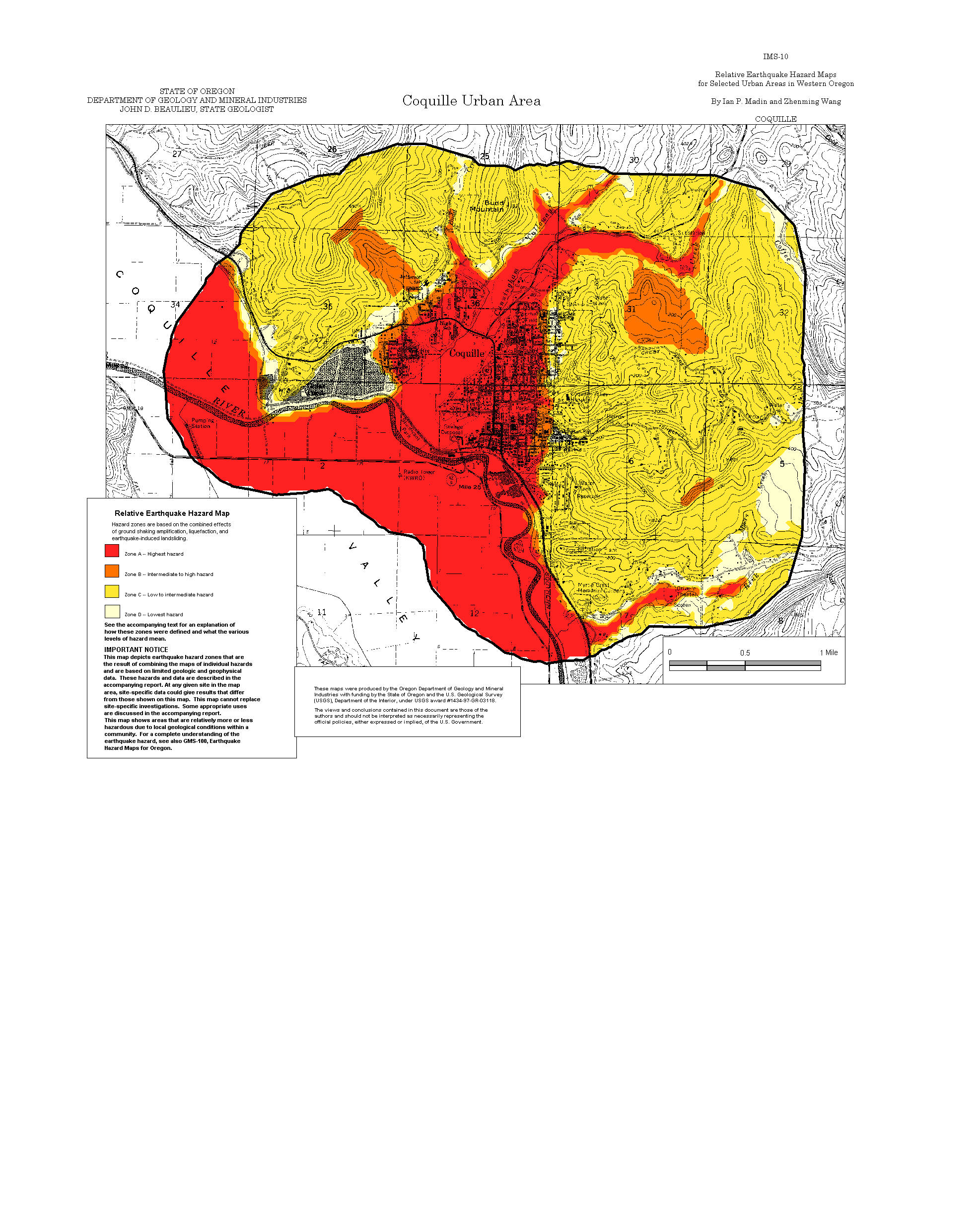
Coquille: Amplification, Liquefaction, Landslide, Relative Hazard
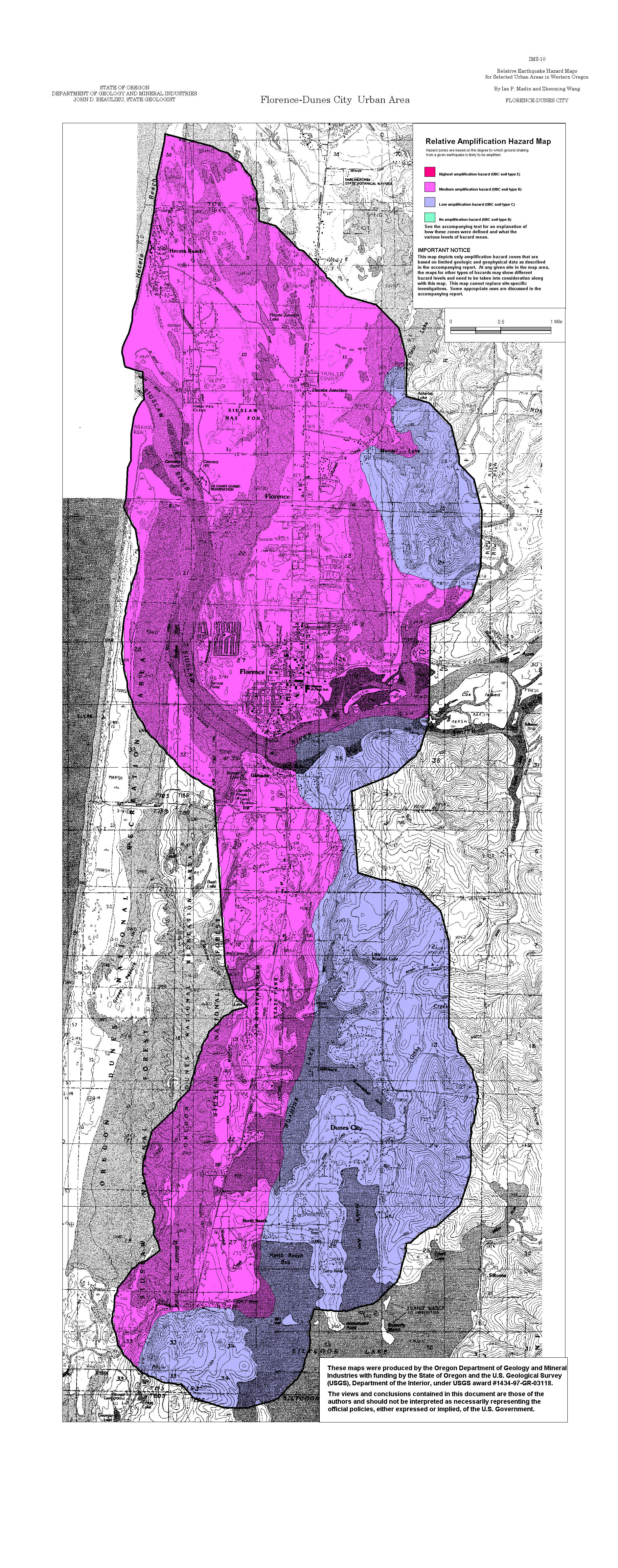
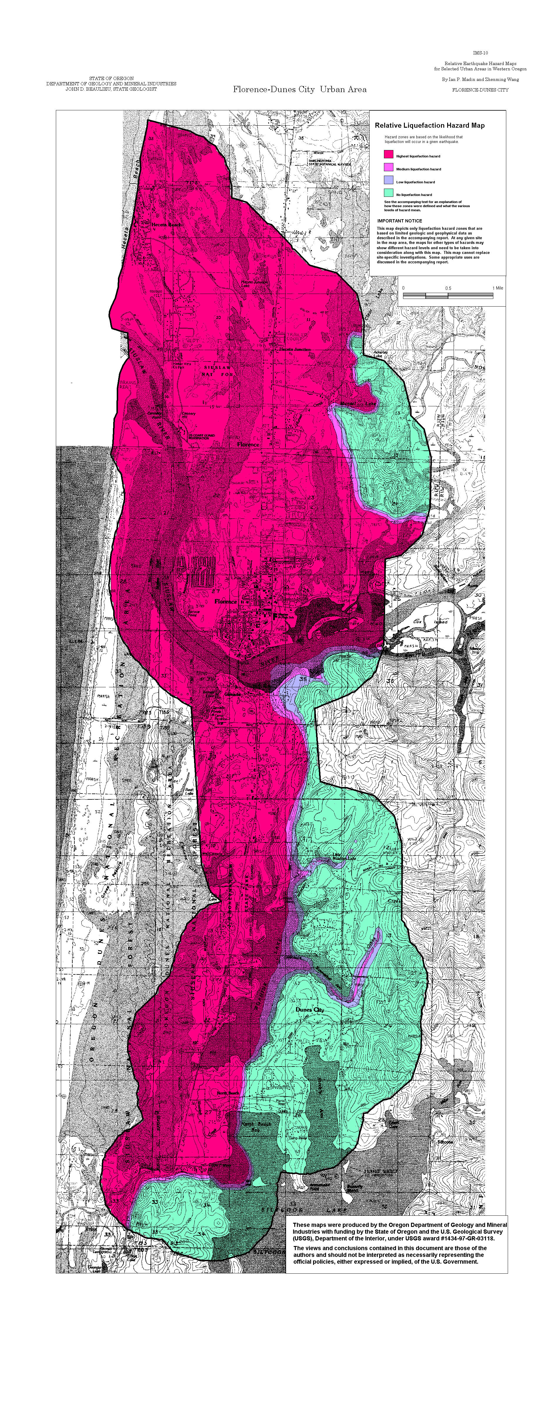
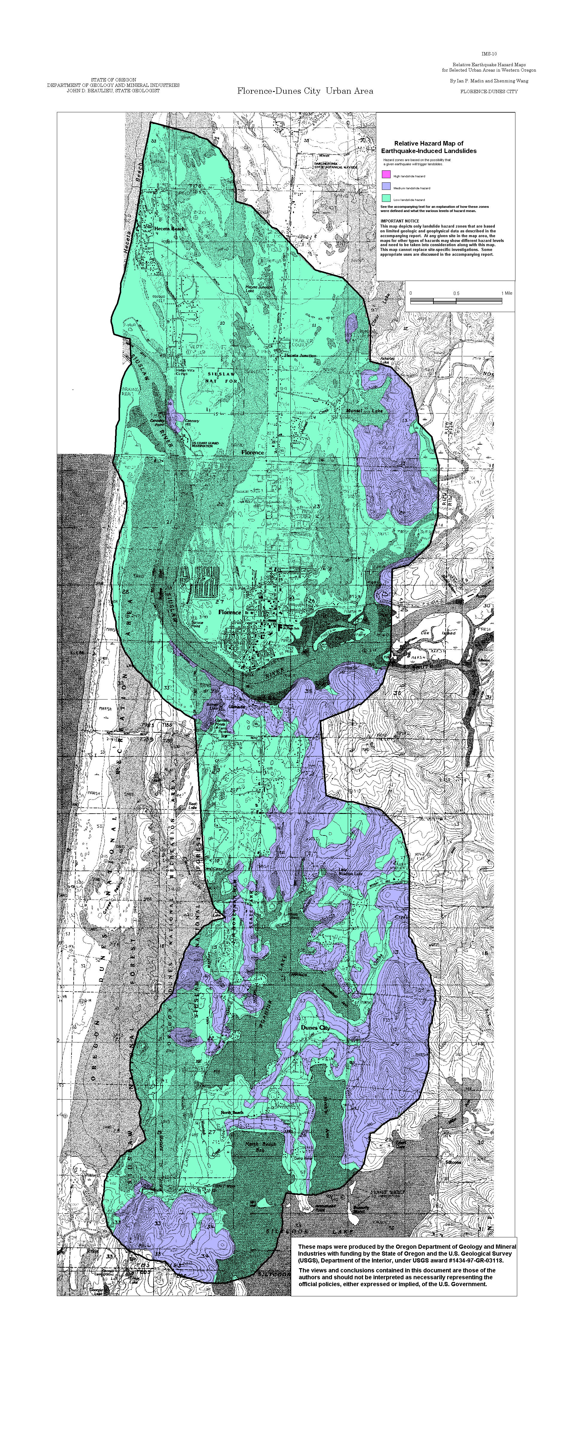
Florence-Dunes City: Amplification, Liquefaction, Landslide, Relative Hazard
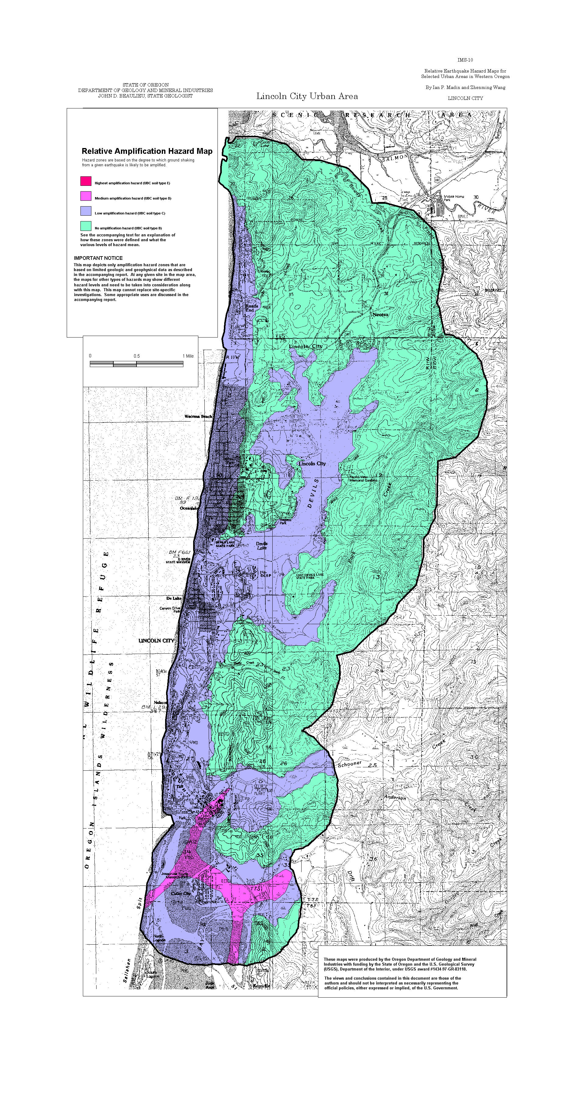
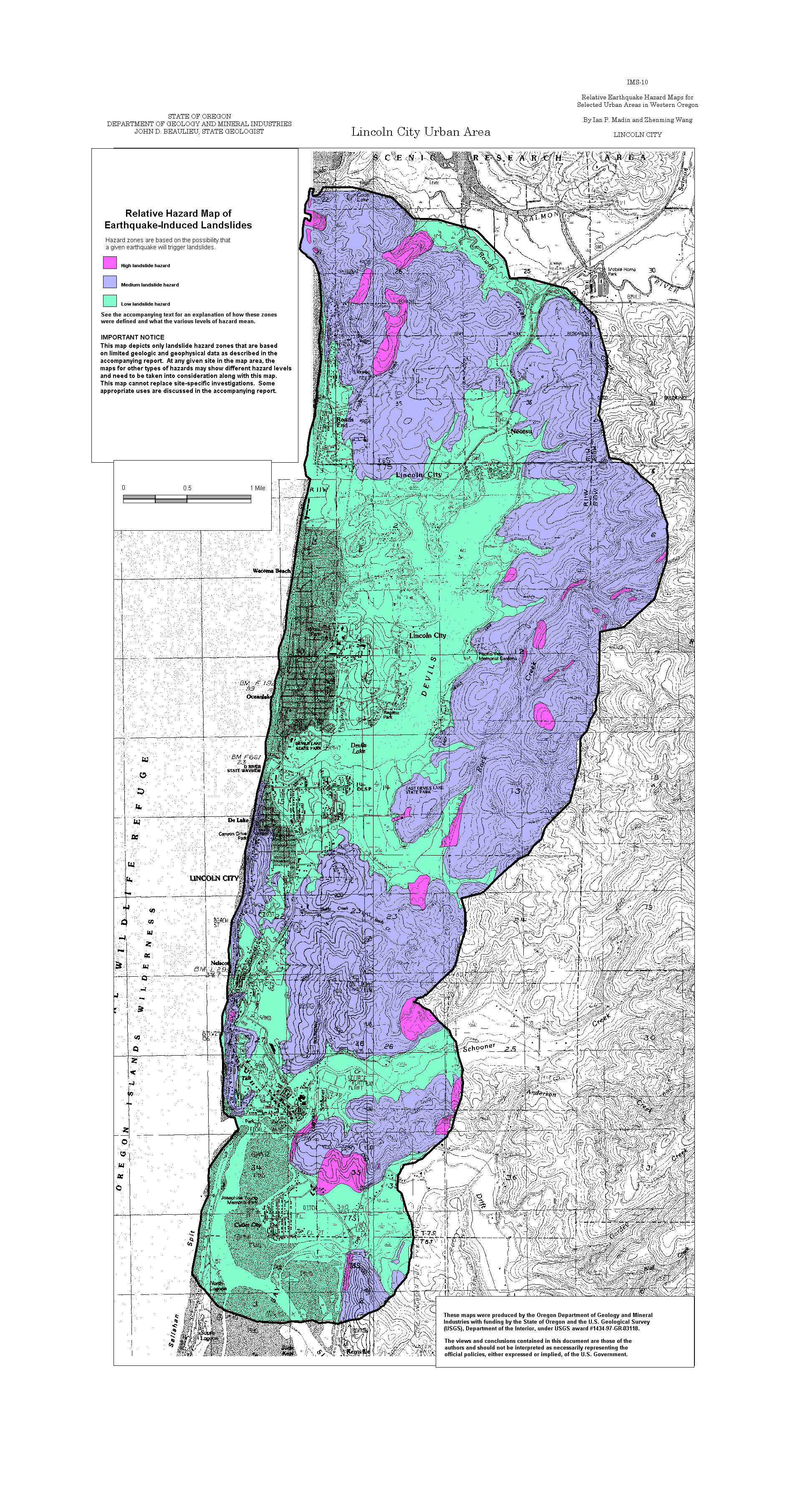
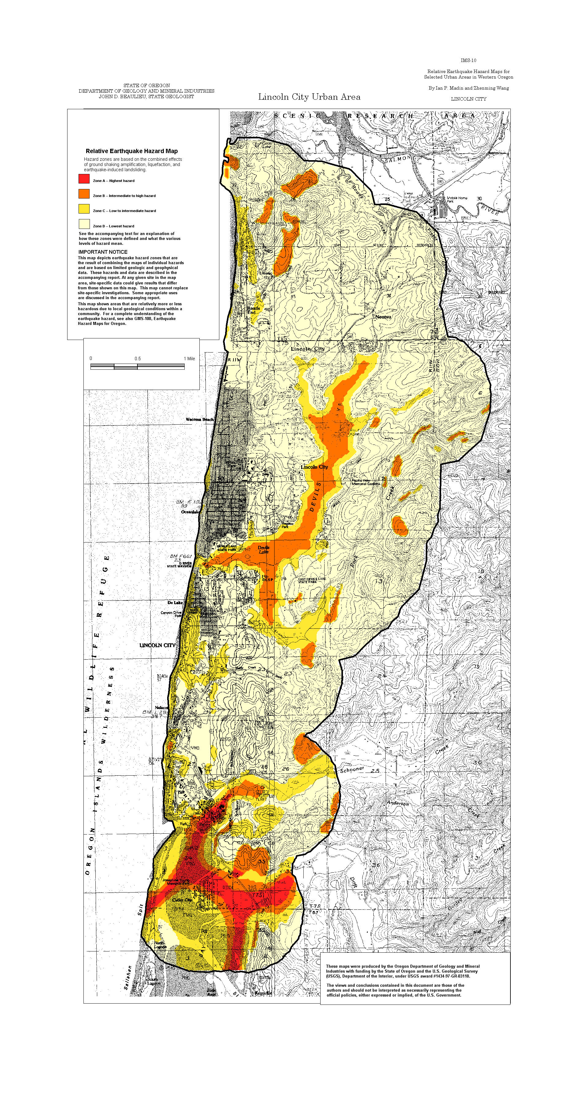
Lincoln City: Amplification, Liquefaction, Landslide, Relative Hazard
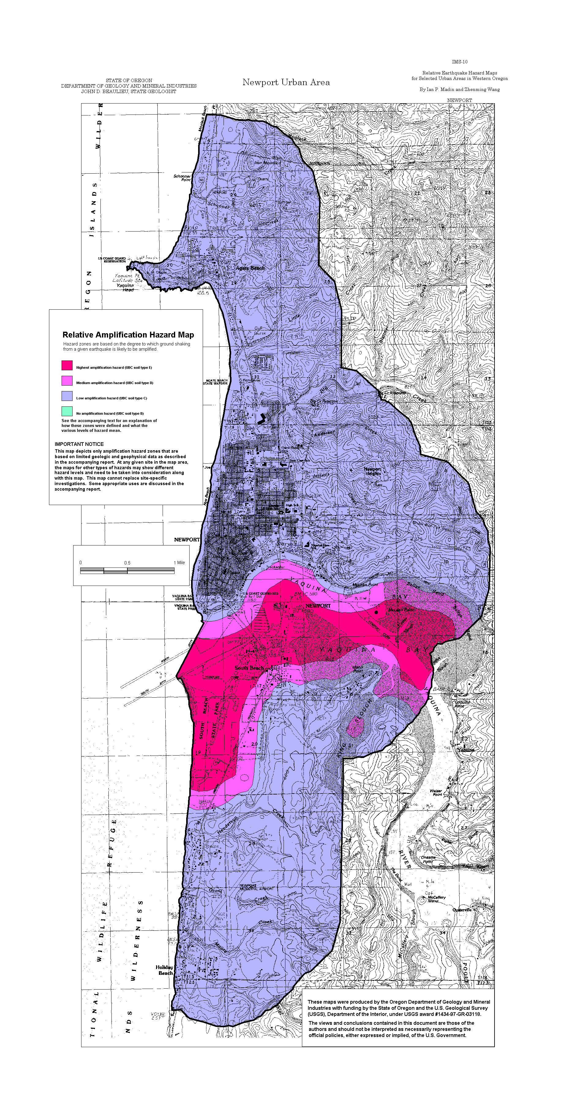
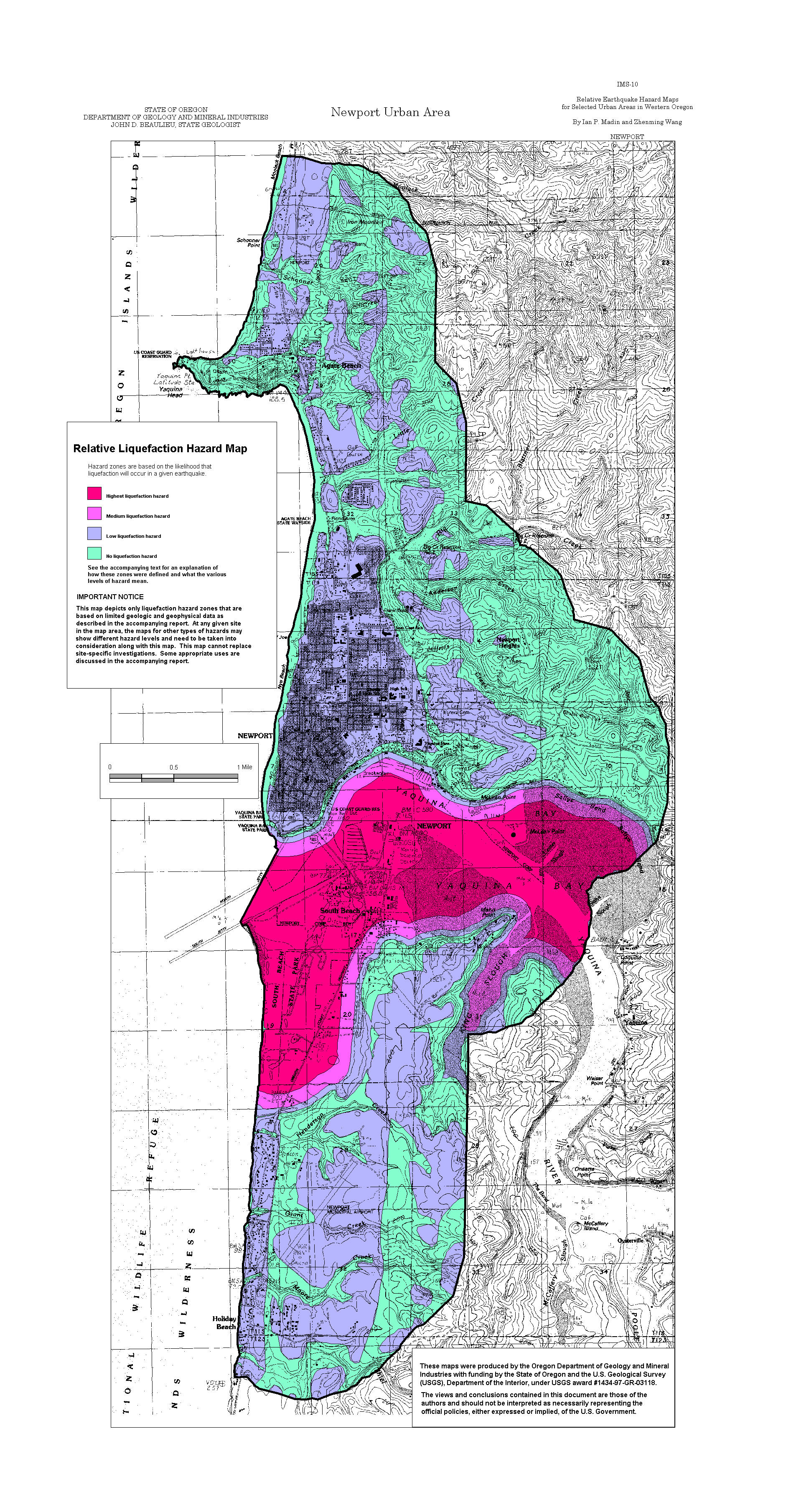
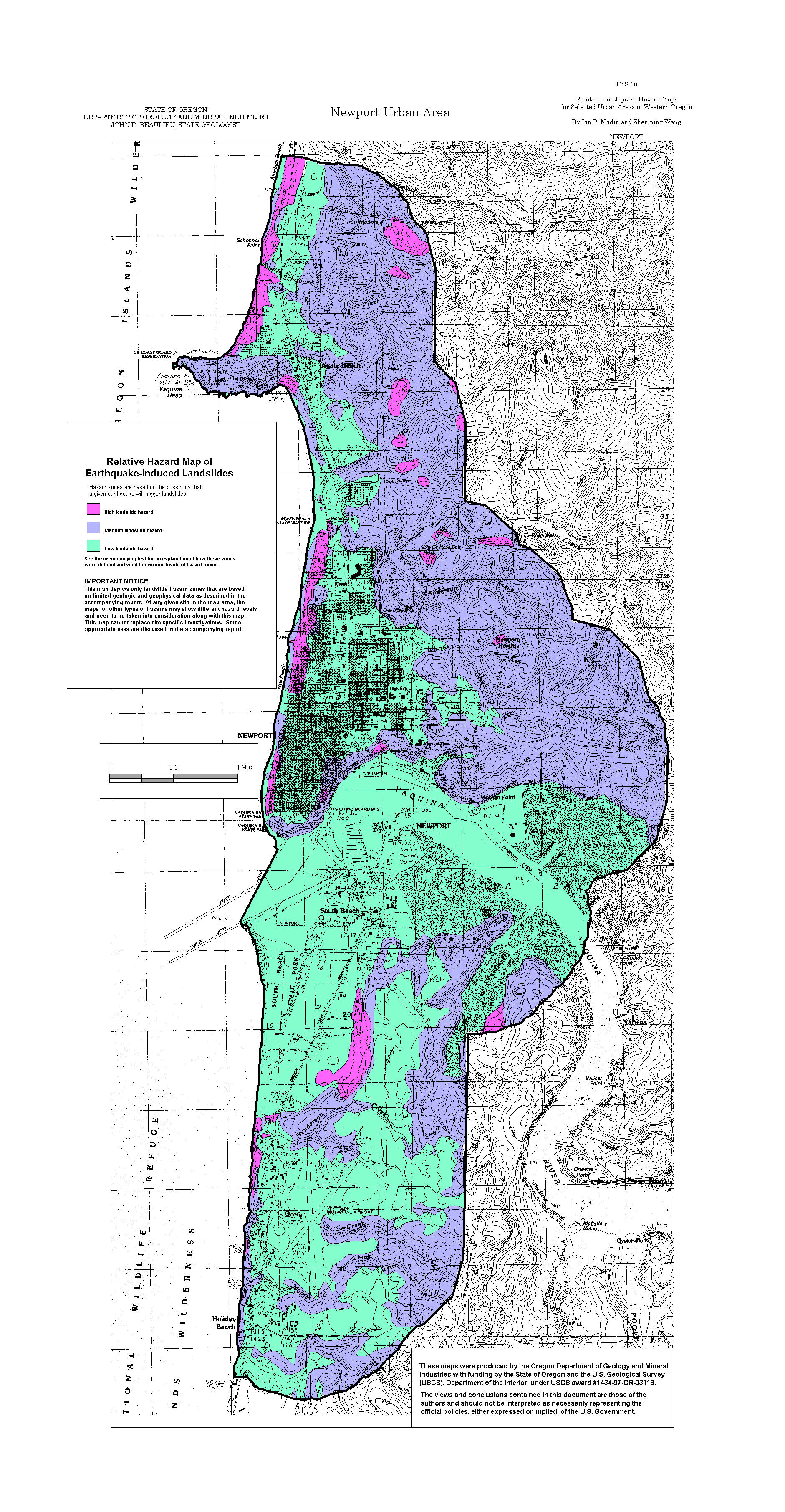
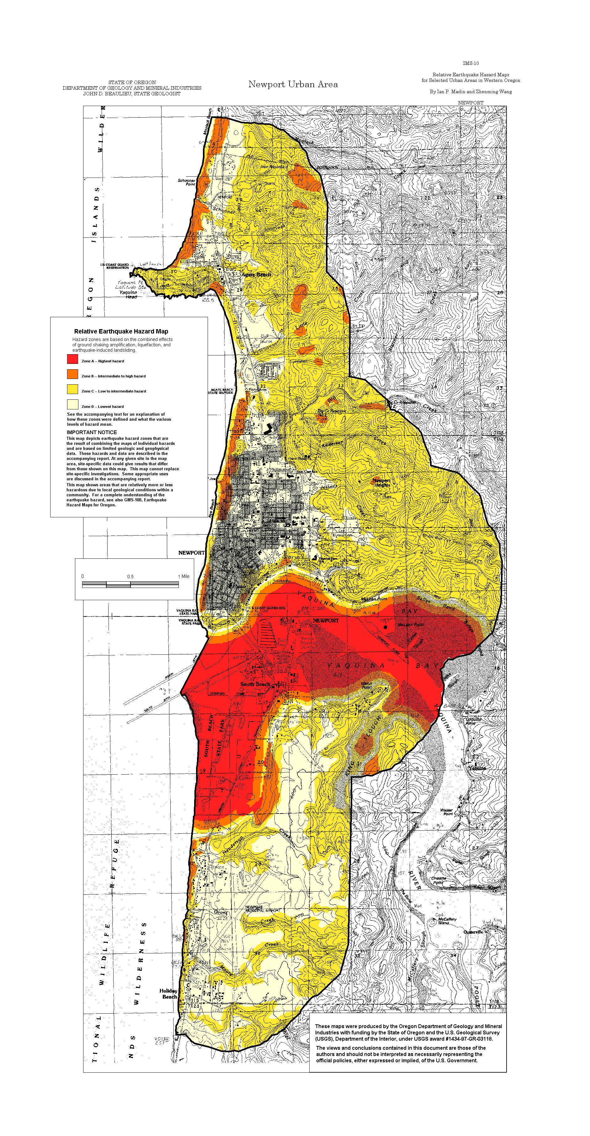
Newport: Amplification, Liquefaction, Landslide, Relative Hazard
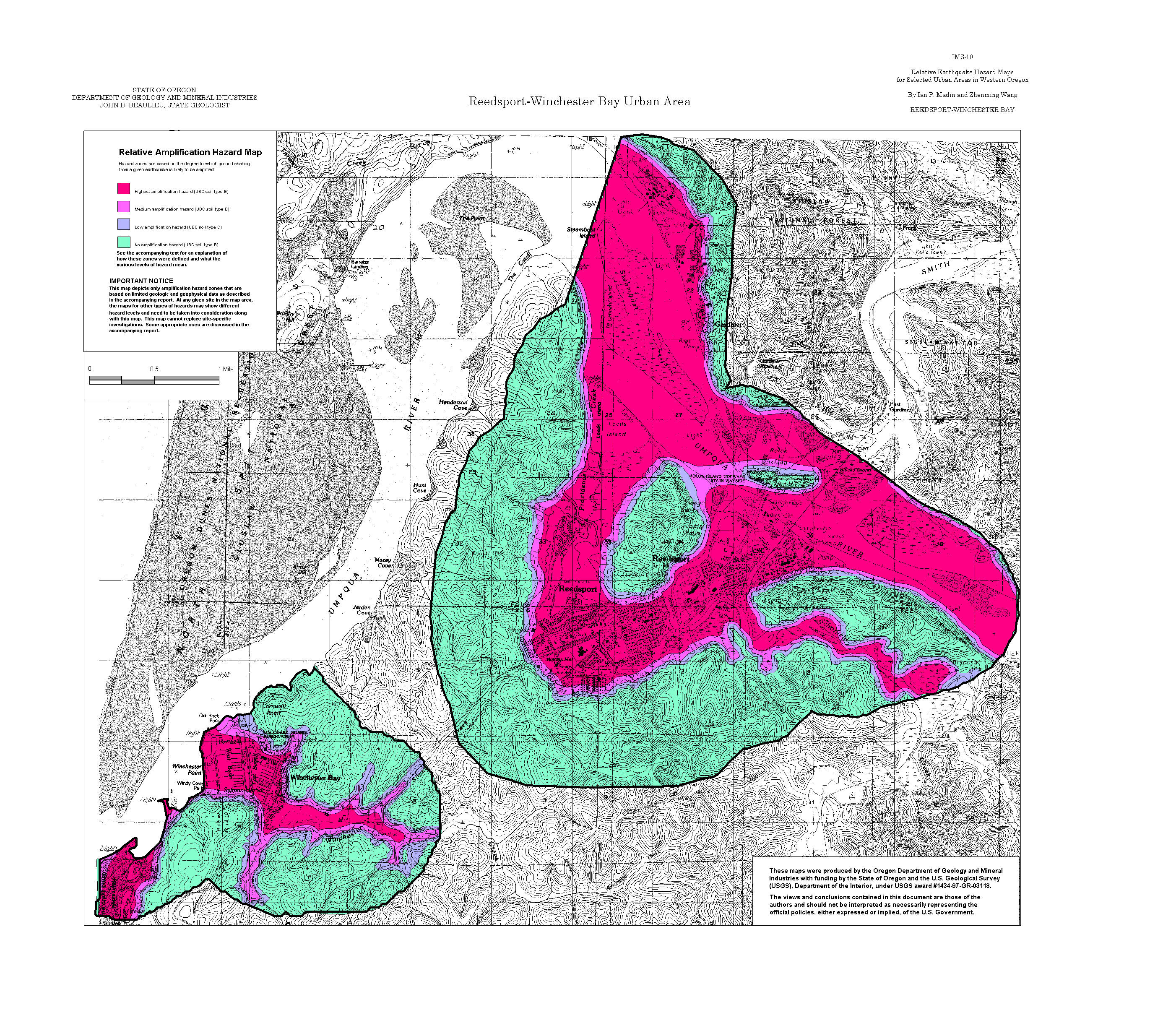
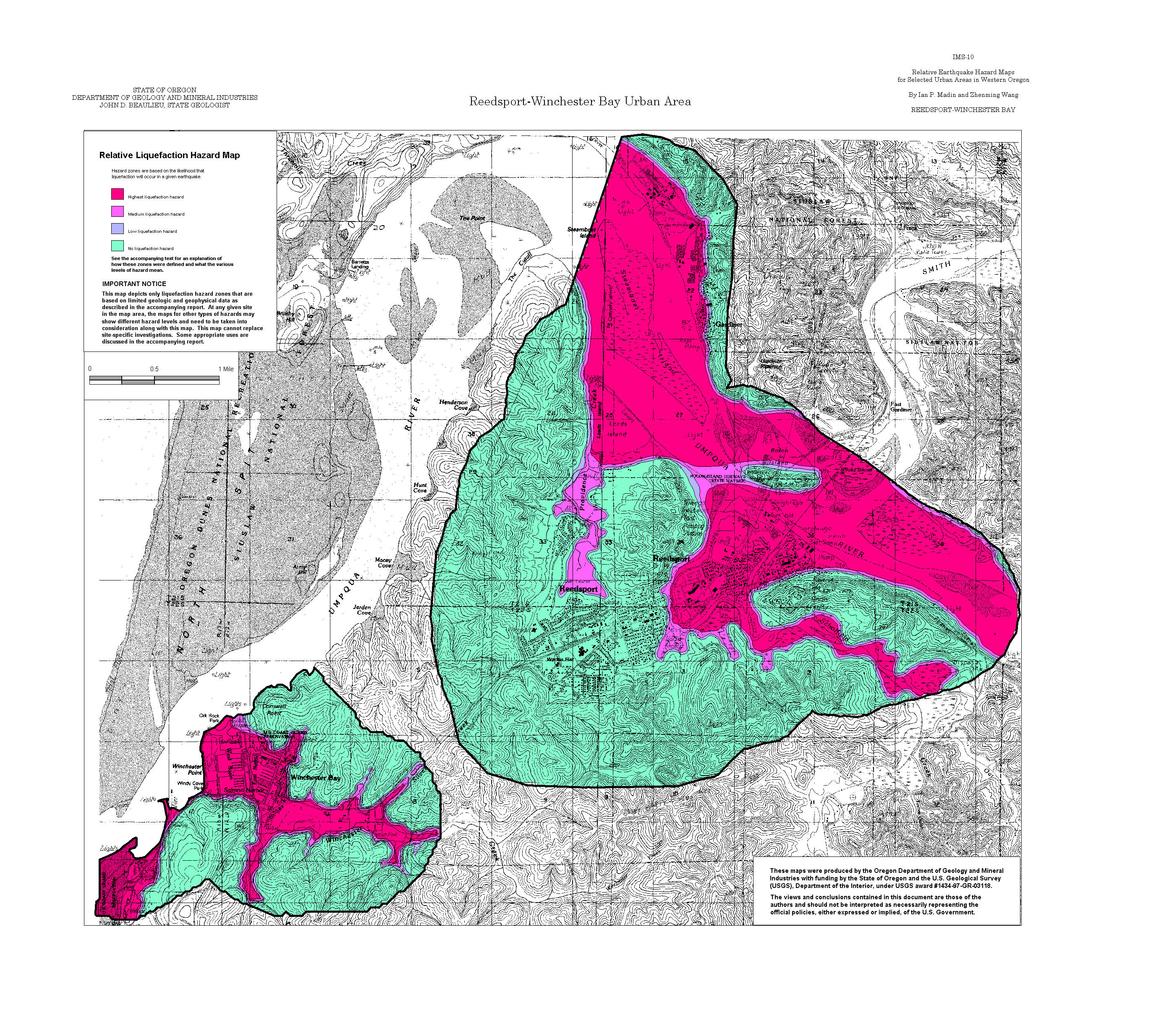
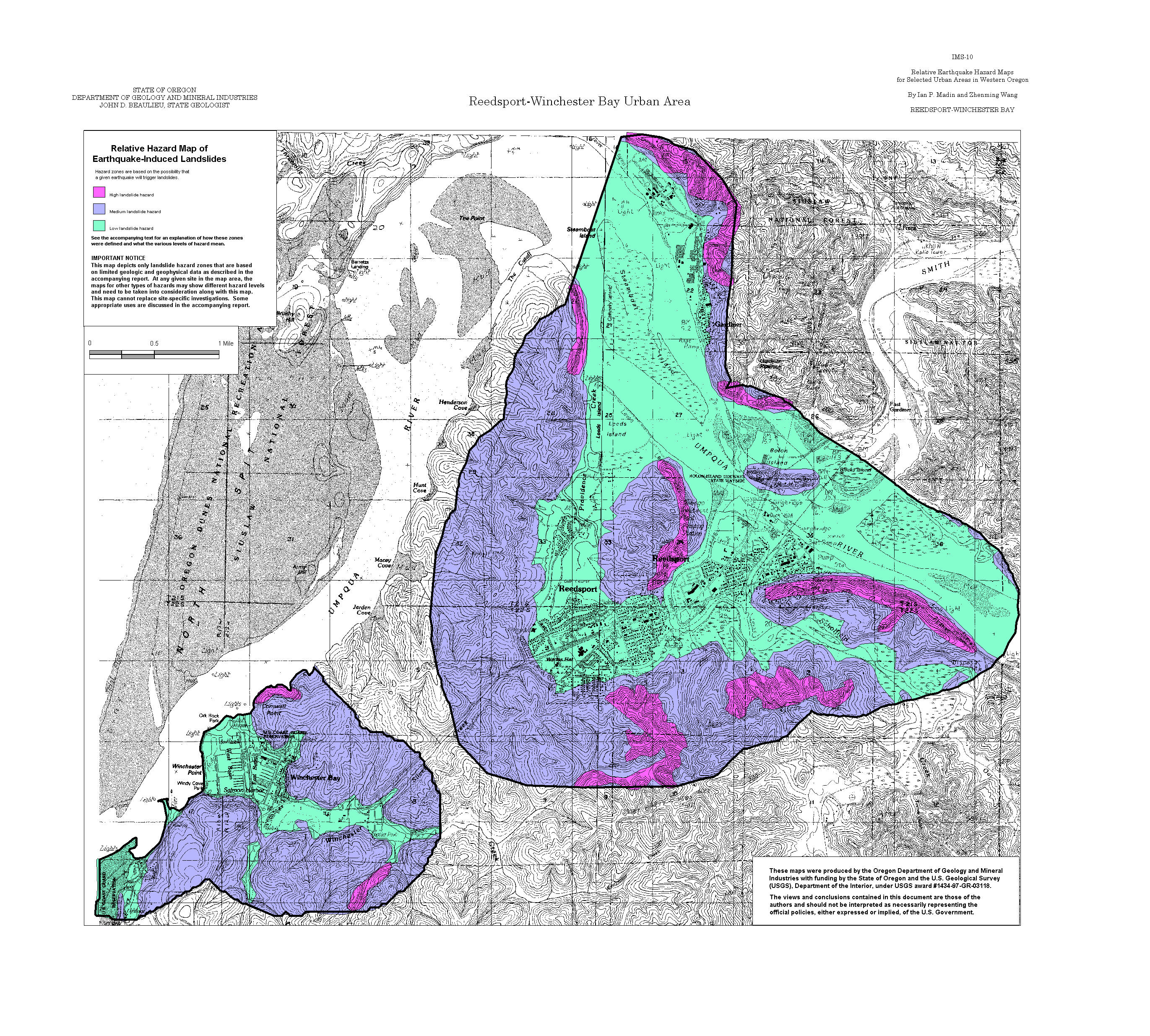
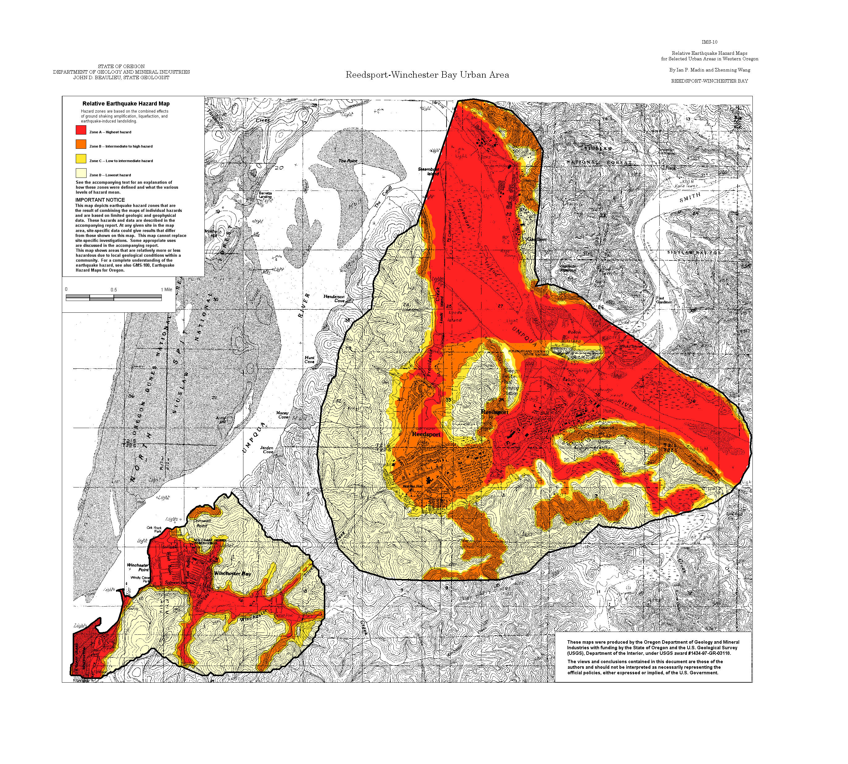
Reedsport- Winchester Bay: Amplification, Liquefaction, Landslide, Relative Hazard
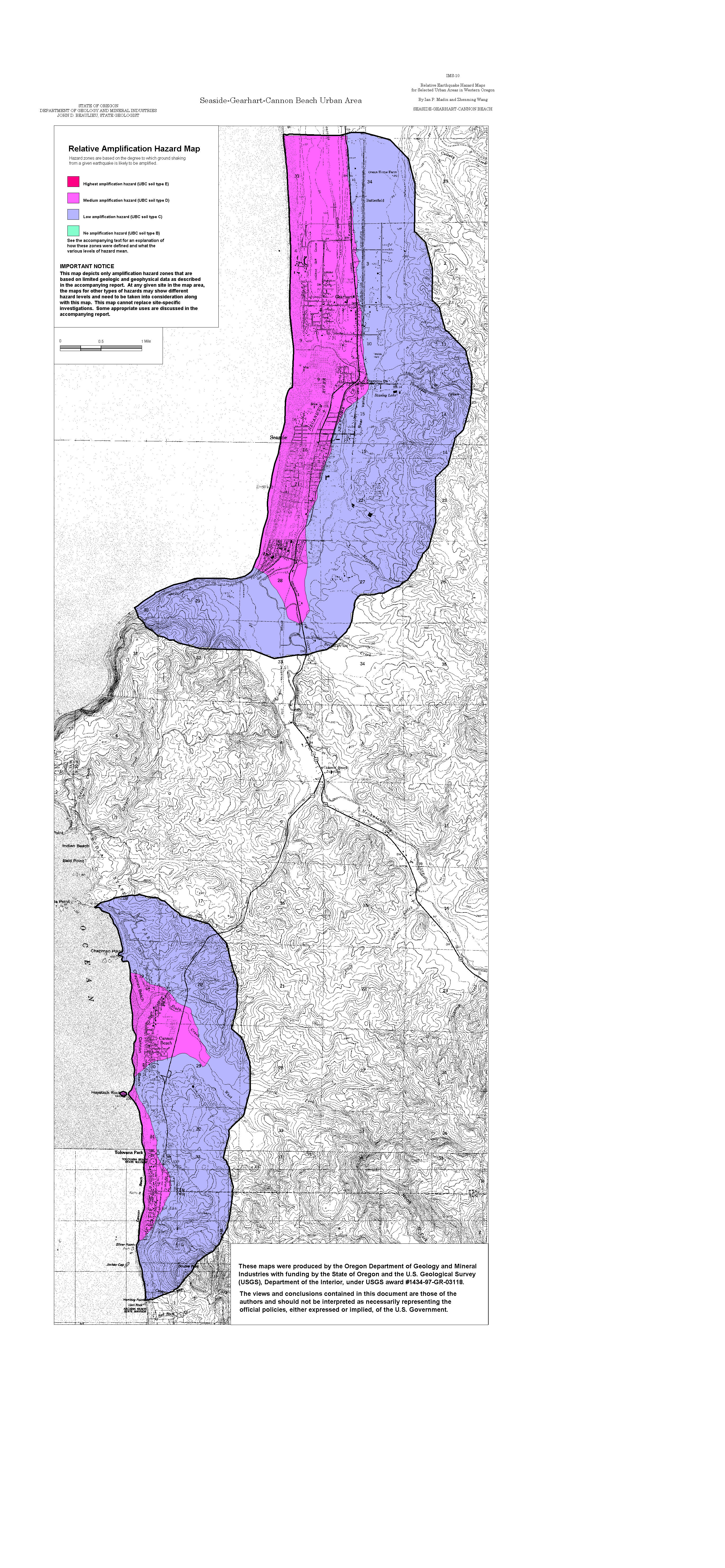
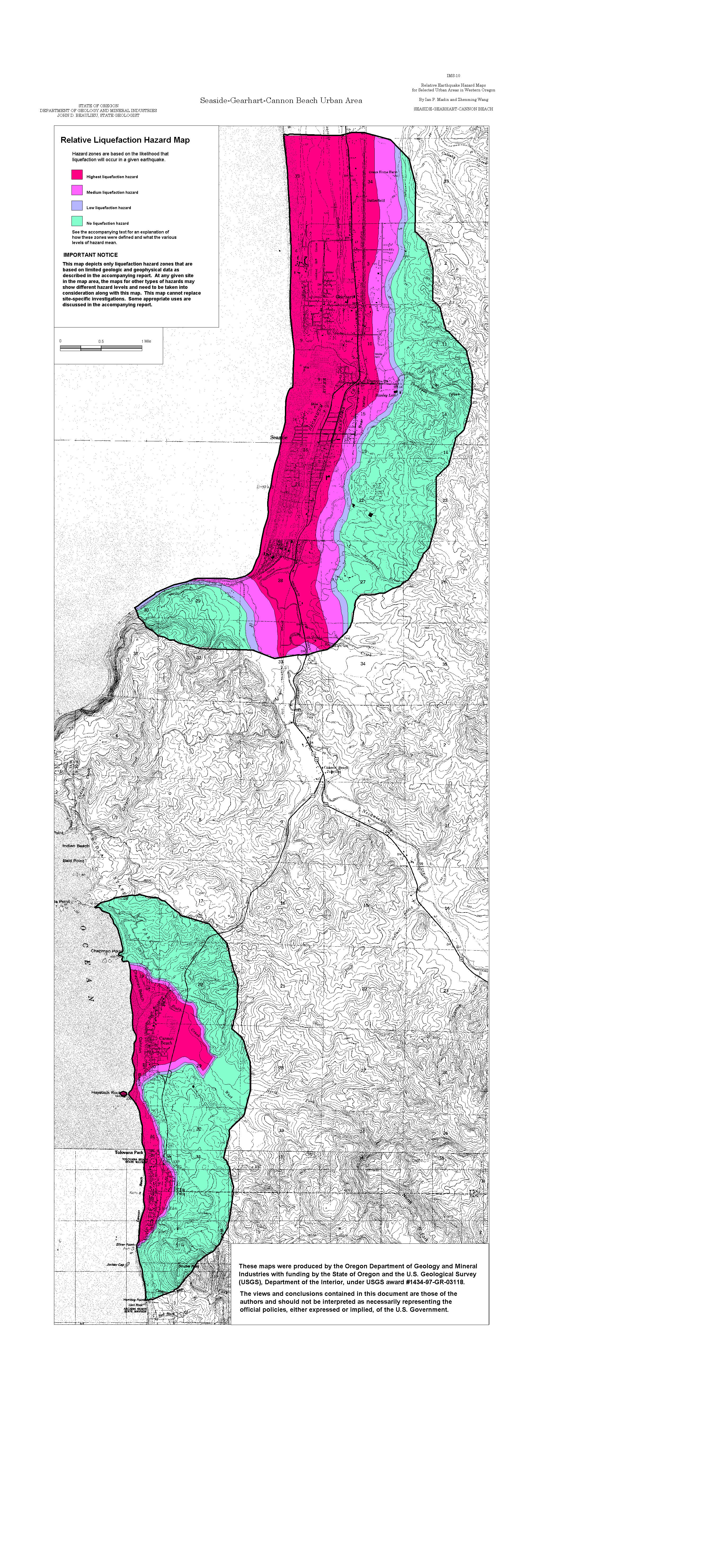
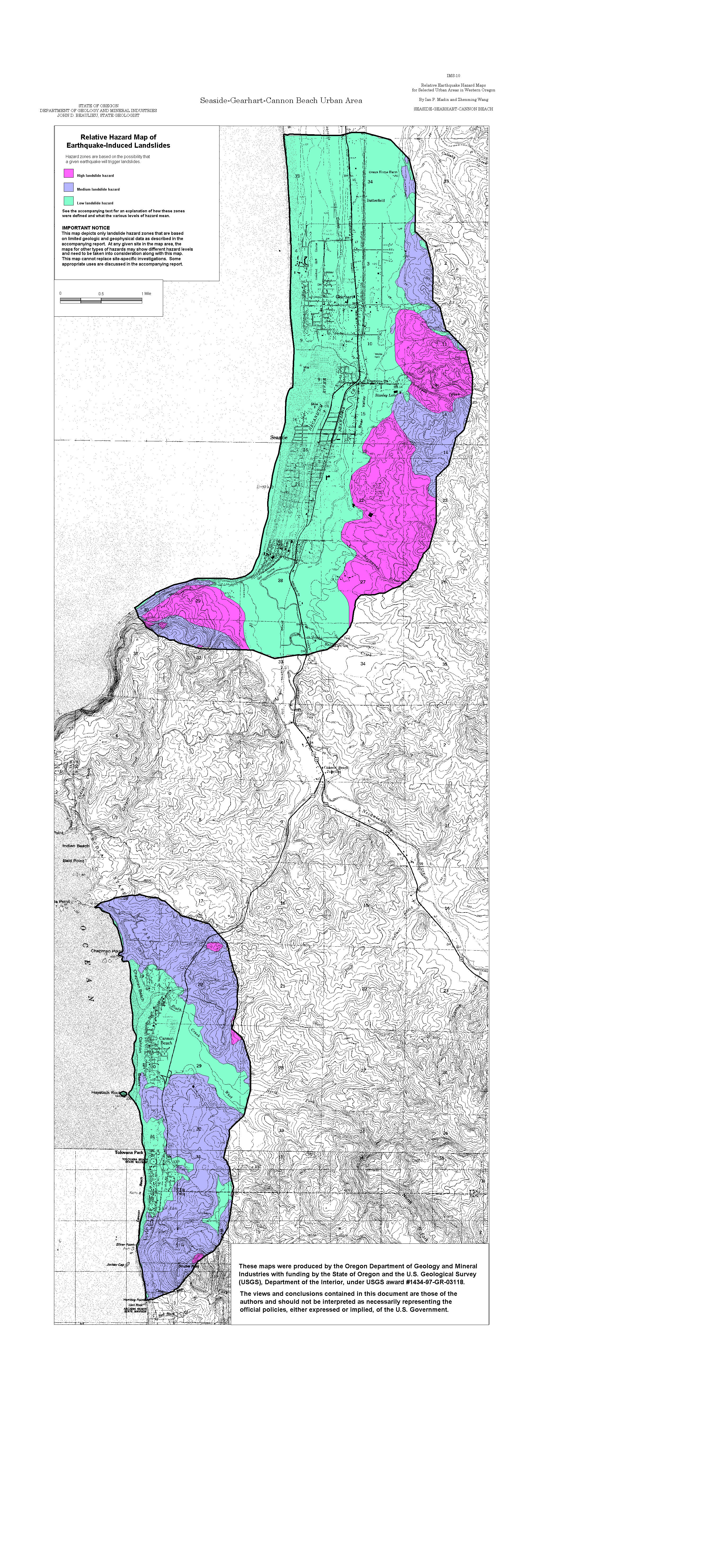
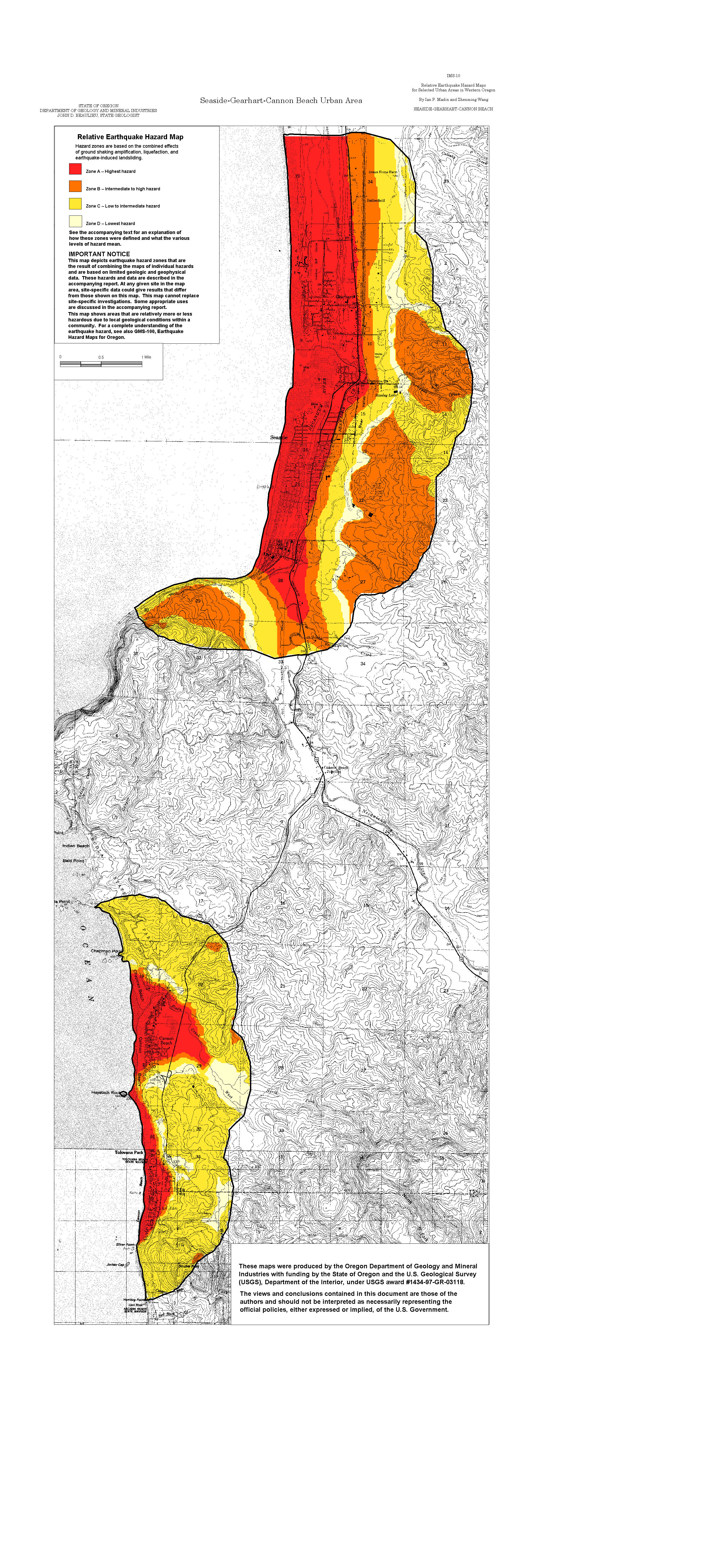
Seaside-Gearhart-Cannon Beach: Amplification, Liquefaction, Landslide, Relative Hazard
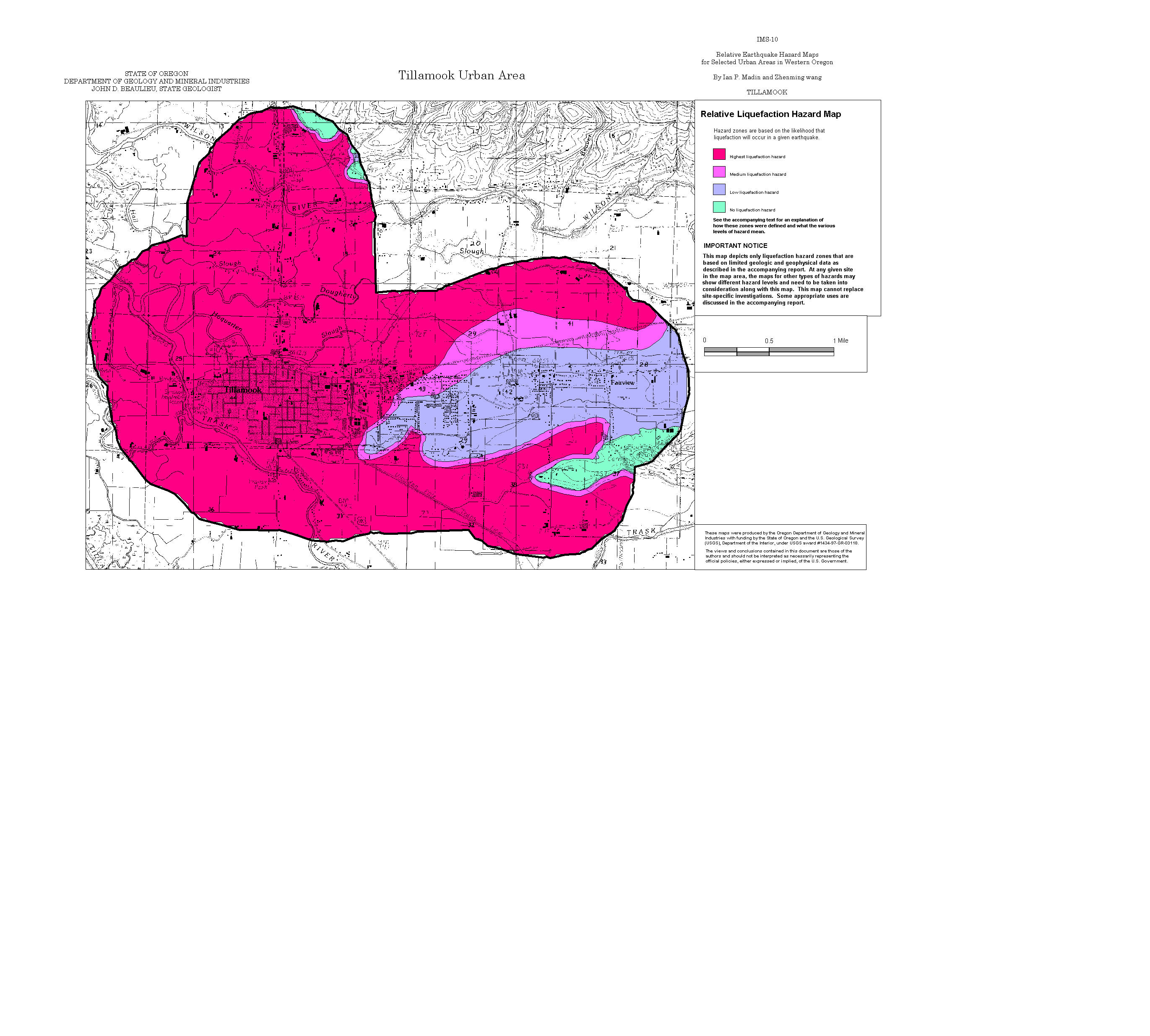
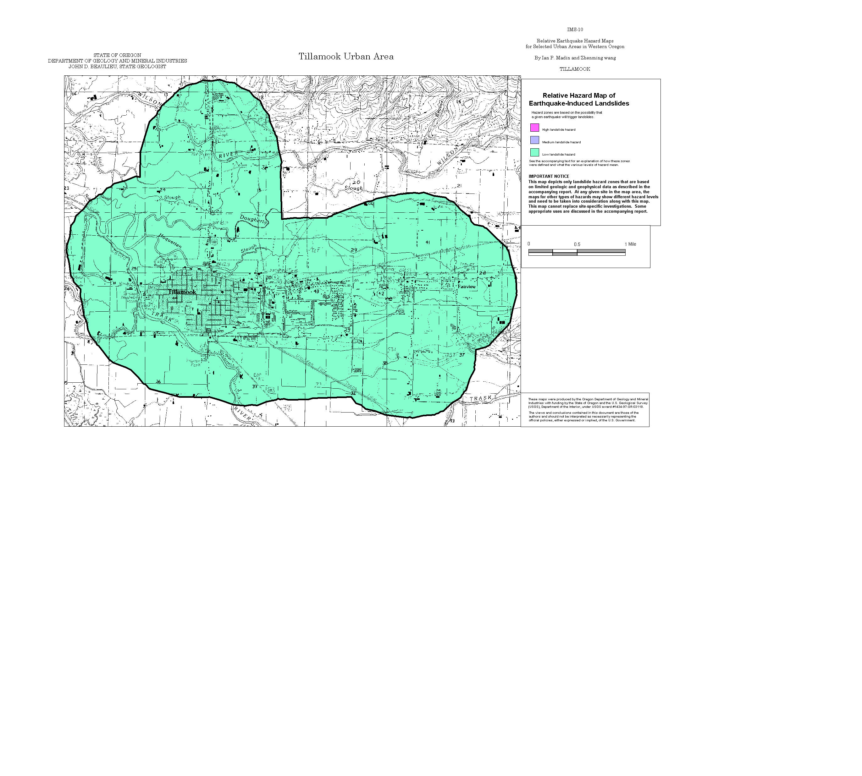
Tillamook: Amplification, Liquefaction, Landslide, Relative Hazard
ArcView GIS files (zipped)
MapInfo GIS files (zipped)