[Go back] | Publications Center | DOGAMI Home
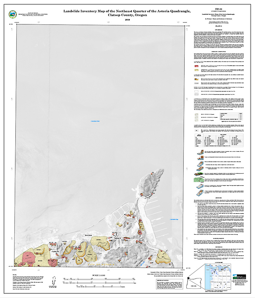
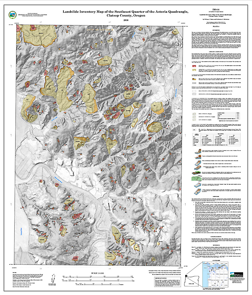
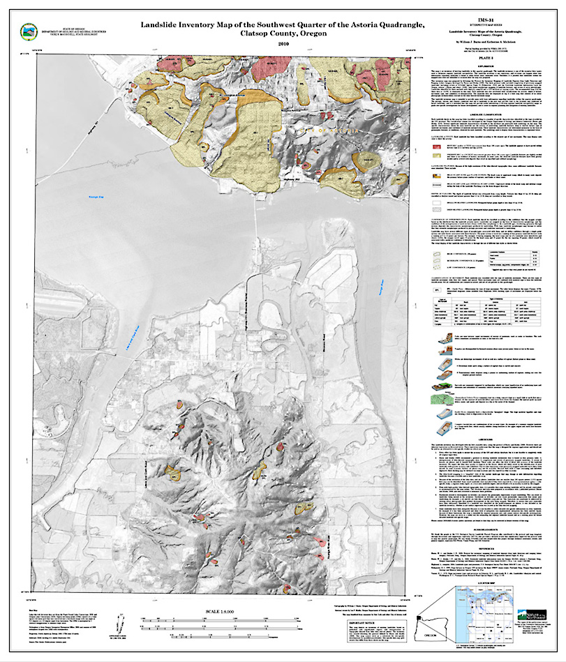
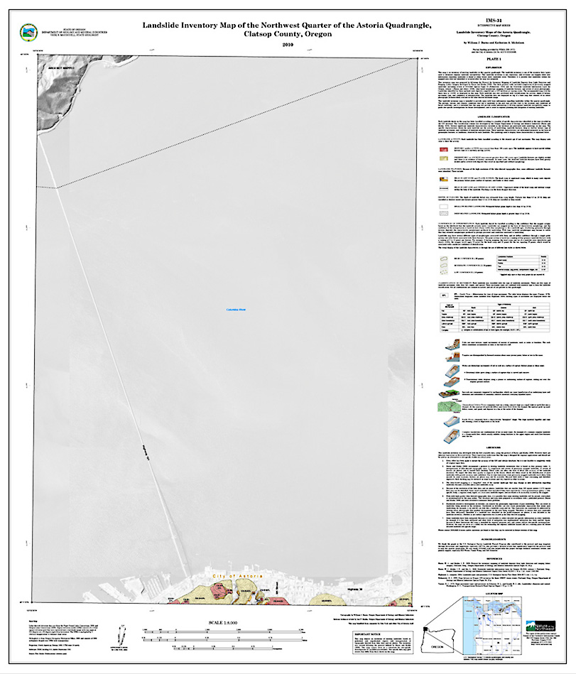
IMS-31, Landslide Inventory Maps of the Astoria quadrangle, Clatsop County, Oregon, by William J. Burns and Katherine A. Mickelson.
(NW, NE, SE, and SW quarter quadrangles of the Astoria 7.5' quadrangle; 1:8,000 scale)
Download publication .zip file (167 MB)
Individual plates (36 x 44 inches).
IMS-31 contains the four quarter quads that comprise the Astoria 7.5' quad as well as:
- Special Paper 42, Protocol for inventory mapping of landslide deposits from light detection and ranging (lidar) imagery, by William J. Burns and Ian P. Madin -- included to provide background on how the landslide inventory data were prepared.
In addition, IMS-31 contains a geodatabase, metadata for the GIS files, and a readme.txt file.
Individual plates (36 x 44 inches).