[Go back] | Publications Center | DOGAMI Home
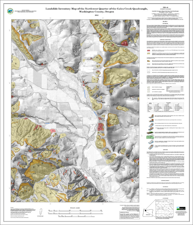
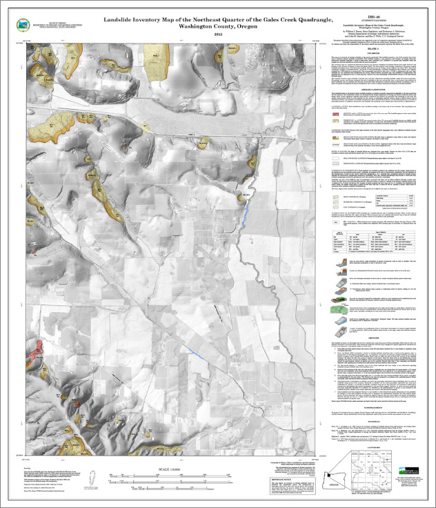
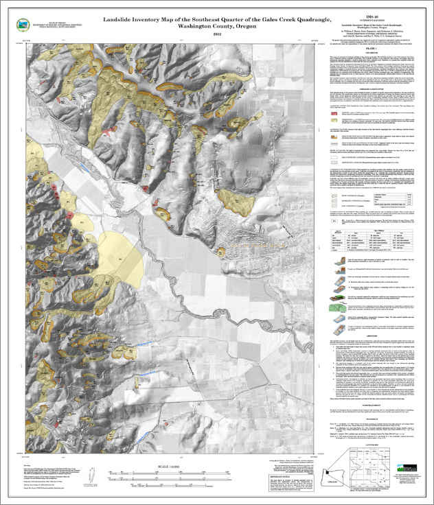
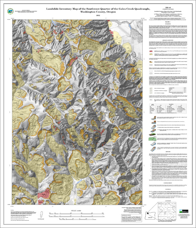
IMS-46, Landslide inventory maps of the Gales Creek quadrangle, Washington County, Oregon, by William J. Burns, Serin Duplantis, and Katherine A. Mickelson
(NW, NE, SE, and SW quarter-quadrangle plates of the Gales Creek 7.5' quadrangle; 1:8,000 scale)
Download publication .zip file (187 MB)
IMS-46 contains the four quarter quadrangles that comprise the Gales Creek 7.5' quadrangle, a geodatabase, metadata for the GIS files, and a readme.txt file. IMS-46 also contains:
|
Special Paper 42, Protocol for inventory mapping of landslide deposits from light detection and ranging (lidar) imagery, by William J. Burns and Ian P. Madin -- included to provide background on how the landslide inventory data were prepared |
|
DOGAMI Fact Sheet: "Understanding Landslide Deposit Maps" |