DOGAMI OPEN-FILE REPORT SERIES
[Go back] | Publications Center | DOGAMI Home
PUBLICATION
PREVIEW
Open-File
Report O-23-02, Landslide Inventory and Risk Reduction of the North and Central Portions of Wasco County, Oregon,
by William J. Burns, Nancy Calhoun, Jon Franczyk, Jason D. McClaughry, and Katherine Daniel; 28 p. report, 2 map plates, one EsriŽ
geodatabases with internal metadata, external metadata in .xml format.
What's in this report?
Landslides are common throughout Oregon due to the combination of high precipitation, steep slopes, landslide-prone geologic units, and frequent earthquakes. In June 2020, the Oregon Department of Geology and Mineral Industries (DOGAMI) received a grant from the Federal Emergency Management agency (FEMA) through the Risk MAP program as a Cooperating Technical Partner (CTP)(Cooperative Agreement EMS-2020-CA-00010) to perform regional landslide inventory mapping of the north and central portions of Wasco County, Oregon. A share of this funding was passed through to Wasco County Planning and Oregon Department of Land Conservation and Development (DLCD) to work on risk reduction activities. The purpose of this project was to provide detailed information about the landslide hazards in this area and perform continued landslide risk reduction.
View the interactive StoryMap for this project!
Report downloads:
- Text
report (30 p., 28.1 MB PDF)
- Map Plates (2 plates; 10.9 MB zip file; view/download individual
plates below)
- GIS metadata
bundle(4 .xml files; 18 KB zip file)
- Full GIS data
bundle, with .xml metadata (2.4 MB,
zip file; view .xml metadata links below)
- Complete
publication bundle (36.4 MB zip file)
Study Area:

GEOGRAPHIC INFORMATION SYSTEM (GIS) DATA
Geodatabase is EsriŽ version 10.1 format.
Metadata is embedded in the geodatabases and is also provided as separate .xml
formatted files.
Each dataset listed below has an associated, standalone .xml
file containing metadata in the Federal Geographic Data Committee Content
Standard for Digital Geospatial Metadata format.
|
Wasco_Landslide_Inventory.gdb: |
||
|
Feature
classes: |
|
|
|
Deposits |
polygons |
|
|
Scarp_Flanks |
polygons |
|
|
Scarps |
polylines |
|
|
Study Area |
polygon |
|
MAP PLATES (PDFs)
Plate
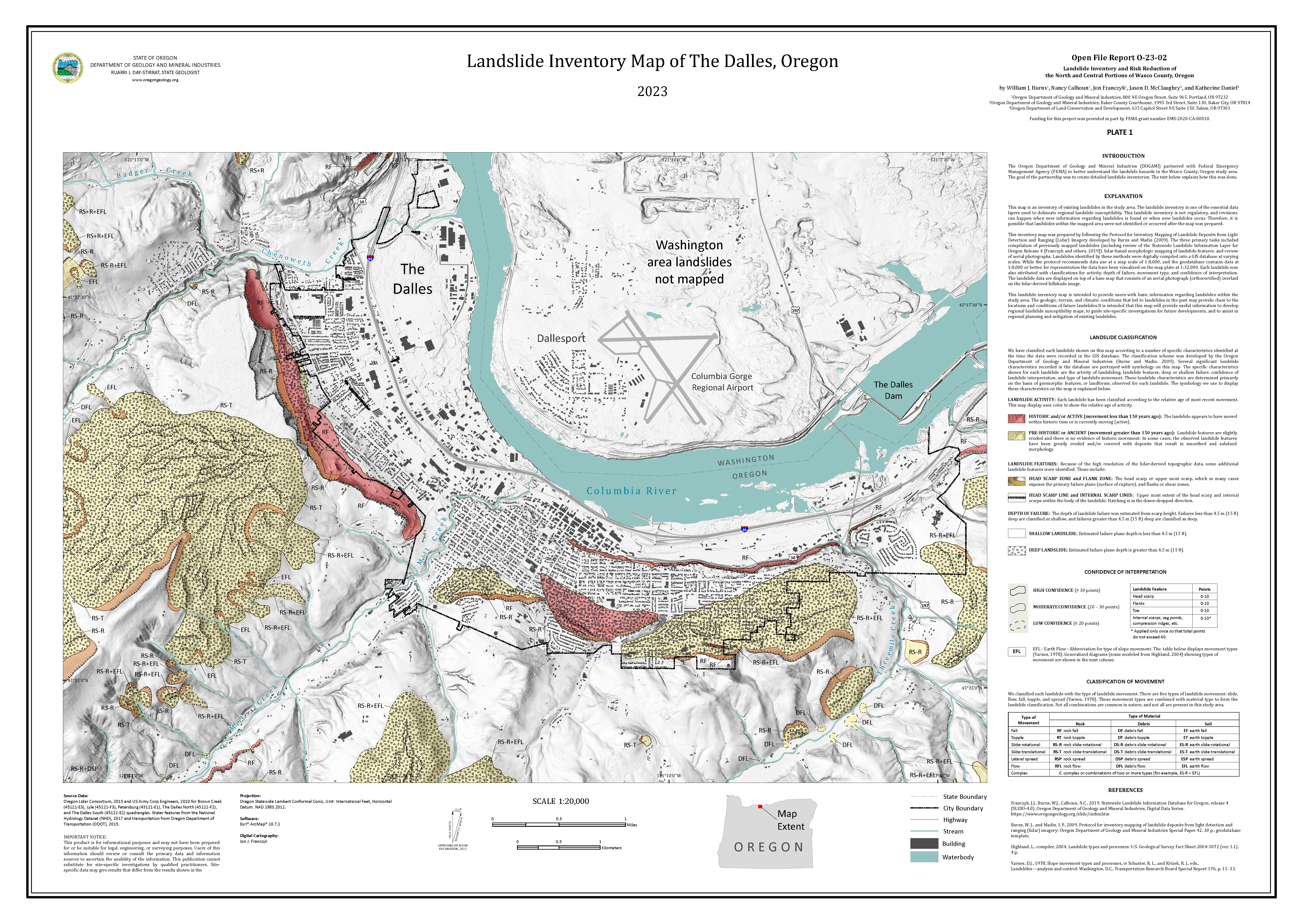
1, Landslide Inventory Map of The Dalles, Oregon (9.4 MB PDF)

Plate
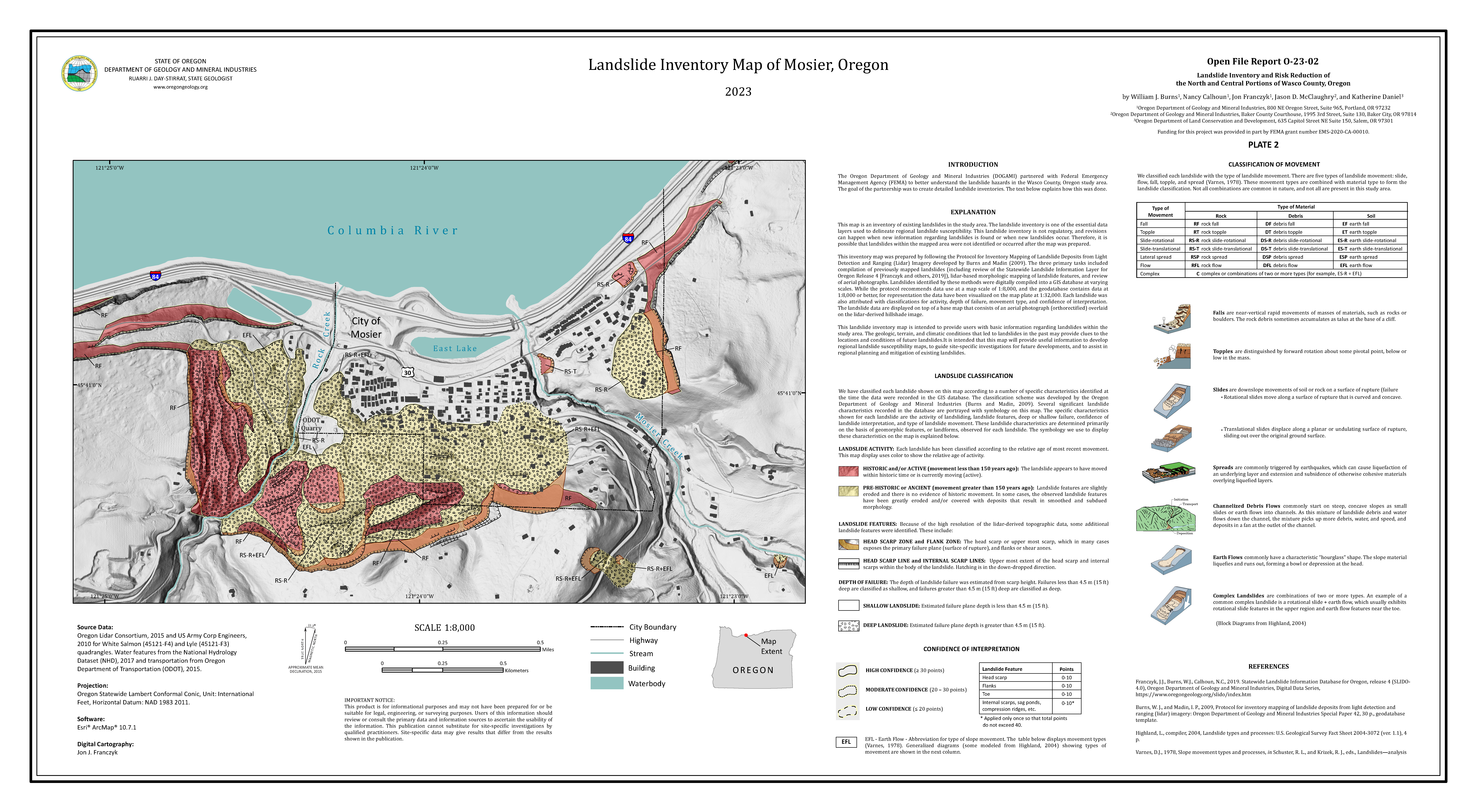
2, Landslide Inventory Map of Mosier, Oregon (4.0 MB PDF)
