[Go back] | Publications Center | DOGAMI Home
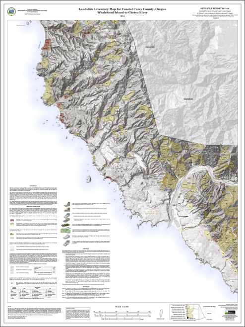
Open-File Report O-14-10, Landslide inventory of coastal Curry County, Oregon, by William J. Burns, Katherine A. Mickelson, and Laura L. Stimely.
Download .zip file (717 MB)
FILES INCLUDED WITH THIS PUBLICATION
The file set consists of:
Geodatabase:
Esri v10.1 formatted Geodatabase. Metadata is embedded in the geodatabase.
Curry_Landslide_Inventory.gdb:
feature dataset classes:
- Deposits (polygons),
- Photos (points),
- Scarp_Flanks (polygons),
- Scarps (polylines)
Text report:
PDF file format. 10-p., in two versions, one suitable for small-file-size onscreen viewing and one suitable for high-resolution printing:
• O-14-10_report_print / onscreen.pdf
Appendices:
Report text only from DOGAMI Special Paper 42, Protocol for Inventory Mapping of Landslide Deposits from Light Detection and Ranging (Lidar) Imagery, by William J. Burns and Ian P. Madin, describes the protocol used to map landslides in this study.
DOGAMI Open-File Report O-13-02, Landslide Inventory Map of the Harbor Hills Area, Curry County, Oregon, by William J. Burns, Serin Duplantis, and Cullen B. Jones. This publication is included with the O-14-10 publication set because the study extent of O-13-02 overlaps that of O-14-10; O-13-02 data are included in the O-14-10 study.
Plates folder (see images below):
PDF file format; dimensions 36 x 48 inches, scale 1:14,000. Each map plate comes in two versions, one suitable for small-file-size onscreen viewing and one suitable for high-resolution printing:
Plate 1. New River to Blacklock Point
Plate 2. Blacklock Point to Port Orford
Plate 3. Port Orford to Lookout Rock
Plate 4. Lookout Rock to Nesika Beach
Plate 5. Nesika Beach to Gold Beach
Plate 6. Gold Beach to Crook Point
Plate 7. Crook Point to Whalehead Island
Plate 8. Whalehead Island to Winchuck River
Plate location map:
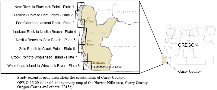
Plate 1. New River to Blacklock Point
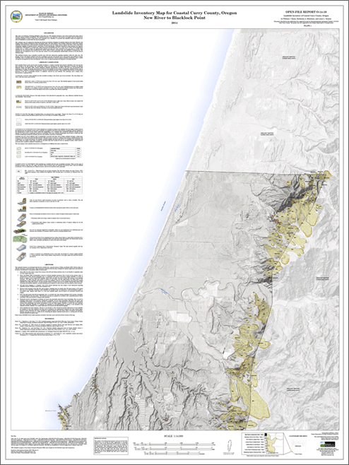
Plate 2. Blacklock Point to Port Orford
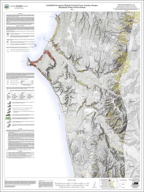
Plate 3. Port Orford to Lookout Rock
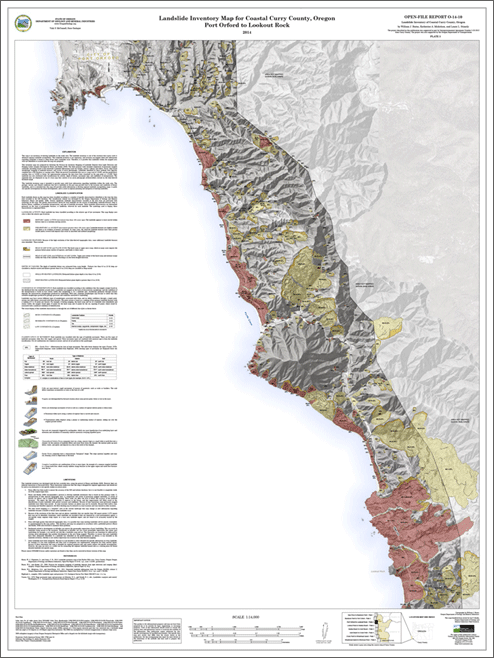
Plate 4. Lookout Rock to Nesika Beach
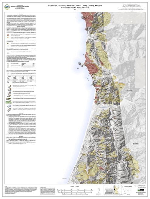
Plate 5. Nesika Beach to Gold Beach
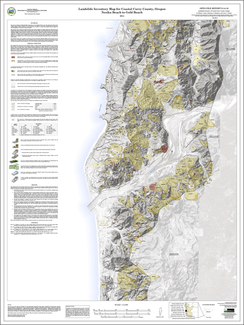
Plate 6. Gold Beach to Crook Point
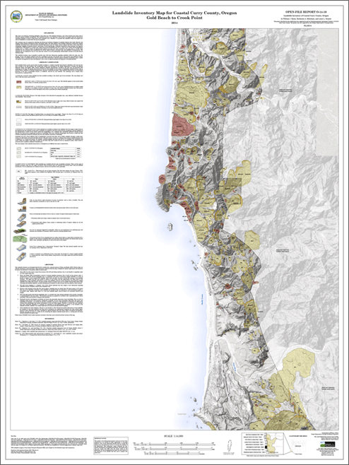
Plate 7. Crook Point to Whalehead Island
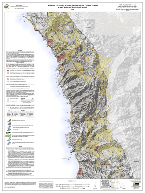
Plate 8. Whalehead Island to Winchuck River