[Go back] | Publications Center | DOGAMI Home
Open-File Report O-17-03, Landslide Inventory of Eastern Multnomah County
by William J. Burns and Kassandra O. Lindsey, Esri geodatabase, metadata, 4 map plates, scale 1:12,000.
Download complete publication including GIS data (575 MB .zip file)
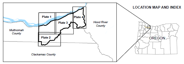
Plate 1, Western Area, scale 1:12,000, 36 x 48 inches (13 MB PDF)
Plate 2, Southern Area, scale 1:12,000, 48 x 36 inches (16 MB PDF)
Plate 3, Central Area, scale 1:12,000, 36 x 48 inches (16 MB PDF)
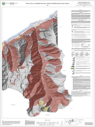
Plate 4, Eastern Area, scale 1:12,000, 36 x 48 inches (19 MB PDF)
Related publication:
Summary:
Eastern Multnomah County is home to the iconic Columbia River Gorge and its linked tourism and recreational opportunities, the I-84 transportation corridor, and significant permanent population and industry. This area is also home to significant landslide hazards. The high landslide hazard combined with dense development results in high risk. The purpose of this project is to provide accurate, detailed landslide inventory maps to help communities in this region become more aware of and resilient to landslide hazards.
GEOGRAPHIC INFORMATION SYSTEM (GIS) DATA
Geodatabase is Esri® version 10.4 format.
Metadata is embedded in the geodatabase and is also provided as separate .xml formatted files.
Landslide_Inventory_East_Multnomah.gdb:
Feature classes:
Metadata in .xml file format:
PLATES
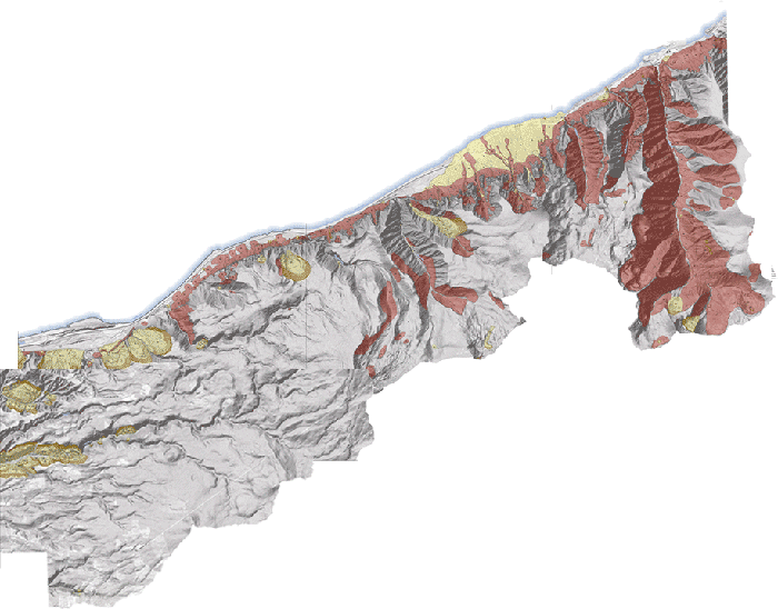
Plate 1, Western Area, scale 1:12,000, 36 x 48 inches
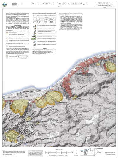
Plate 2, Southern Area, scale 1:12,000, 48 x 36 inches
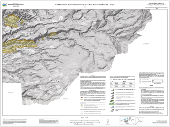
Plate 3, Central Area, scale 1:12,000, 36 x 48 inches
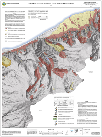
Plate 4, Eastern Area, scale 1:12,000, 36 x 48 inches