DOGAMI Interpretive Map Series
[Go back] | Publications Center | DOGAMI Home
Publication Preview
 IMS-8, Relative earthquake hazard maps for selected urban areas in western Oregon: Canby-Barlow-Aurora, Lebanon, Silverton-Mount Angel, Stayton-Sublimity-Aumsville, Sweet Home, Woodburn-Hubbard, by Ian P. Madin and Zhenming Wang, 1999, 22 p., 1:24,000.
readme.txt (accompanies CD-ROM version of publication)
metadata text ( html | text )
explanatory text ( pdf | text )
Maps (jpg format)
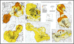
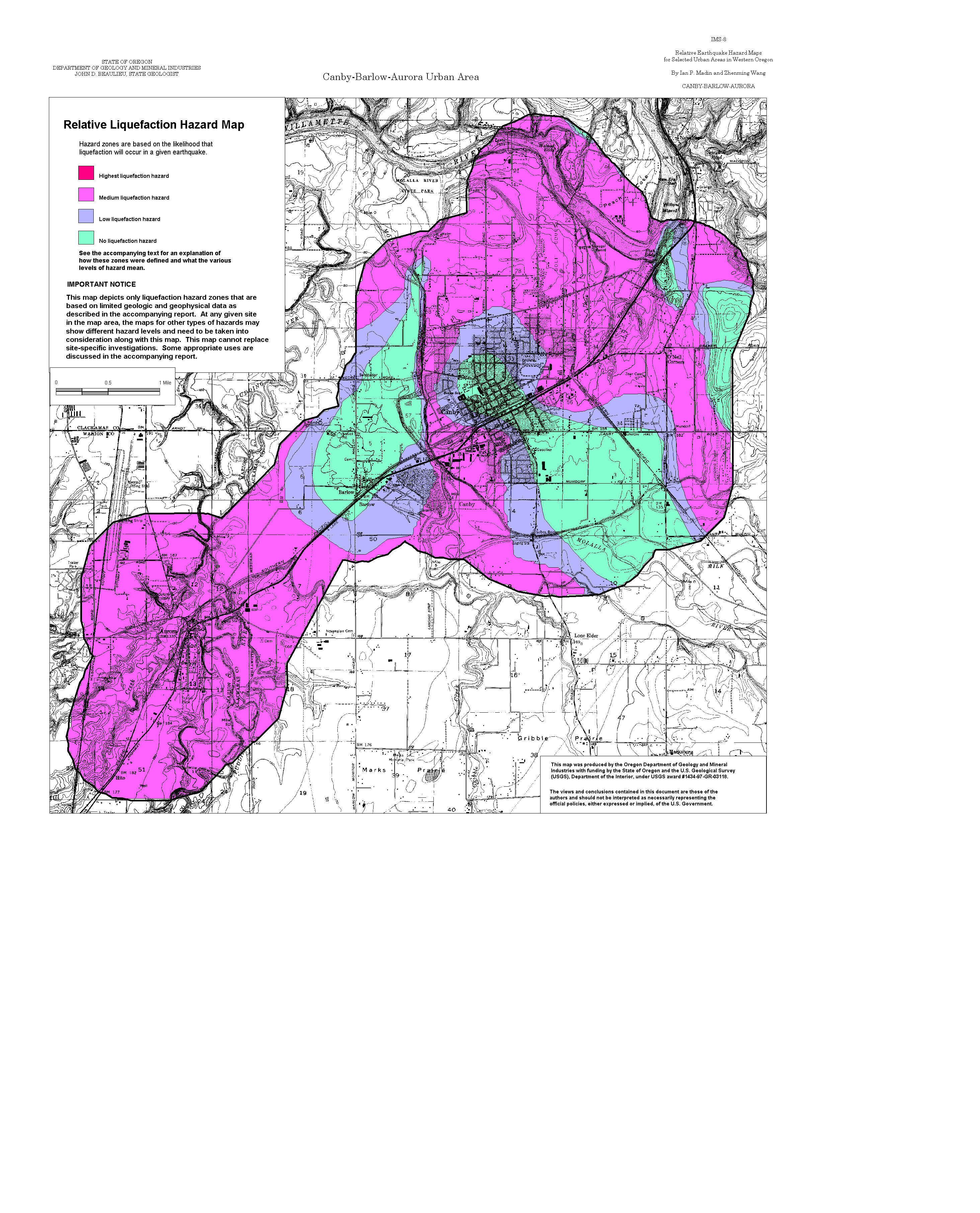
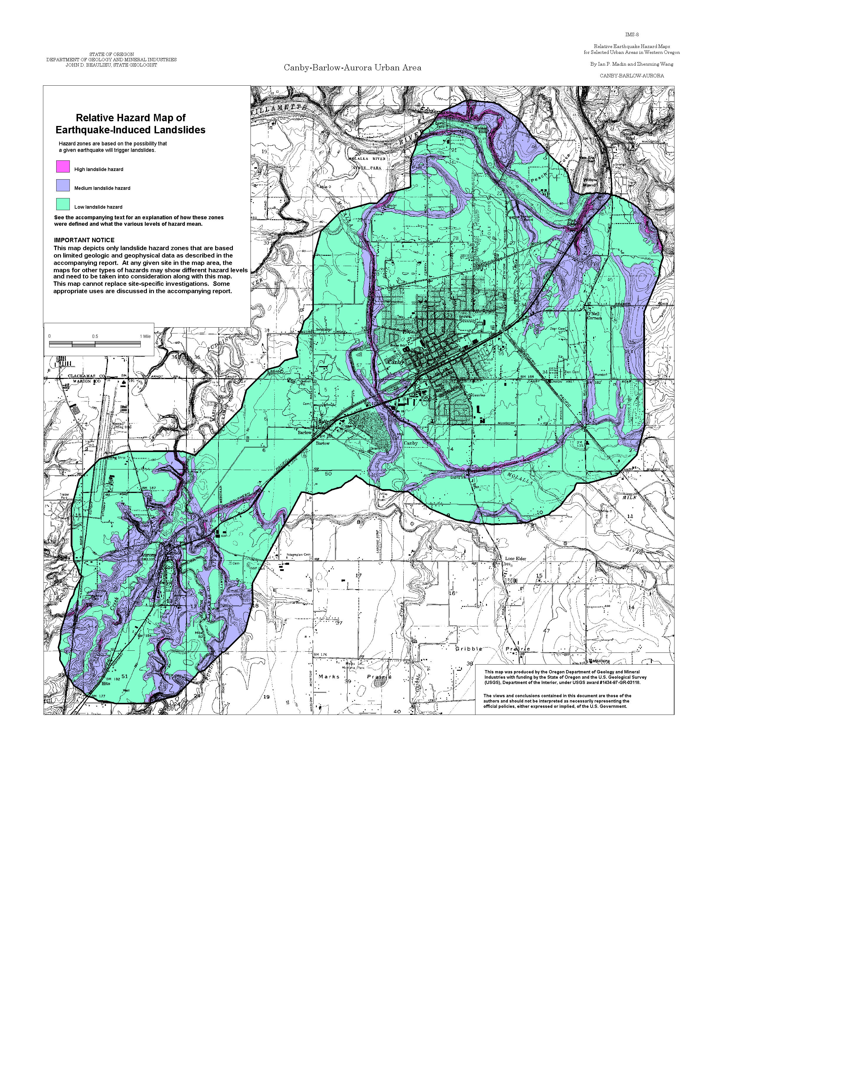
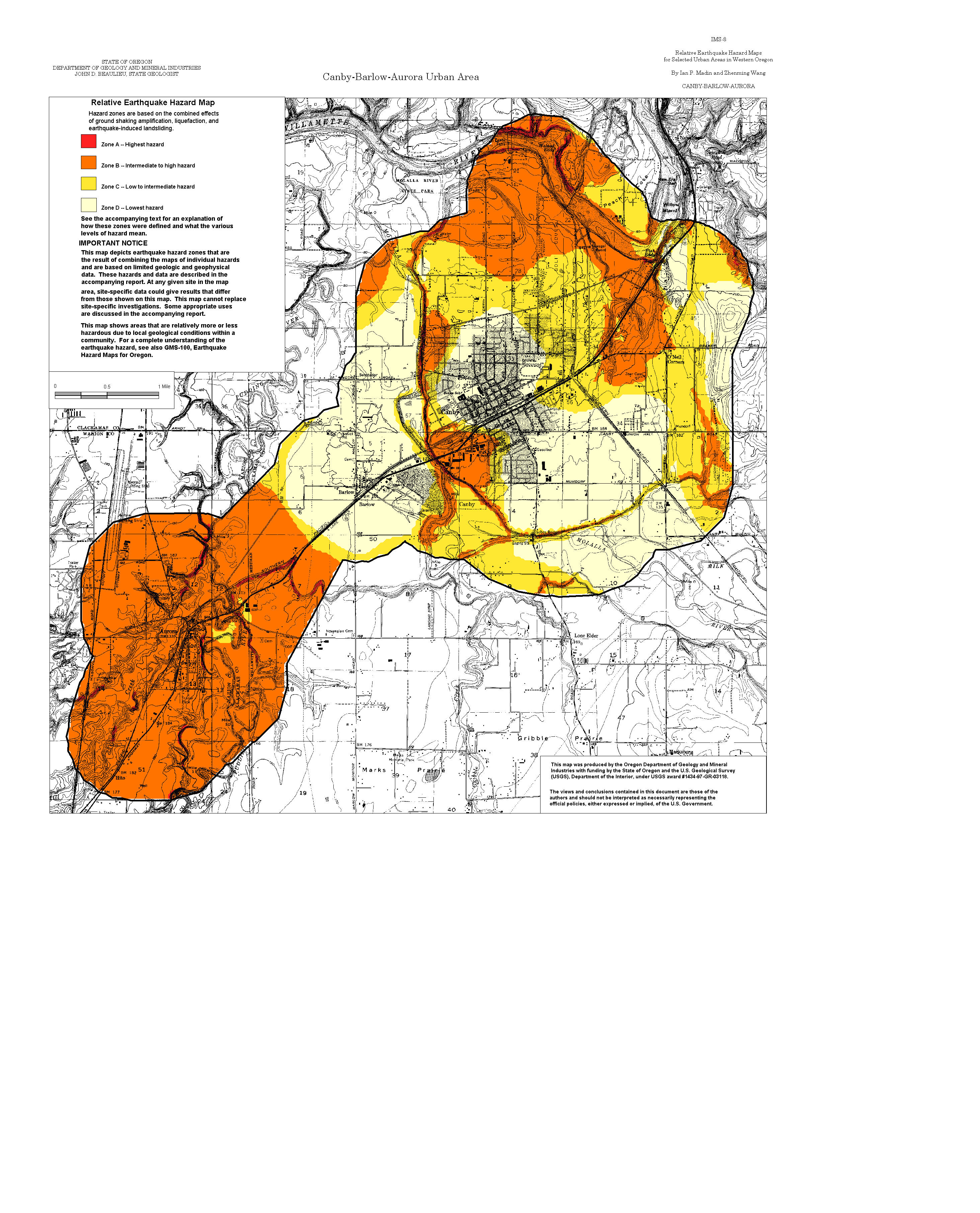
Canby-Barlow-Aurora: Amplification, Liquefaction, Landslide, Relative Hazard
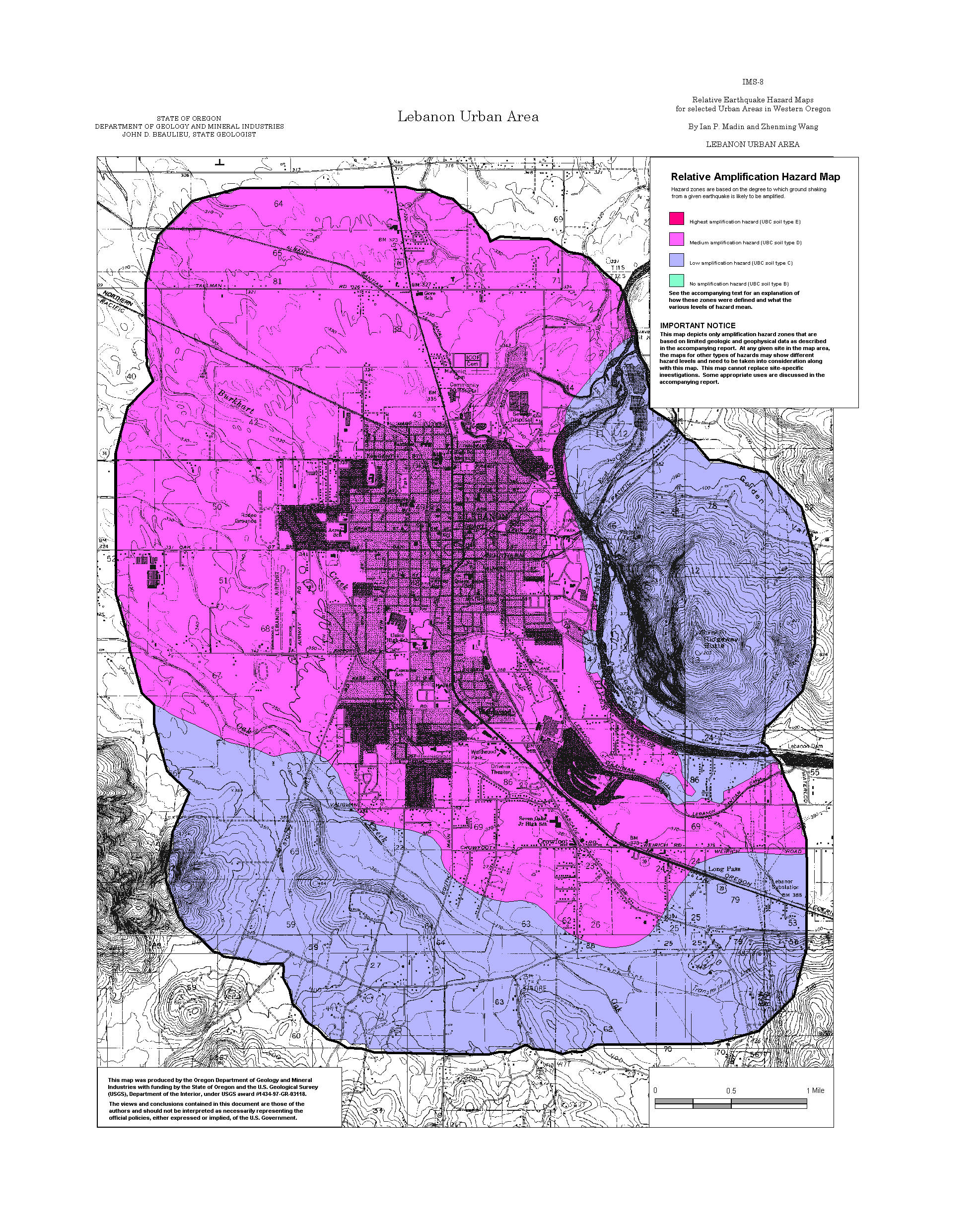
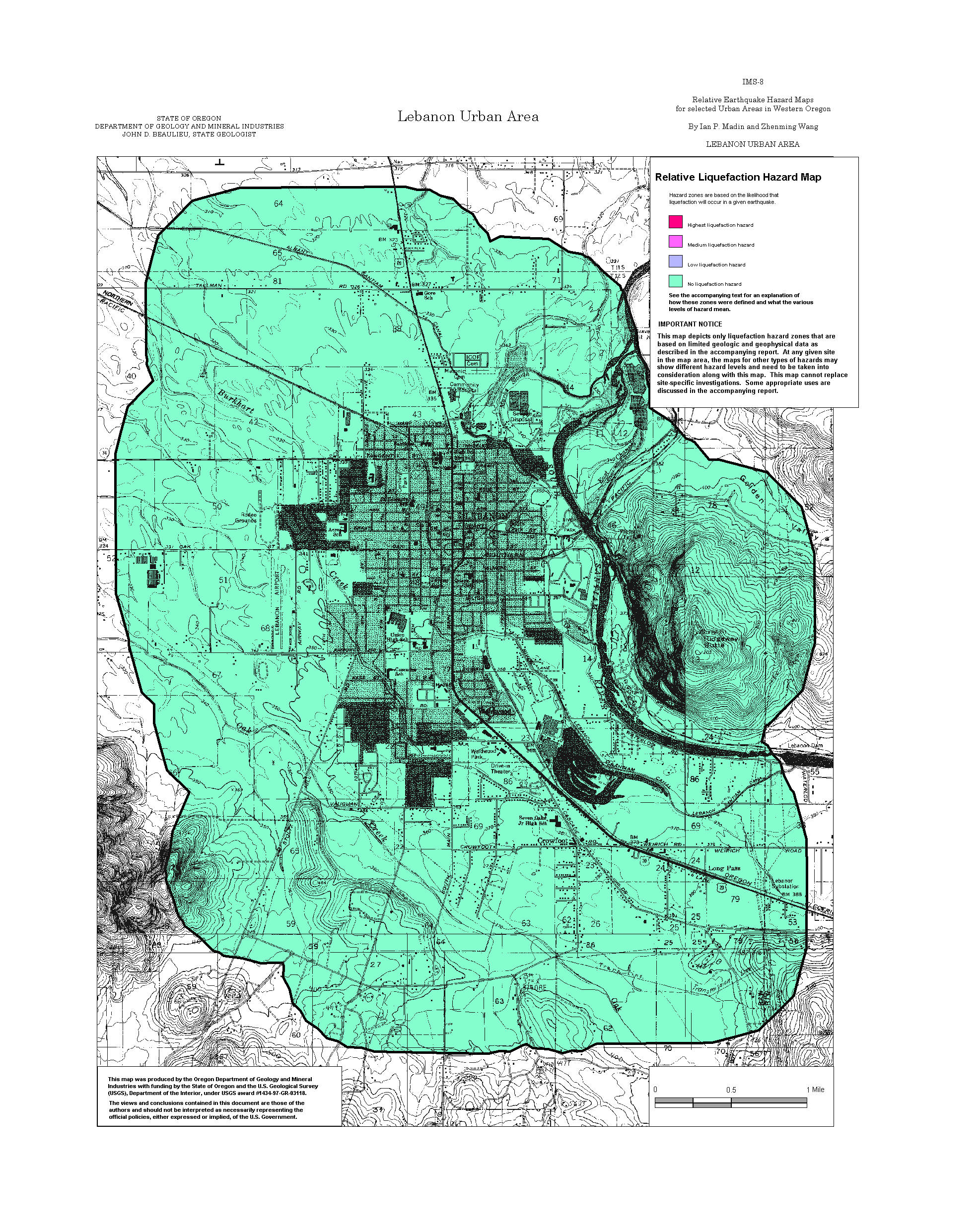
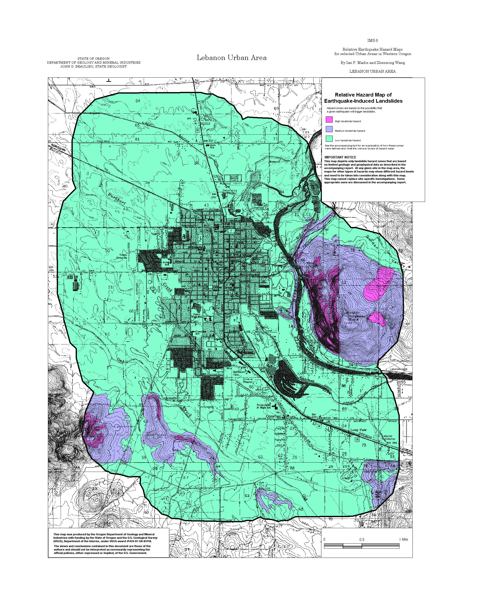
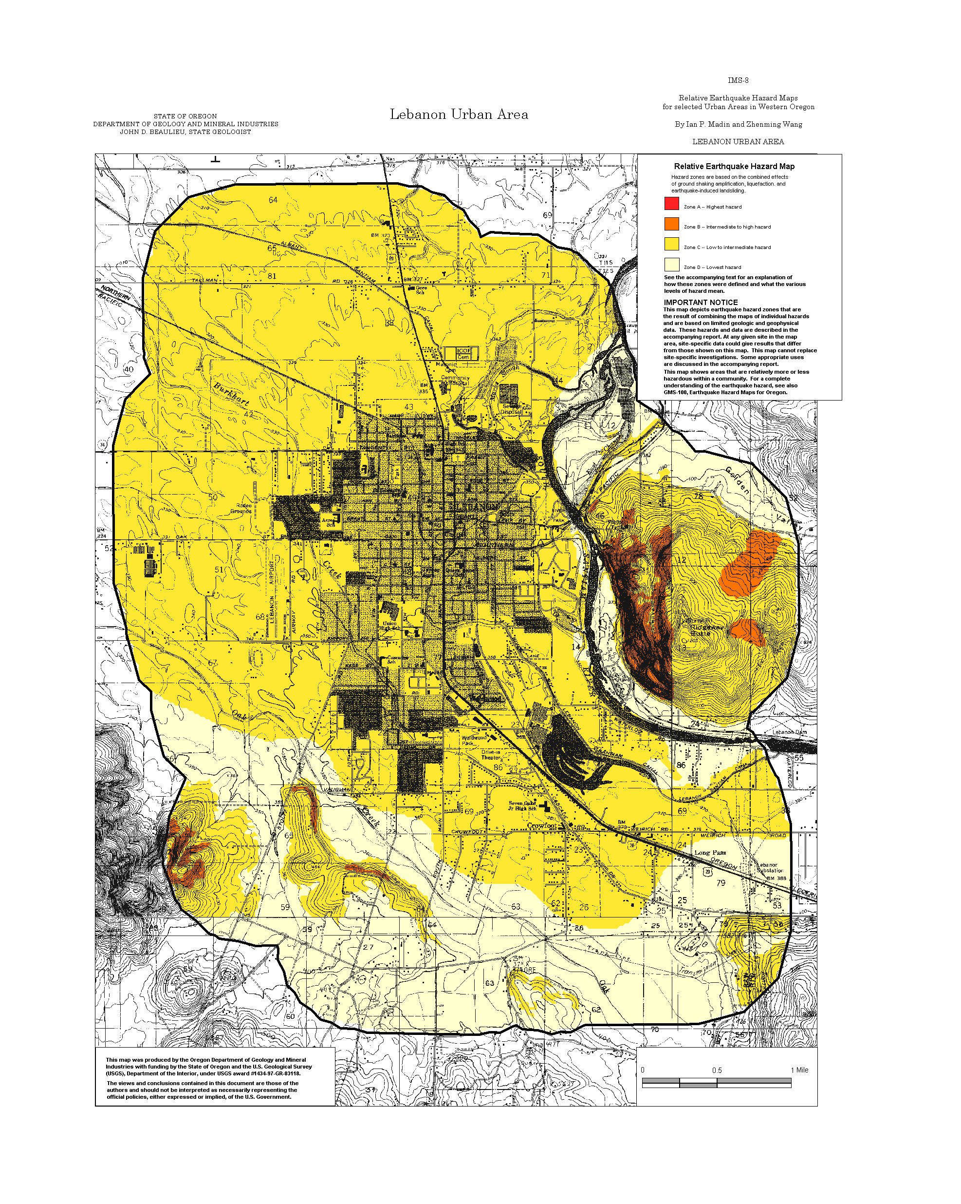
Lebanon: Amplification, Liquefaction, Landslide, Relative Hazard
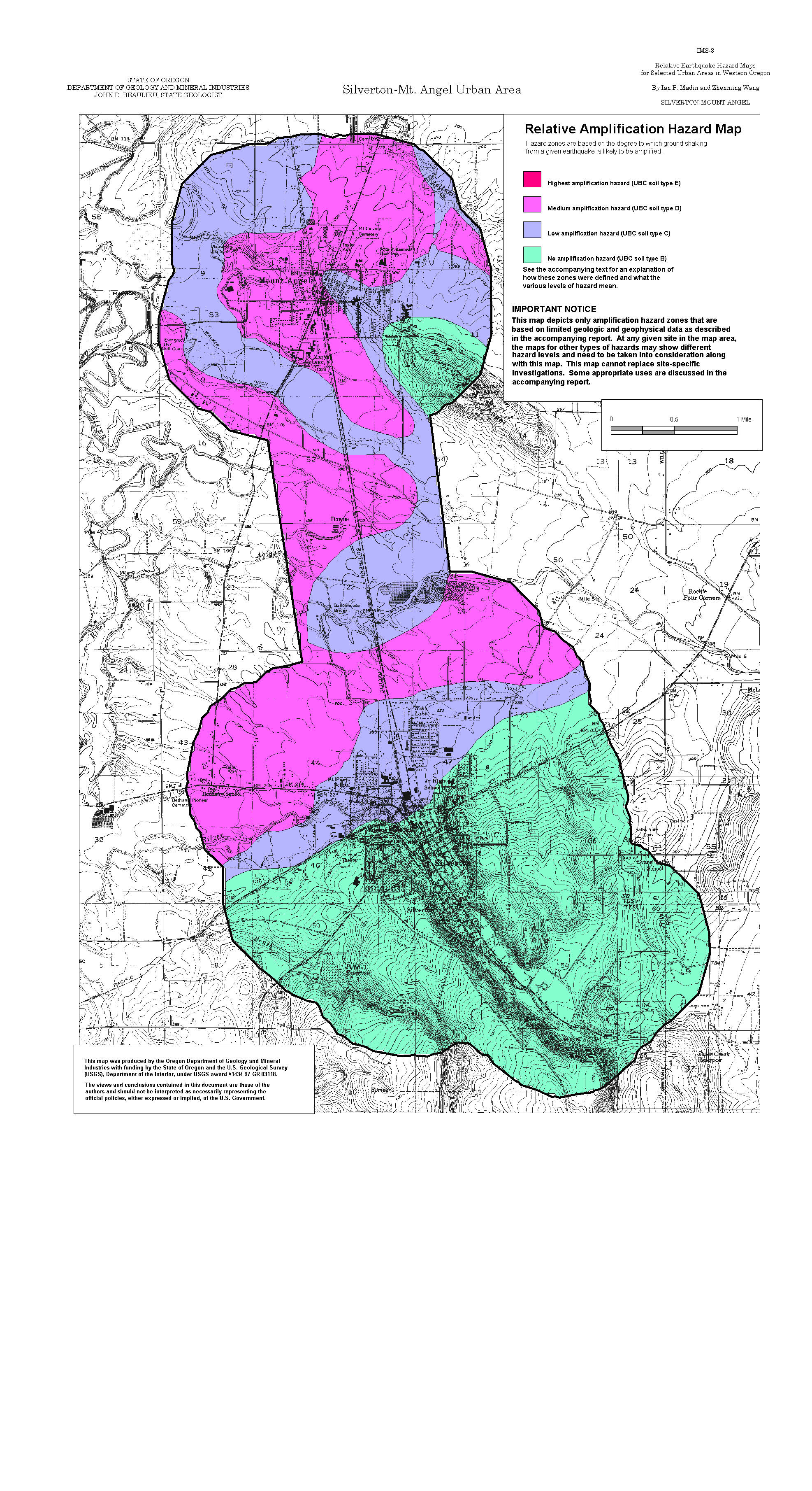
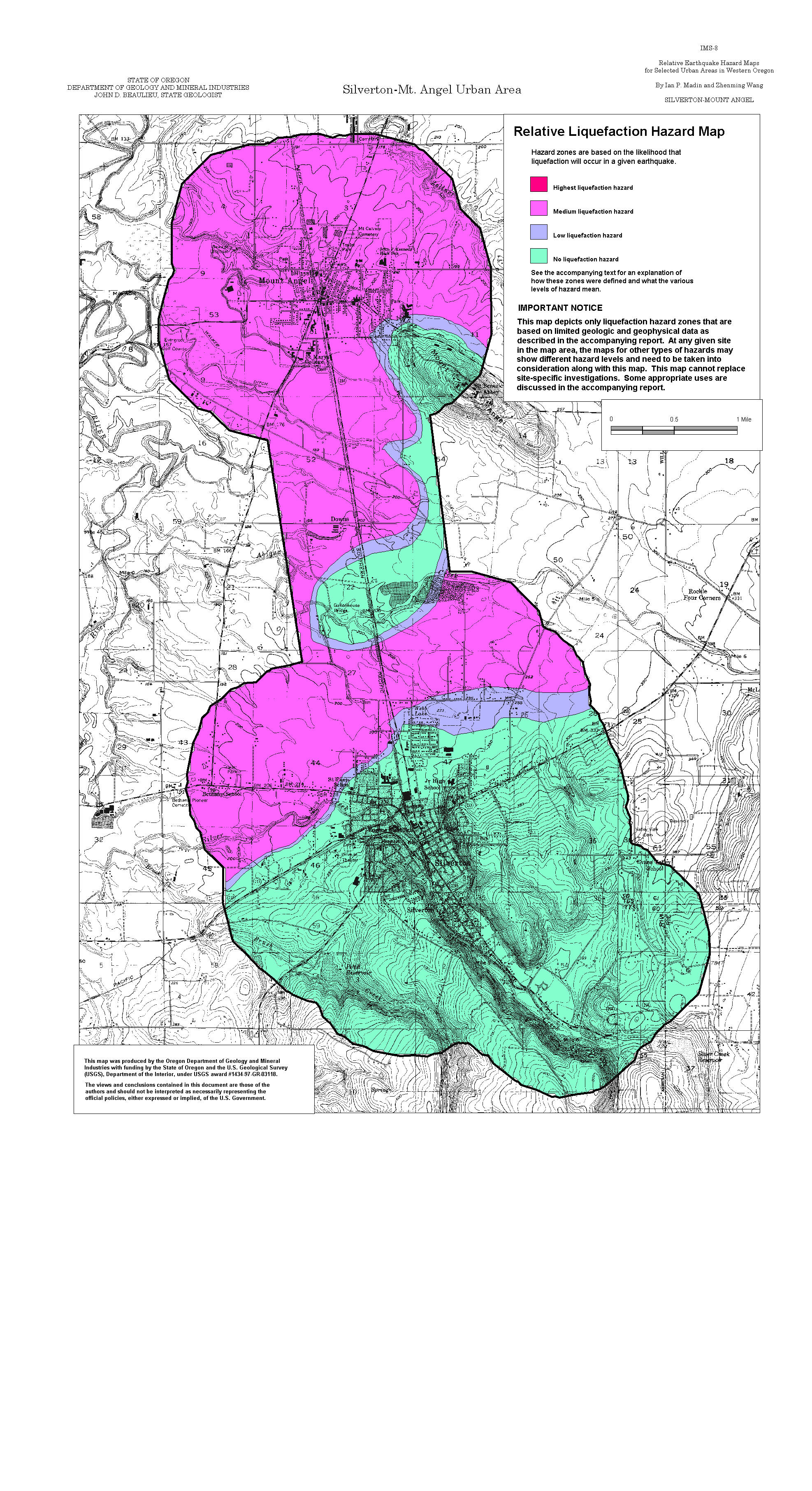
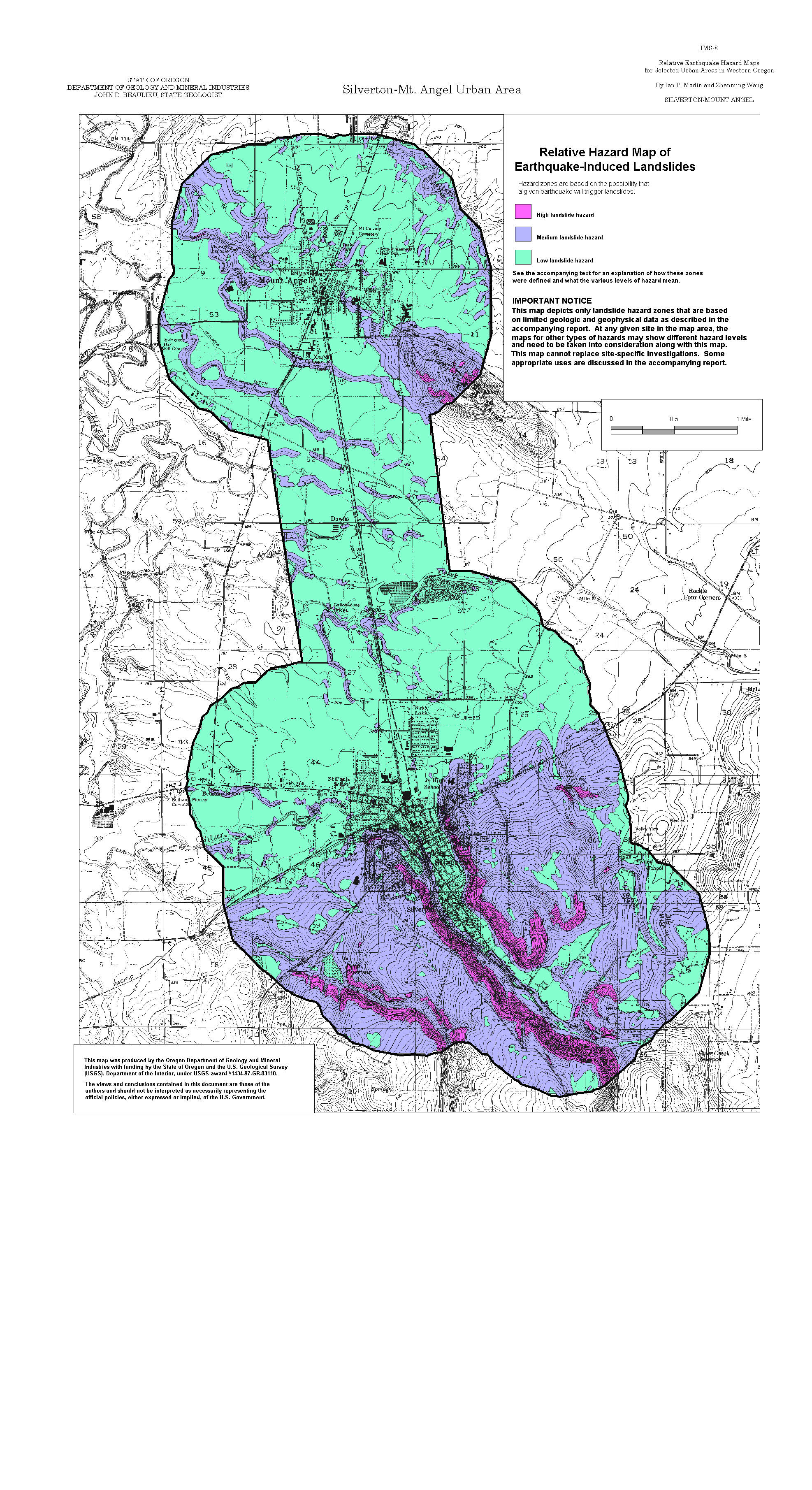
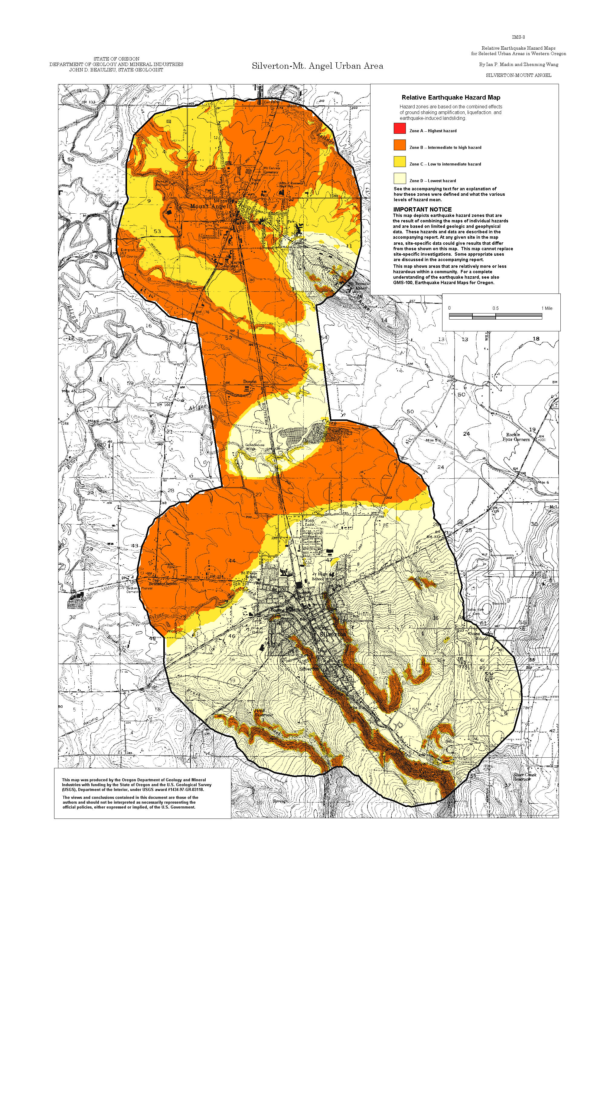
Silverton-Mt. Angel: Amplification, Liquefaction, Landslide, Relative Hazard
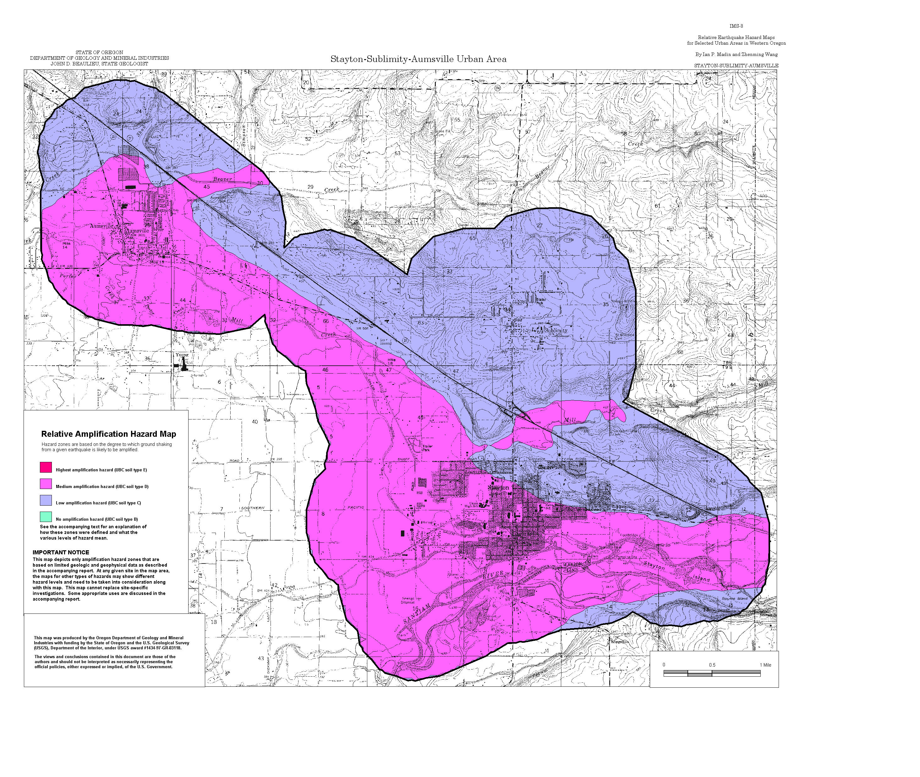
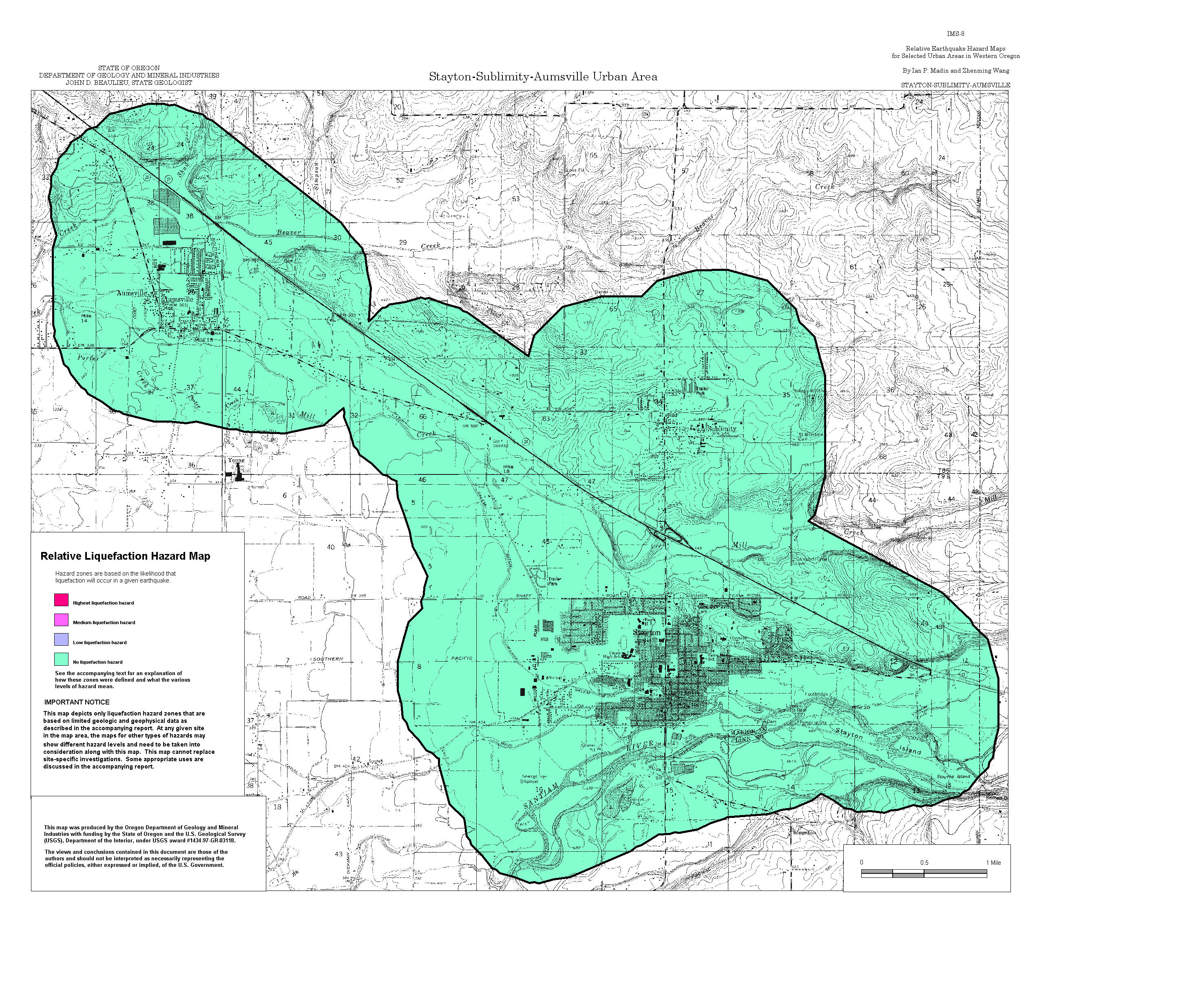
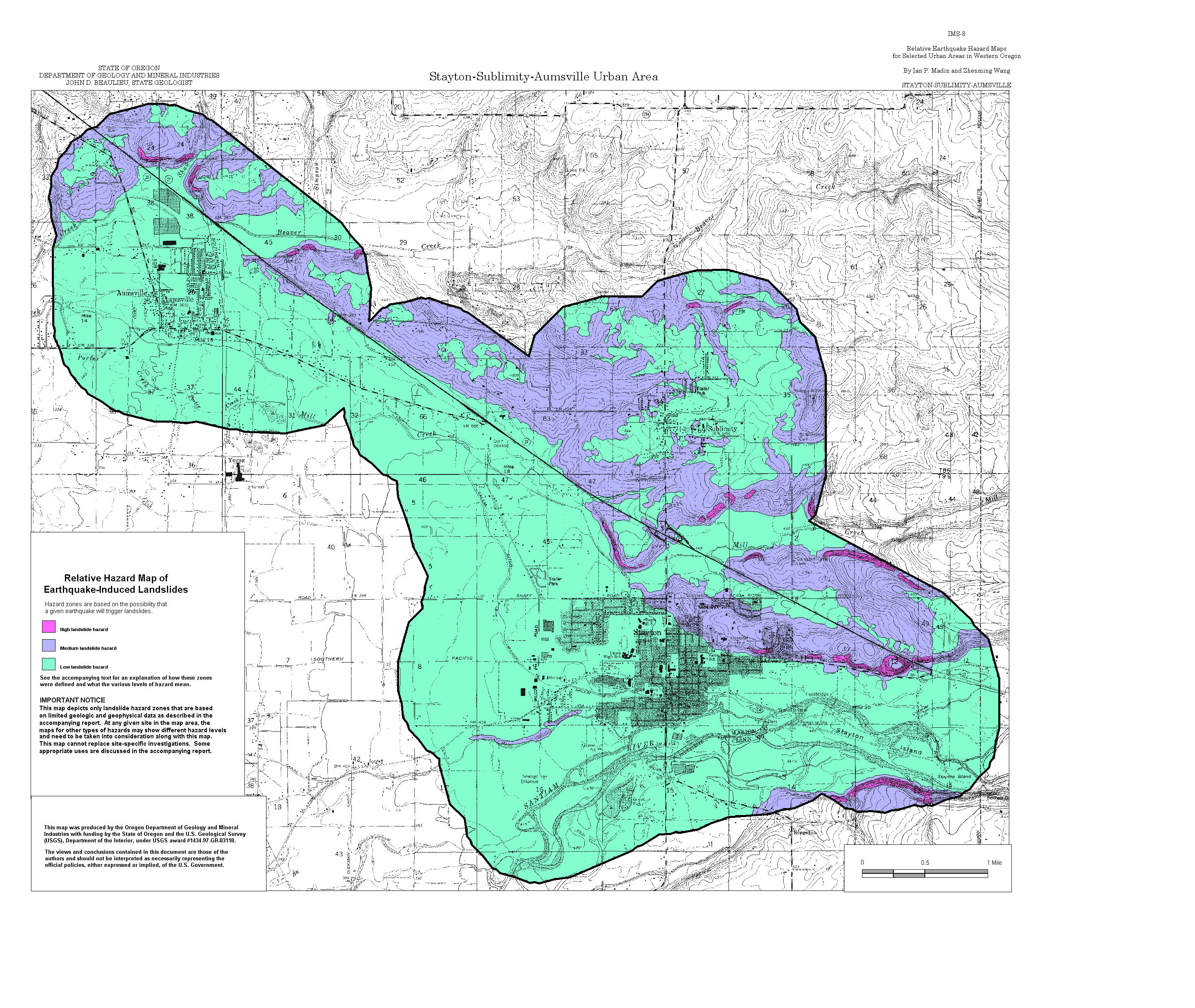
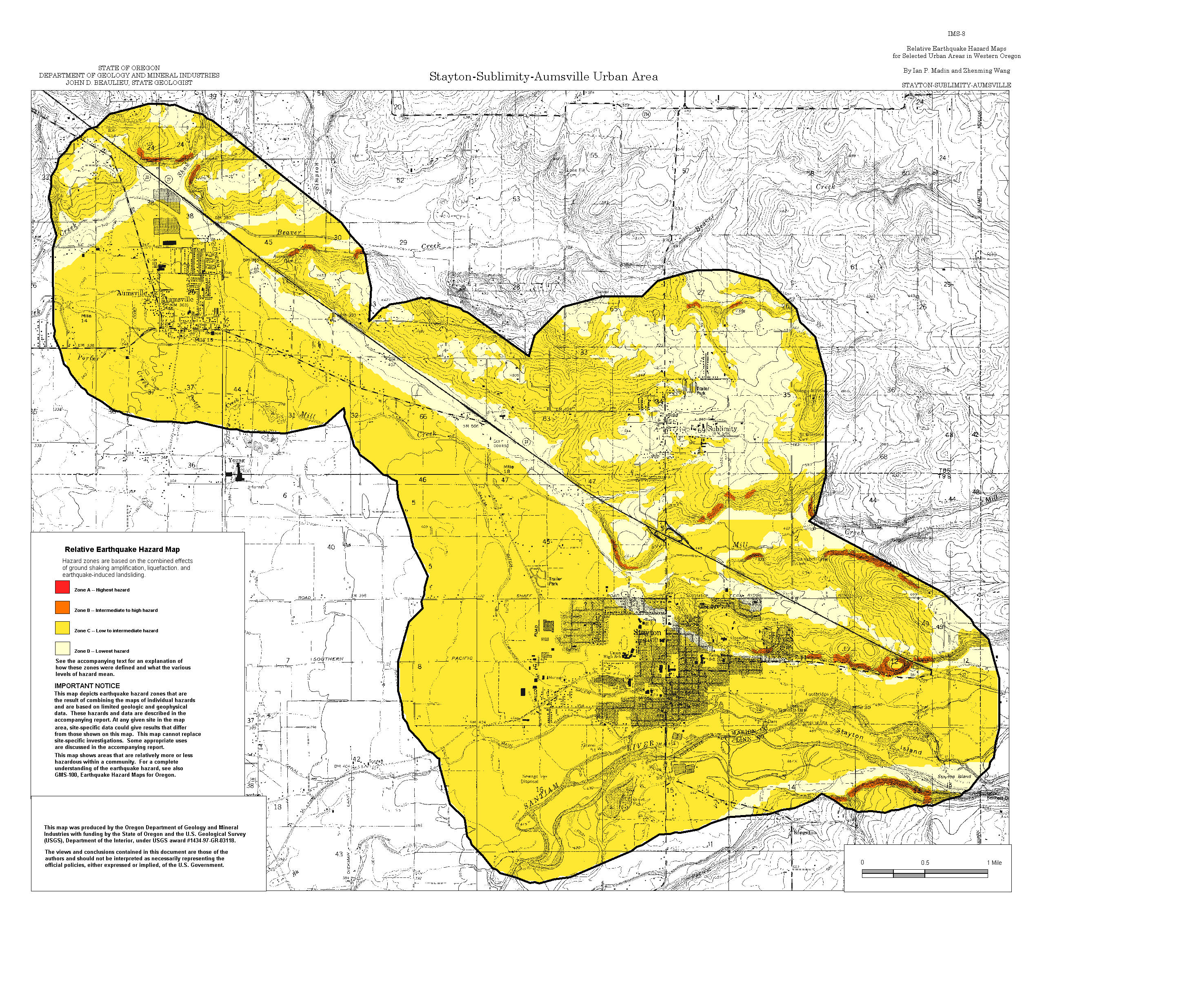
Stayton-Sublimity-Aumsville: Amplification, Liquefaction, Landslide, Relative Hazard
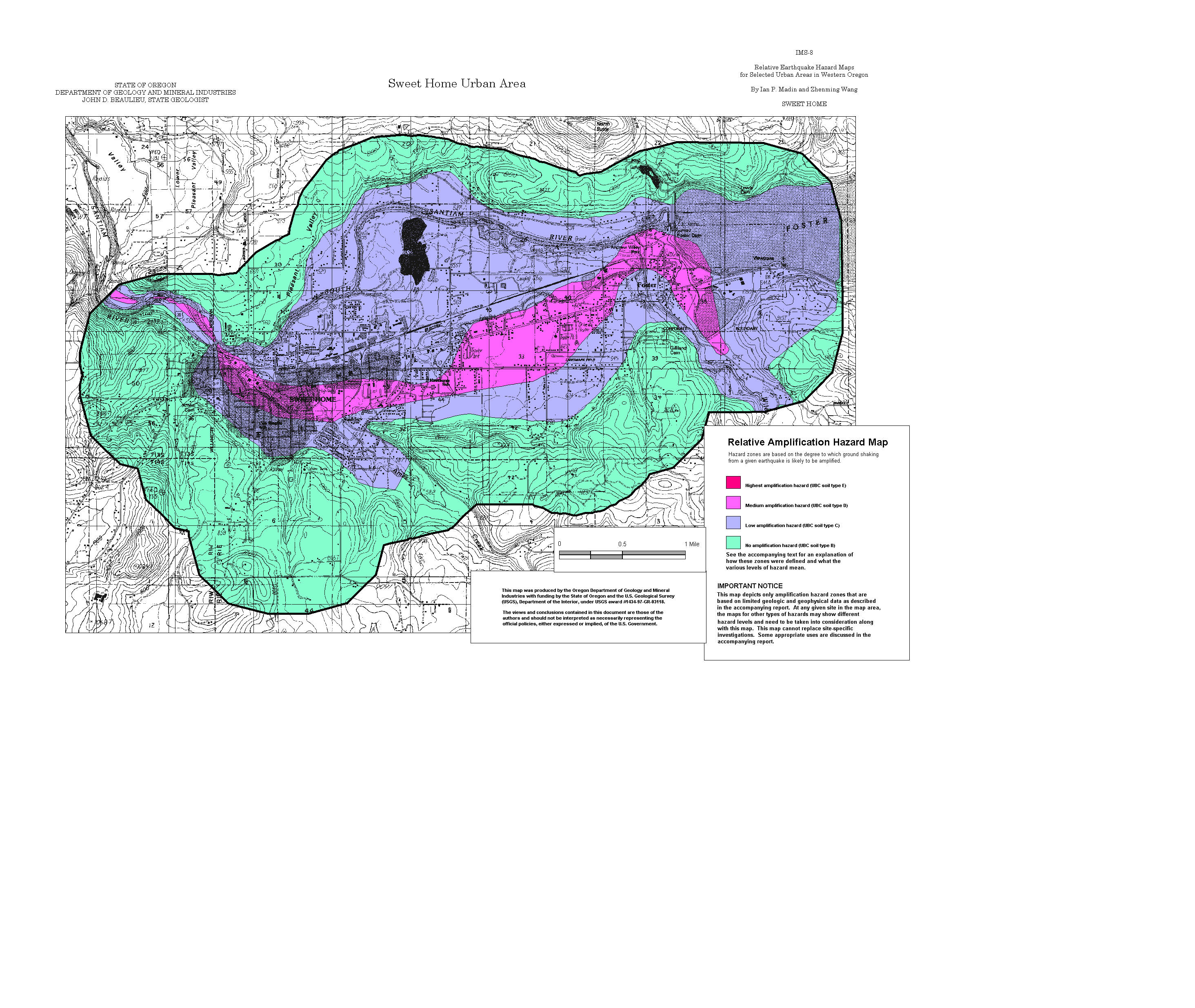
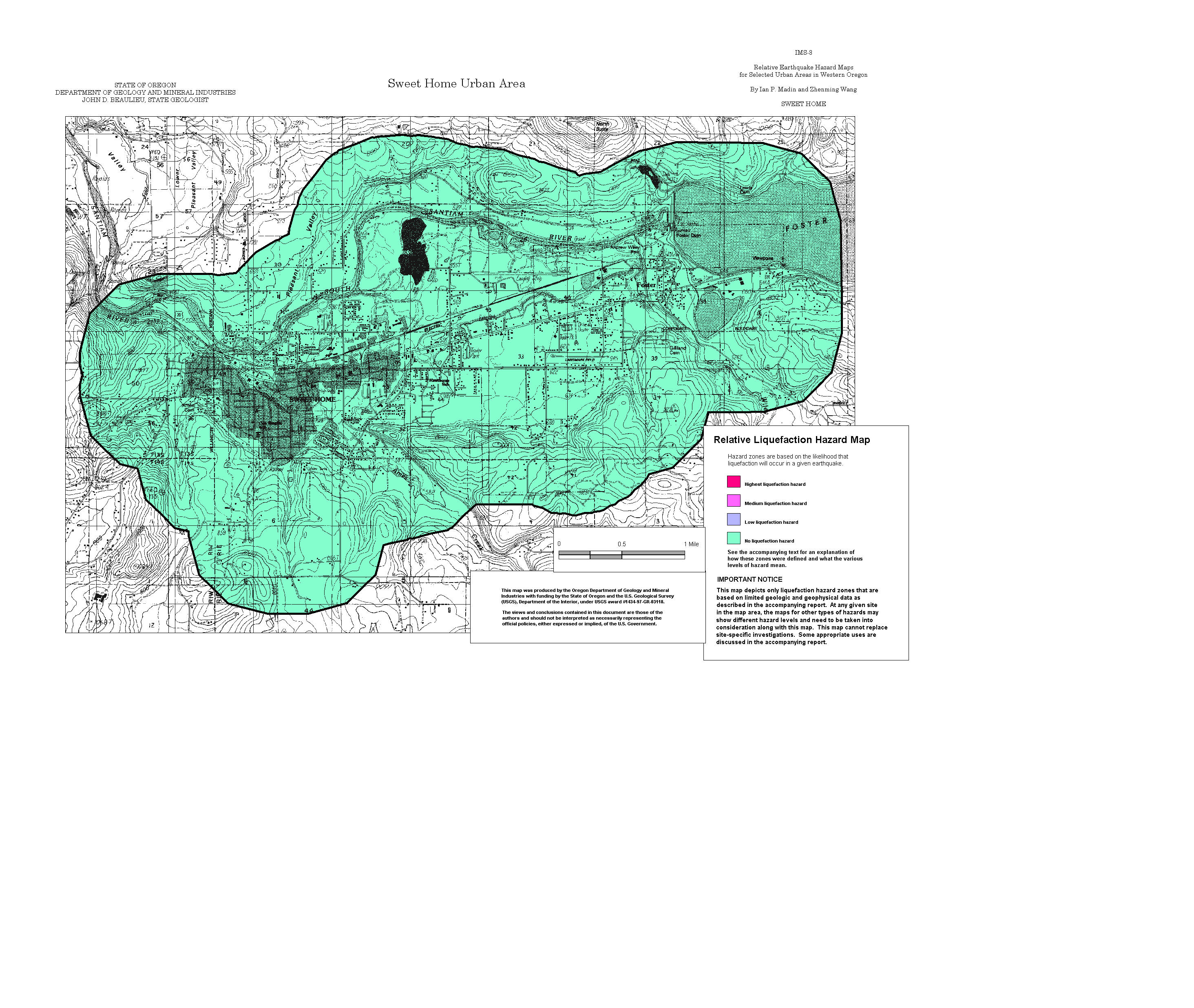
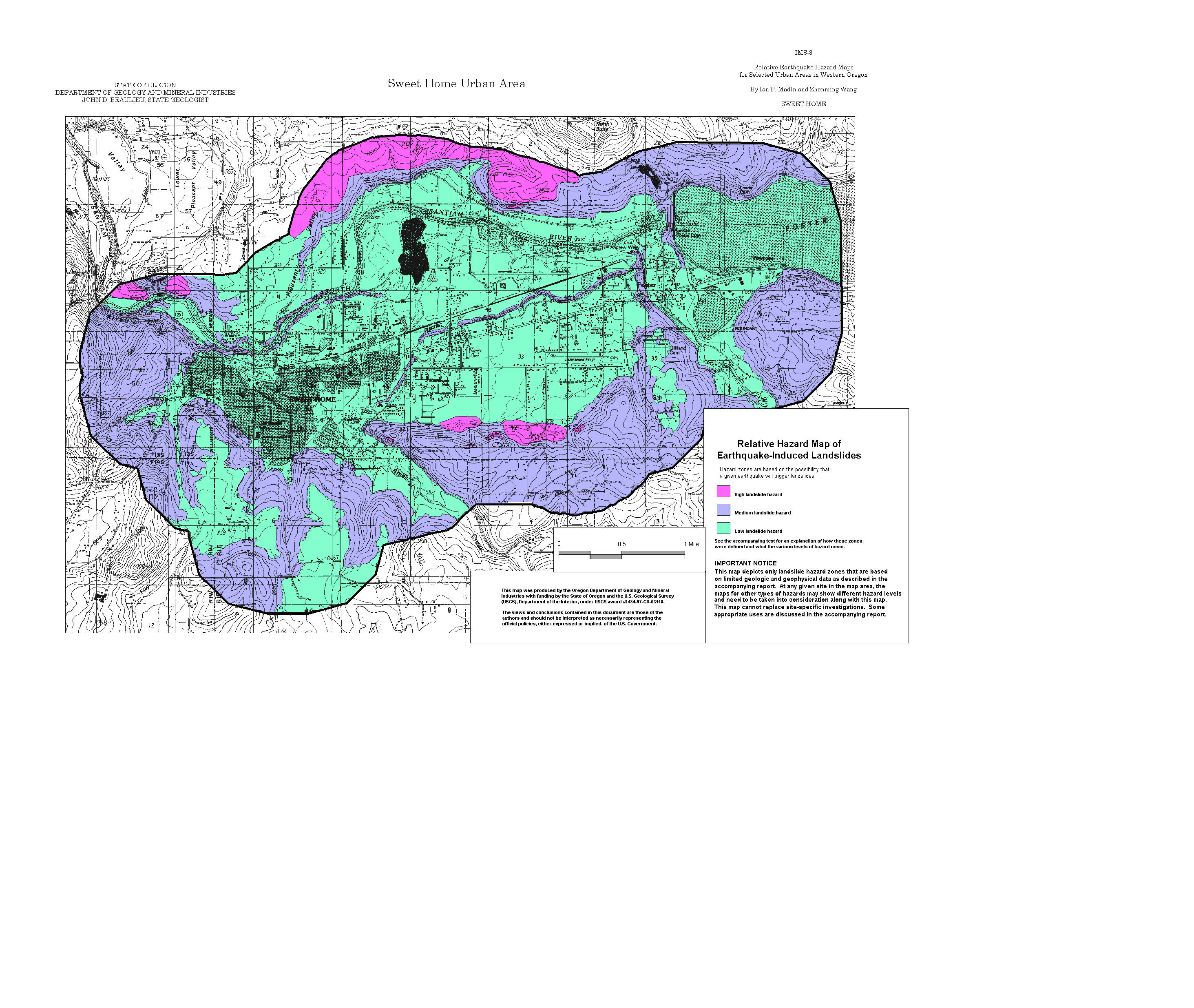
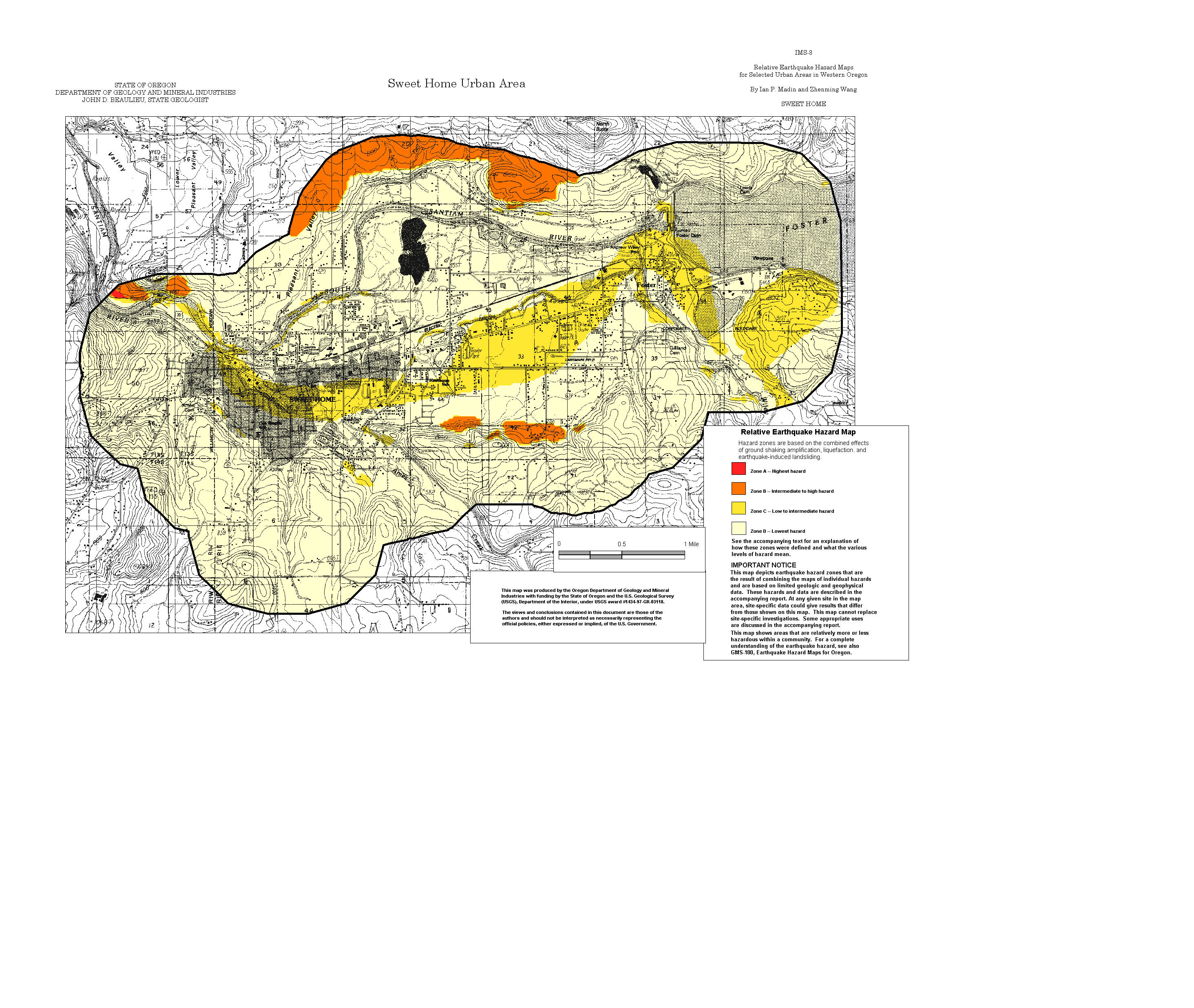
Sweet Home: Amplification, Liquefaction, Landslide, Relative Hazard
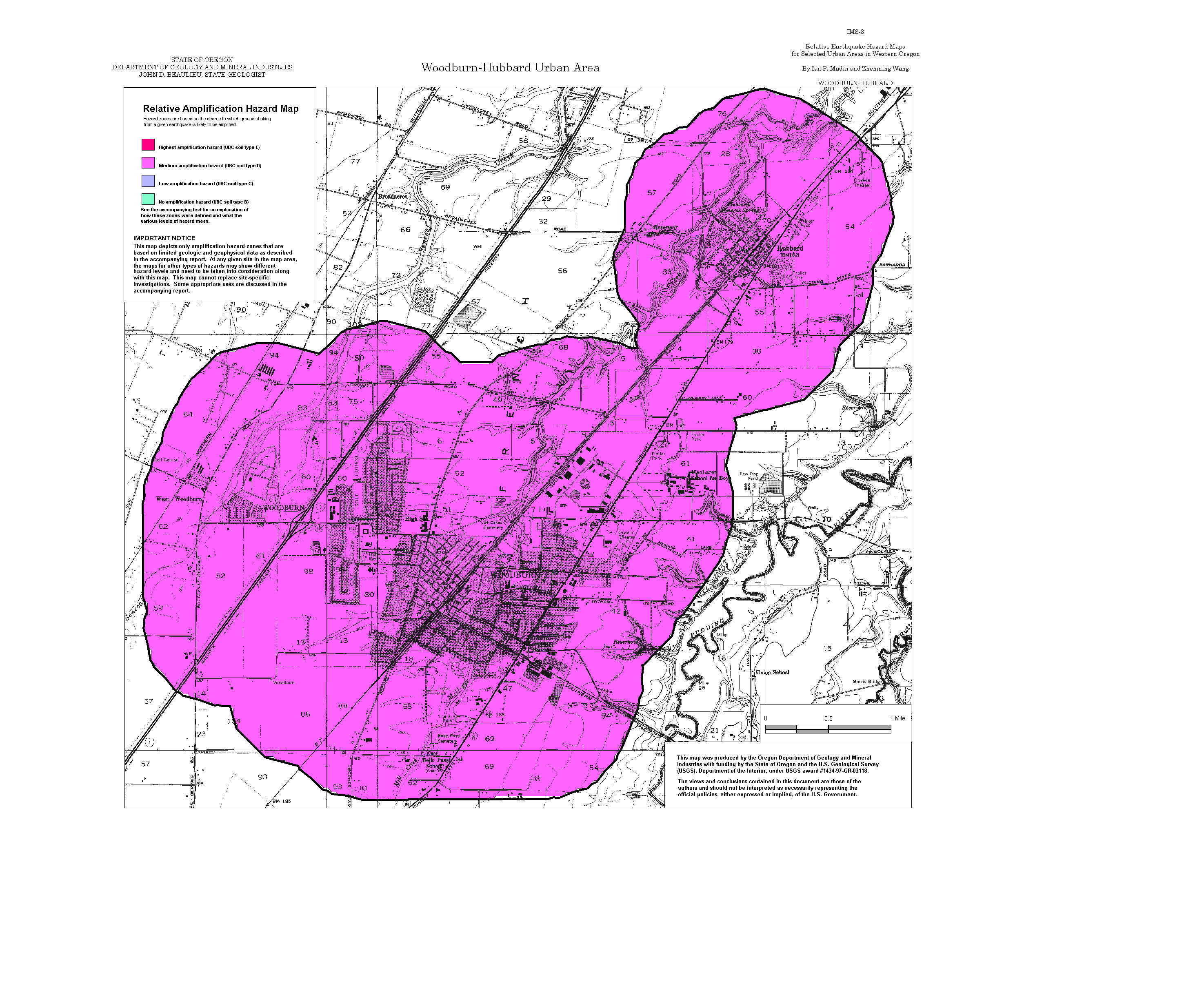
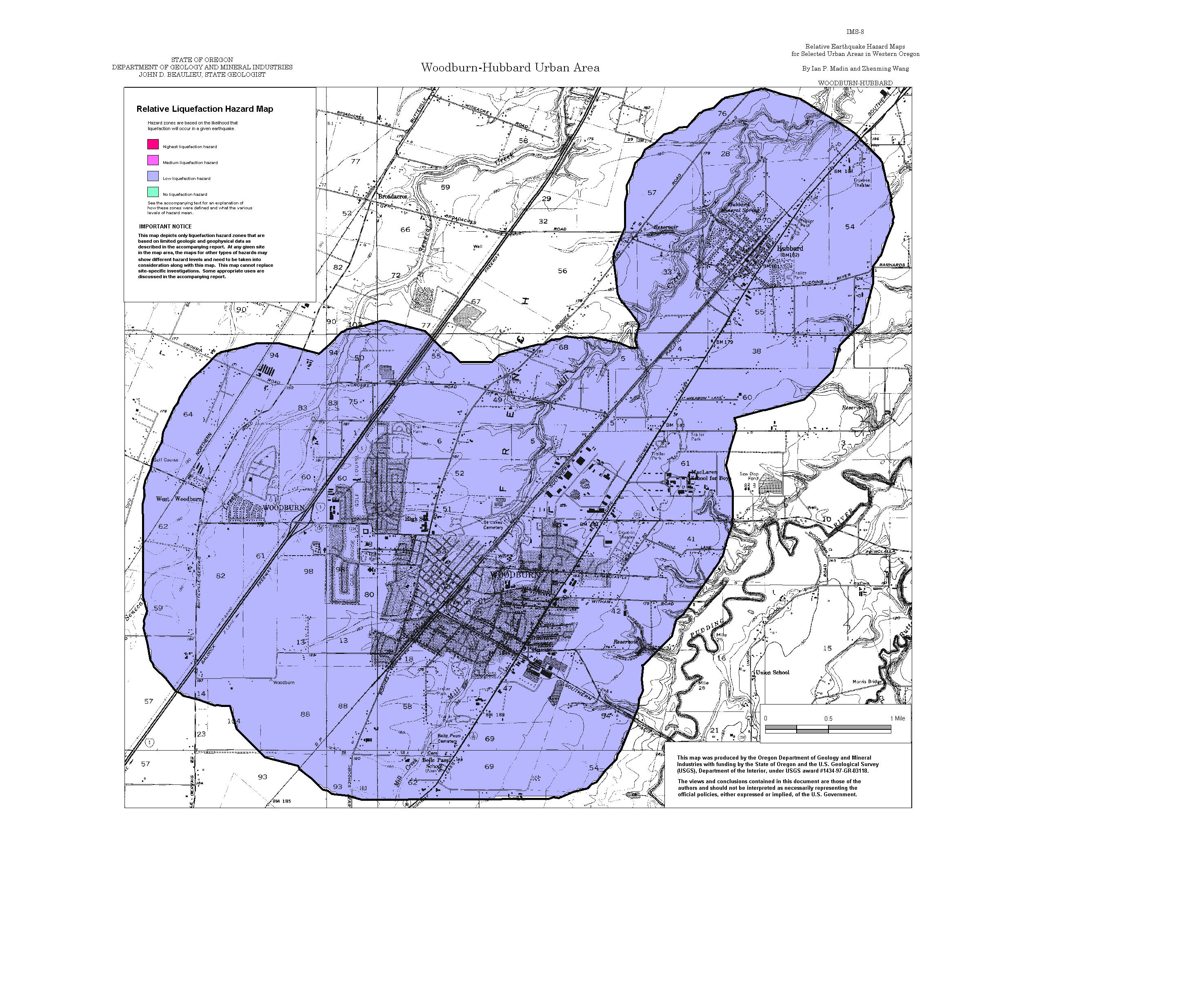
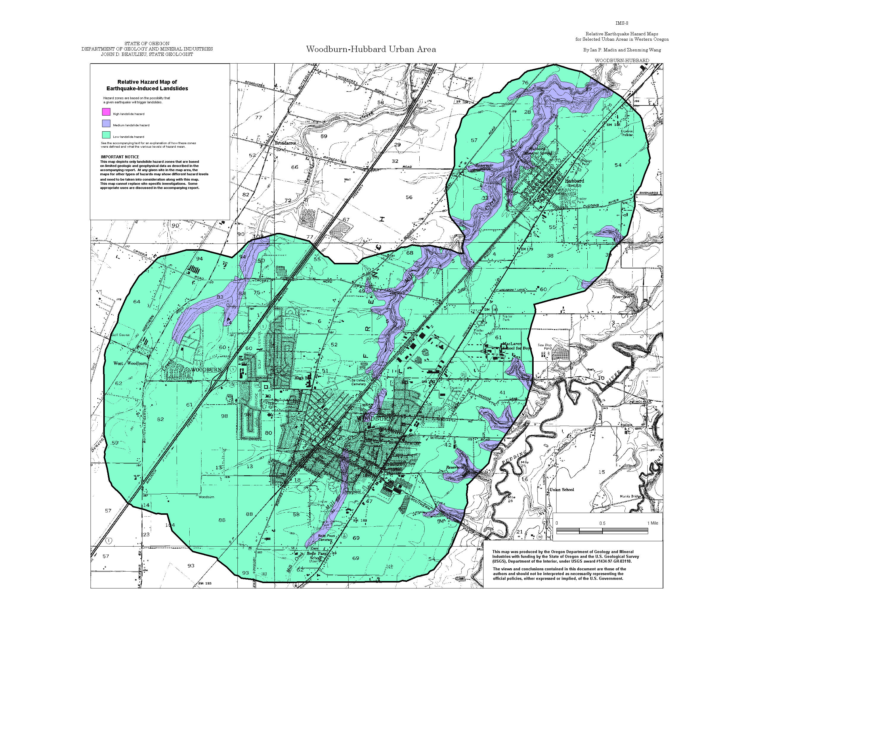
Woodburn-Hubbard: Amplification, Liquefaction, Landslide, Relative Hazard
ArcView GIS files (zipped)
MapInfo GIS files (zipped)