[Go back] | Publications Center | DOGAMI Home
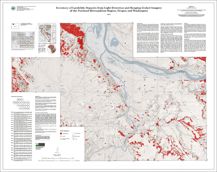
IMS-53, Inventory of landslide deposits from light detection and ranging (lidar) imagery of the Portland metropolitan region, Oregon and Washington, by William J. Burns, Ian P. Madin, Katherine A Mickelson, and Serin Duplantis. Scale 63,360. PDF plate size: 54 x 43 inches.
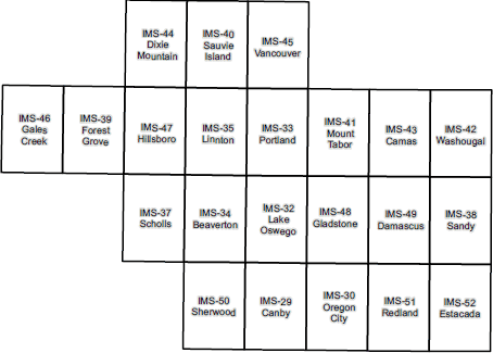
This map plate shows generalized landslide inventory data covering 22 U.S. Geological Survey 7.5-minute quadrangles in the Portland metropolitan area.
Download publication .zip file (244 MB)
See list below for individual quadrangle publications.
IMS-53 also contains:
|
Special Paper 42, Protocol for inventory mapping of landslide deposits from light detection and ranging (lidar) imagery, by William J. Burns and Ian P. Madin -- included to provide background on how the landslide inventory data were prepared |
|
DOGAMI Fact Sheet: "Understanding Landslide Deposit Maps" |
Coverage: