DOGAMI Open-File Report Series
[Go back] | Publications Center | DOGAMI Home
Publication Preview
Open-File Report O-13-05, Landslide inventory, susceptibility maps, and risk analysis for the City of Astoria, Clatsop County, Oregon, by William J. Burns and Katherine A. Mickelson
Download zip file (91 MB)
This publication consists of:
- 33-page text report, plus four Hazus appendices. PDF provided in print and onscreen versions.
- Appendices folder:
- Hazus runs as separate PDF files
- GIS folder – shapefiles and metadata for:
- Astoria_Deep_Susceptibility
- Astoria_Shallow_Susceptibility
- HeadScarp-Flanks_Astoria_Access
- LandslideDeposits_Astoria_Access
- Scarps_Astoria
- Map-plates folder. PDFs provided in print and onscreen versions:
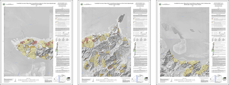
- Plate 1: Landslide Inventory Map of the Central-Western Quarter of the Astoria Quadrangle, Clatsop County, Oregon
- Plate 2, Landslide Inventory Map of the Central-Eastern Quarter of the Astoria Quadrangle, Clatsop County, Oregon
- Plate 3, Landslide Inventory Map of the Central-Western Quarter of the Cathlamet Bay Quadrangle, Clatsop County, Oregon
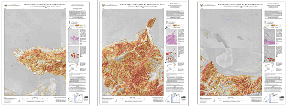
- Plate 4, Shallow-Seated Landslide Susceptibility Map of the Central-Western Quarter of the Astoria Quadrangle, Clatsop County, Oregon
- Plate 5, Shallow-Seated Landslide Susceptibility Map of the Central-Eastern Quarter of the Astoria Quadrangle, Clatsop County, Oregon
- Plate 6, Shallow-Seated Landslide Susceptibility Map of the Central-Western Quarter of the Cathlamet Bay Quadrangle, Clatsop County, Oregon
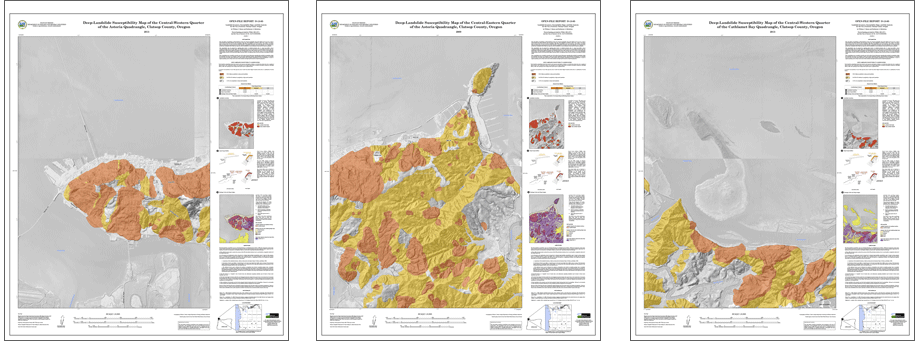
- Plate 7, Deep-Landslide Susceptibility Map of the Central-Western Quarter of the Astoria Quadrangle, Clatsop County, Oregon
- Plate 8, Deep-Landslide Susceptibility Map of the Central-Eastern Quarter of the Astoria Quadrangle, Clatsop County, Oregon
- Plate 9, Deep-Landslide Susceptibility Map of the Central-Western Quarter of the Cathlamet Bay Quadrangle, Clatsop County, Oregon