DOGAMI Interpretive Map Series
[Go back] | Publications Center | DOGAMI Home
Publication Preview
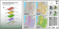 IMS-24, Geologic hazards, earthquake and landslide hazard maps, and future earthquake damage estimates for six counties in the Mid/Southern Willamette Valley including Yamhill, Marion, Polk, Benton, Linn, and Lane Counties, and the City of Albany, Oregon, by William J. Burns, R. Jon Hofmeister, and Yumei Wang, 2008, 121 p., scale 1:422,400. Contains GIS data, Hazus data files, map plate, and text report.
To view IMS-24 publication PDFs, click on links below:
- IMS-24 main report text (8 MB) << READ THIS BEFORE READING ANY APPENDICES
- IMS-24 Appendix A: Benton County earthquake scenarios, geologic hazard maps, and HAZUS-MH reports (1 MB)
- IMS-24 Appendix B: City of Albany earthquake scenarios, geologic hazard maps, and HAZUS-MH reports (795 KB)
- IMS-24 Appendix C: Lane County earthquake scenarios, geologic hazard maps, and HAZUS-MH reports (1.9 MB)
- IMS-24 Appendix D: Linn County earthquake scenarios, geologic hazard maps, and HAZUS-MH reports (1.5 MB)
- IMS-24 Appendix E: Marion County earthquake scenarios, geologic hazard maps, and HAZUS-MH reports (1.6 MB)
- IMS-24 Appendix F: Polk County earthquake scenarios, geologic hazard maps, and HAZUS-MH reports (876 KB))
- IMS-24 Appendix G: Yamhill County earthquake scenarios, geologic hazard maps, and HAZUS-MH reports (937 KB)
- IMS-24 Appendix H: Procedure used to develop relative ground-shaking amplification susceptibility map, relative liquefaction hazard susceptibility map, relative earthquake-induced landslide susceptibility map, identified landslide areas map, and reference map 1.4 MB)
- IMS-24 Appendix I: Volcanic hazard maps (6.5 MB)
- IMS-24 Appendix J: Pre-disaster mitigation plan action items (101 KB)
- IMS-24 Appendix K: Landslide impact inventory data sheet (74 KB)