
Interpretive Map Series (IMS)
Geology-based maps, prepared at a variety of scales, depicting interpretations of natural hazards or risks.
Click the up/down arrow in the table heading to sort by that column.| No. | Year | Format | Details | Thumbnail |
|---|---|---|---|---|
| IMs-60 | 2018 | preview/ download | IMS-60, Landslide hazard and risk study of Eugene-Springfield and Lane County, Oregon, by Nancy C. Calhoun, William J. Burns, Jon J. Franczyk, and Gustavo Monteverde, 2018, 42 p., appendices, 3 60 x 38 map plates, 1:34,000, GIS data. |  |
| IMS-58 | 2020 | preview/ download | IMS-58, Natural hazard risk report for Tillamook County, Oregon, including the cities of Bay City, Garibaldi, Manzanita, Nehalem, Rockaway Beach, Tillamook, and Wheeler and the unincorporated communities of Neskowin, Oceanside, Netarts, and Pacific City, by Matt C. Williams, Christina Appleby, John Bauer, and Jed Roberts, 2020, 95 p., 7 tabloid size map plates, GIS data. |  |
| IMS-57 | 2018 | preview/ download | Landslide hazard and risk study of central and western Multnomah County, Oregon, by William J. Burns, Nancy C. Calhoun, Jon J. Franczyk, Kassandra O. Lindsey, and Lina Ma, 2018, 42 p. report, appendices, 3 60 x 40 inch map plates, 1:200,000, GIS data. |  |
| IMS-56 | 2017 | preview/ download | Statewide subbasin-level channel migration screening for Oregon, by Jed T. Roberts and Lowell H. Anthony, 2017, 1:800,000. Geodatabase; 38 x 36 inch plate. |  |
| IMS-55 | 2013 | preview/ download | Landslide inventory maps of the southern half of the Pittsburg quadrangle, Columbia County, Oregon, by William J. Burns, Katherine A. Mickelson, and Evan C. Saint-Pierre, 2013, 1:8,000. Geodatabase; 36 x 42 inch plates. Includes DOGAMI Special Paper 42, Protocol for Inventory Mapping of Landslide Deposits from Light Detection and Ranging (Lidar) Imagery. |  |
| IMS-54 | 2013 | preview/ download | Landslide inventory maps of the northern half of the Vernonia quadrangle, Columbia County, Oregon, by William J. Burns, Katherine A. Mickelson, and Evan C. Saint-Pierre, 2013, 1:8,000. Geodatabase; 36 x 42 inch plates. Includes DOGAMI Special Paper 42, Protocol for Inventory Mapping of Landslide Deposits from Light Detection and Ranging (Lidar) Imagery. |  |
| IMS-53 | 2012 | preview/ download | Inventory of landslide deposits from light detection and ranging (lidar) imagery of the Portland metropolitan region, Oregon and Washington, by William J. Burns, Ian P. Madin, Katherine A Mickelson, and Serin Duplantis, 2012, 1:63,360. 54 x 43 inches. Summary map showing generalized data for 22 landslide inventory quadrangle maps in the Portland area. Includes DOGAMI Special Paper 42, Protocol for Inventory Mapping of Landslide Deposits from Light Detection and Ranging (Lidar) Imagery. |  |
| IMS-52 | 2012 | preview/ download | Landslide inventory maps of the Estacada quadrangle, Clackamas County, Oregon, by William J. Burns, Serin Duplantis, Katherine A. Mickelson, and Ian P. Madin, 2012, 1:8,000. Geodatabase; 36 x 42 inch plates. Click on htm link to preview plates. Includes DOGAMI Special Paper 42, Protocol for Inventory Mapping of Landslide Deposits from Light Detection and Ranging (Lidar) Imagery. |  |
| IMS-51 | 2012 | preview/ download | Landslide inventory maps of the Redland quadrangle, Clackamas County, Oregon, by William J. Burns, Serin Duplantis, Katherine A. Mickelson, and Ian P. Madin, 2012, 1:8,000. Geodatabase; 36 x 42 inch plates. Click on htm link to preview plates. Includes DOGAMI Special Paper 42, Protocol for Inventory Mapping of Landslide Deposits from Light Detection and Ranging (Lidar) Imagery. | 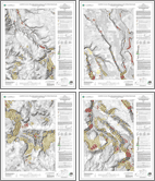 |
| IMS-50 | 2012 | preview/ download | Landslide inventory maps of the Sherwood quadrangle, Clackamas, Washington, Marion, and Yamhill Counties, Oregon, by William J. Burns, Katherine A. Mickelson, and Serin Duplantis, 2012, 1:8,000. Geodatabase; 36 x 42 inch plates. Includes DOGAMI Special Paper 42, Protocol for Inventory Mapping of Landslide Deposits from Light Detection and Ranging (Lidar) Imagery. | 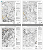 |
| IMS-49 | 2012 | preview/ download | Landslide inventory maps of the Damascus quadrangle, Clackamas and Multnomah Counties, Oregon, by William J. Burns, Ian P. Madin, Serin Duplantis, Katherine A. Mickelson, and Cullen B. Jones, 2012, 1:8,000. Geodatabase; 36 x 42 inch plates. Includes SP-42, Protocol for Inventory Mapping of Landslide Deposits from Light Detection and Ranging (Lidar) Imagery. |  |
| IMS-48 | 2012 | preview/ download | Landslide inventory maps of the Gladstone quadrangle, Clackamas and Multnomah Counties, Oregon, by William J. Burns, Katherine A. Mickelson, Serin Duplantis, and Ian P. Madin, 2012, 1:8,000. Geodatabase; 36 x 42 inch plates. Includes DOGAMI Special Paper 42, Protocol for Inventory Mapping of Landslide Deposits from Light Detection and Ranging (Lidar) Imagery. |  |
| IMS-47 | 2012 | preview/ download | Landslide inventory maps of the Hillsboro quadrangle, Washington and Multnomah Counties, Oregon, by William J. Burns, Katherine A. Mickelson, Serin Duplantis, and Kendra J. Williams, 2012, 1:8,000. Geodatabase; 36 x 42 inch plates. Includes SP-42, Protocol for Inventory Mapping of Landslide Deposits from Light Detection and Ranging (Lidar) Imagery. |  |
| IMS-46 | 2012 | preview/ download | Landslide inventory maps of the Gales Creek quadrangle, Washington County, Oregon, by William J. Burns, Serin Duplantis, and Katherine A. Mickelson, John M. Spritzer, and Ray E. Wells, 2012, 1:8,000. Geodatabase; 36 x 42 inch plates. Includes DOGAMI Special Paper 42, Protocol for Inventory Mapping of Landslide Deposits from Light Detection and Ranging (Lidar) Imagery. |  |
| IMS-45 | 2012 | preview/ download | Landslide inventory maps of the Vancouver quadrangle, Multnomah County, Oregon, and Clark County, Washington, by William J. Burns, Katherine A. Mickelson, and Serin Duplantis, 2012, 1:8,000. Geodatabase; 36 x 42 inch plates. Includes DOGAMI Special Paper 42, Protocol for Inventory Mapping of Landslide Deposits from Light Detection and Ranging (Lidar) Imagery. |  |
| IMS-44 | 2012 | preview/ download | Landslide inventory maps of the Dixie Mountain quadrangle, Washington, Multnomah, and Columbia Counties, Oregon, by William J. Burns, Katherine A. Mickelson, Serin Duplantis, and Ian P. Madin, 2012, 1:8,000. Geodatabase; 36 x 42 inch plates. Includes DOGAMI Special Paper 42, Protocol for Inventory Mapping of Landslide Deposits from Light Detection and Ranging (Lidar) Imagery. |  |
| IMS-43 | 2012 | preview/ download | Landslide inventory maps of the Camas quadrangle, Multnomah County, Oregon, and Clark County, Washington, by William J. Burns, Katherine A. Mickelson, and Serin Duplantis, 2012, 1:8,000. Geodatabase; 36 x 42 inch plates. Includes DOGAMI Special Paper 42, Protocol for Inventory Mapping of Landslide Deposits from Light Detection and Ranging (Lidar) Imagery. |  |
| IMS-42 | 2012 | preview/ download | Landslide inventory maps of the Washougal quadrangle, Multnomah County, Oregon, and Clark County, Washington, by William J. Burns, Katherine A. Mickelson, and Serin Duplantis, 2012, 1:8,000. Geodatabase; 36 x 42 inch plates. Includes DOGAMI Special Paper 42, Protocol for Inventory Mapping of Landslide Deposits from Light Detection and Ranging (Lidar) Imagery. |  |
| IMS-41 | 2012 | preview/ download | Landslide inventory maps of the Mount Tabor quadrangle, Multnomah County, Oregon, and Clark County, Washington, by William J. Burns, Katherine A. Mickelson, and Serin Duplantis, 2012, 1:8,000. Geodatabase; 36 x 42 inch plates. Includes DOGAMI Special Paper 42, Protocol for Inventory Mapping of Landslide Deposits from Light Detection and Ranging (Lidar) Imagery. |  |
| IMS-40 | 2012 | preview/ download | Landslide inventory maps of the Sauvie Island quadrangle, Columbia and Multnomah Counties, Oregon, and Clark County, Washington, by William J. Burns, Serin Duplantis, and Katherine A. Mickelson, 2012, 1:8,000.. Geodatabase; 36 x 42 inch plates. Includes SP-42, Protocol for Inventory Mapping of Landslide Deposits from Light Detection and Ranging (Lidar) Imagery. |  |
| IMS-39 | 2012 | preview/ download | Landslide inventory maps of the Forest Grove quadrangle, Washington County, Oregon, by William J. Burns, Katherine A. Mickelson, Serin Duplantis, and Kendra J. Williams, 2012, 1:8,000. Geodatabase; 36 x 42 inch plates. Includes DOGAMI Special Paper 42, Protocol for Inventory Mapping of Landslide Deposits from Light Detection and Ranging (Lidar) Imagery. |  |
| IMS-38 | 2012 | preview/ download | Landslide inventory maps of the Sandy quadrangle, Clackamas and Multnomah Counties, Oregon, by William J. Burns, Katherine A. Mickelson, and Serin Duplantis, 2012, 1:8,000. Geodatabase; 36 x 42 inch plates. Includes DOGAMI Special Paper 42, Protocol for Inventory Mapping of Landslide Deposits from Light Detection and Ranging (Lidar) Imagery. |  |
| IMS-37 | 2012 | preview/ download | Landslide inventory maps of the Scholls quadrangle, Washington County, Oregon, by William J. Burns, Katherine A. Mickelson, Serin Duplantis, and Kendra J. Williams, 2012, 1:8,000. Geodatabase; 36 x 42 inch plates. Includes DOGAMI Special Paper 42, Protocol for Inventory Mapping of Landslide Deposits from Light Detection and Ranging (Lidar) Imagery. |  |
| IMS-36 | 2012 | preview/ download | Missoula floods - inundation extent and primary flood features in the Portland metropolitan area, Clark, Cowlitz, and Skamania Counties, Washington, and Clackamas, Columbia, Marion, Multnomah, Washington, and Yamhill Counties, Oregon, by William J. Burns and Daniel E. Coe, 2012. |  |
| IMS-35 | 2011 | preview/ download | Landslide inventory maps of the Linnton quadrangle, Multnomah and Washington Counties, Oregon, by William J. Burns, Ian P. Madin, Katherine A. Mickelson, and Marina C. Drazba, 2011, 1:8,000. Geodatabase; 36 x 42 inch quarter-quad plates; 27 x 42 inch overview quad plate. Click on htm link to preview plates. Includes DOGAMI Special Paper 42, Protocol for Inventory Mapping of Landslide Deposits from Light Detection and Ranging (Lidar) Imagery. |  |
| IMS-34 | 2011 | preview/ download | Landslide inventory maps of the Beaverton quadrangle, Washington County, Oregon, by William J. Burns, Ian P. Madin, and Katherine A. Mickelson, 2011, 1:8,000. Geodatabase; 36 x 42 inch quarter-quad plates; 27 x 42 inch overview quad plate. Includes DOGAMI Special Paper 42, Protocol for Inventory Mapping of Landslide Deposits from Light Detection and Ranging (Lidar) Imagery. |  |
| IMS-33 | 2010 | preview/ download | Landslide inventory maps for the Portland quadrangle, Multnomah and Washington Counties, Oregon, by William J. Burns and Serin Duplantis, 2010, 1:8,000. Geodatabase; 36 x 42 inch quarter-quad plates; 27 x 42 inch overview quad plate. Includes DOGAMI Special Paper 42, Protocol for Inventory Mapping of Landslide Deposits from Light Detection and Ranging (Lidar) Imagery. |  |
| IMS-32 | 2010 | preview/ download | Landslide inventory maps for the Lake Oswego quadrangle, Clackamas, Multnomah, and Washington Counties, Oregon, by William J. Burns and Serin Duplantis, 2010, 1:8,000. Geodatabase; 36 x 42 inch quarter-quad plates; 27 x 42 inch overview quad plate. Includes SP-42, Protocol for Inventory Mapping of Landslide Deposits from Light Detection and Ranging (Lidar) Imagery. |  |
| IMS-31 | 2010 | preview/ download | Landslide inventory maps for the Astoria quadrangle, Clatsop County, Oregon, by William J. Burns and Katherine A. Mickelson, 2010, 1:8,000. Geodatabase; 36 x 42 inch plates. Includes SP-42, Protocol for Inventory Mapping of Landslide Deposits from Light Detection and Ranging (Lidar) Imagery. |  |
| IMS-30 | 2010 | preview/ download | Landslide inventory maps for the Oregon City quadrangle, Clackamas County, Oregon, by William J. Burns and Katherine A. Mickelson, 2010, 1:8,000. Geodatabase; 36 x 42 inch plates. Includes IMS-26 (NW quarter of the Oregon City quadrangle) and SP-42, Protocol for Inventory Mapping of Landslide Deposits from Light Detection and Ranging (Lidar) Imagery. |  |
| IMS-29 | 2009 | preview/ download | Landslide inventory maps for the Canby quadrangle, Clackamas, Marion, and Washington Counties, Oregon, by William J. Burns, 2009, 1:8,000. Geodatabase; 36 x 42 inch plates. Includes SP-42, Protocol for Inventory Mapping of Landslide Deposits from Light Detection and Ranging (Lidar) Imagery. |  |
| IMS-28 | 2009 | preview/ download | Oregon: A Geologic History, by Ian P. Madin, 2009, 1 p., 1:633,600. 50 x 58-inch poster. Also see companion web site. |  |
| IMS-27 | 2009 | preview/ download | Landslide inventory map of the southwest quarter of the Beaverton quadrangle, Washington County, Oregon, by William J. Burns, 2009, 1:8,000. Note: IMS-27 is included in IMS-34, which maps the full quadrangle. |  |
| IMS-26 | 2009 | preview/ download | Landslide inventory map of the northwest quarter of the Oregon City quadrangle, Clackamas County, Oregon, by William J. Burns and Ian P. Madin, 2009, 1:8,000. Includes shapefiles. |  |
| IMS-25 | 2007 | preview/ download | Tsunami hazard map of the Florence-Siuslaw River area, Lane County, Oregon, by George R. Priest, Arun Chawla, and Jonathan C. Allan, 2007, 42 p., 1:20,000. Note: See Tsunami Inundation Map (TIM) series maps for more recent modeling.. |  |
| IMS-24 | 2008 | preview/ download | Geologic hazards, earthquake and landslide hazard maps, and future earthquake damage estimates for six counties in the Mid/Southern Willamette Valley including Yamhill, Marion, Polk, Benton, Linn, and Lane Counties, and the City of Albany, Oregon, by William J. Burns, R. Jon Hofmeister, and Yumei Wang, 2008, 121 p., 1:422,400. Contains GIS data, HAZUS data files, map plate and text report. |  |
| IMS-23 | 2003 | preview/ download | Tsunami hazard map of the Alsea Bay (Waldport area), Lincoln County, Oregon, by George R. Priest, Arun Chawla and Jonathan C. Allan, 2003, 27 p., 1:24,000. Contains GIS data and animations. Note: See Tsunami Inundation Map (TIM) series maps for more recent modeling. |  |
| IMS-22 | 2002 | GIS overview map of potential rapidly moving landslide hazards in western Oregon, by R. Jon Hofmeister, Daniel J. Miller, Keith A. Mills, Jason C. Hinkle, and Ann E. Beier, 2002. The htm file link provides the report text and 1:100,000 hazard maps in PDF format. |  |
|
| IMS-21 | 2002 | preview/ download | Tsunami hazard map of the Coos Bay, Coos County, Oregon, by George R. Priest, Jonathon C. Allan, Edward P. Myers III, and Antonio M. Baptista, 2002, 20 p., 1:48,000.Note: See Tsunami Inundation Map (TIM) series maps for more recent modeling. |  |
| IMS-20 | 2000 | Relative earthquake hazard maps of ground motion amplification, liquefaction, and slope instability for Klamath County, Oregon, by Zhenming Wang, and Yumei Wang, 2000, 28 p., Amplification Map, 1:500,000; Liquefaction Map, 1:500,000; Slope Instability Map, 1:500,000; Figure 1, 1:1,000,000; Figure 2, 1:1,000,000; Figure A-1, 1:1,000,000 Figure B-1, 1:1,000,000. |  |
|
| IMS-19 | 2000 | .zip (4 MB) | Relative earthquake hazard map of the Klamath Falls metropolitan area, by Gerald L. Black, Zhenming Wang, Thomas J. Wiley, and George R. Priest, 2000, 17 p., Relative Earthquake Hazard Map, 1:24,000; Amplification Map, 1:96,000; Liquefaction Map, 1:96,000; Slope Instability Map, 1:96,000. |  |
| IMS-18 | 2000 | PDF (0.5 MB) | Earthquake-induced slope instability: relative hazard map, eastern portion of the Eola Hills, Polk County, Oregon, by R. Jon Hofmeister and Yumei Wang, 2000, 1:24,000. |  |
| IMS-17 | 2000 | PDF (1.5 MB) |
Earthquake-induced slope instability; relative hazard map, western portion of the Salem Hills, Marion County, Oregon, by R. Jon Hofmeister, Yumei Wang, and David K. Keefer, 2000, 1:24,000 |  |
| IMS-16 | 2000 | preview/ download | Earthquake scenario and probabilistic ground shaking maps for the Portland, Oregon, metropolitan area, by Ivan Wong, Walter Silva, Jacqueline Bott, Douglas Wright, Patricia Thomas, Nick Gregor, Sylvia Li, Matthew Mabey, Anna Sojourner, and Yumei Wang, 2000, 16 p., 1:62,500. file. Zip file contains explanatory text and map sheets. |  |
| IMS-15 | 2000 | PDF (0.8 MB) | Earthquake scenario and probabilistic ground shaking maps for the Portland, Oregon, metropolitan area, by Ivan Wong, Walter Silva, Jacqueline Bott, Douglas Wright, Patricia Thomas, Nick Gregor, Sylvia Li, Matthew Mabey, Anna Sojourner, and Yumei Wang, 2000, 1:62,500. |  |
| IMS-14 | 2000 | preview/ download | Relative earthquake hazard map of the Eugene-Springfield metropolitan area, Lane County, Oregon, by Gerald L. Black, Zhenming Wang, Thomas J. Wiley, Yumei Wang, and David K. Keefer, 2000, 16 p., Relative Earthquake Hazard Map, 1:48,000; Amplification Map, Liquefaction Map, and Slope Instability Map, 1:150,000. Zip file contains explanatory text, metadata, and GIS files. |  |
| IMS-13 | 2000 | .zip (5 MB) | Tsunami hazard map of the Gold Beach area, Curry County, Oregon, by George R. Priest, Edward P. Myers III, Antonio M. Baptista, and Robert A. Kamphaus, 2000, 3 p., 1:12,000. Note: See Tsunami Inundation Map (TIM) series maps for more recent modeling. |  |
| IMS-12 | 1999 | PDF (0.5 MB) |
Tsunami hazard map of the Warrenton area, Clatsop County, Oregon, by George R. Priest, Edward P. Myers III, Antonio M. Baptista, and Robert A. Kamphaus, 1999, 5 p., 1:24,000.Note: See Tsunami Inundation Map (TIM) series maps for more recent modeling. |  |
| IMS-11 | 1999 | PDF (0.5 MB) |
Tsunami hazard map of the Astoria area, Clatsop County, Oregon, by George R. Priest, Edward P. Myers III, Antonio M. Baptista, Garnet Erdakos, and Robert A. Kamphaus, 1999, 4 p., 1:24,000. Note: See Tsunami Inundation Map (TIM) series maps for more recent modeling. |  |
| IMS-10 | 1999 | preview/ download | Relative earthquake hazard maps for selected coastal communities in Oregon: Astoria-Warrenton, Brookings, Coquille, Florence-Dunes City, Lincoln City, Newport, Reedsport-Winchester Bay, Seaside-Gearhart-Cannon Beach, Tillamook, by Ian P. Madin and Zhenming Wang, 1999, 25 p., 1:24,000. Zip file contains explanatory text, metadata, map sheets, and GIS files. |  |
| IMS-9 | 1999 | preview/ download | Relative earthquake hazard maps for selected urban areas in western Oregon: Ashland, Cottage Grove, Grants Pass, Roseburg, Sutherlin-Oakland, by Ian P. Madin and Zhenming Wang, 1999, 21 p., 1:24,000. Download 43 MB .zip file. Zip file contains explanatory text, metadata, map sheets, and GIS files. | 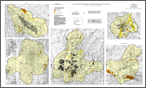 |
| IMS-8 | 1999 | preview/ download | Relative earthquake hazard maps for selected urban areas in western Oregon: Canby-Barlow-Aurora, Lebanon, Silverton-Mount Angel, Stayton-Sublimity-Aumsville, Sweet Home, Woodburn-Hubbard, by Ian P. Madin and Zhenming Wang, 1999, 22 p., 1:24,000. | 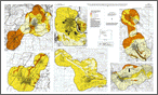 |
| IMS-7 | 1999 | preview/ download | Relative earthquake hazard maps for selected urban areas in western Oregon: Dallas, Hood River, McMinnville-Dayton-Lafayette, Monmouth-Independence, Newburg-Dundee, Sandy, Sheridan-Willamina, St. Helens-Columbia City-Scappoose, by Ian P. Madin and Zhenming Wang, 1999, 24 p., 1:24,000. Download 66 MB .zip file. Zip file contains explanatory text, metadata, map sheets, and GIS files. | 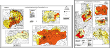 |
| IMS-6 | 1998 | PDF (5 MB) |
Water-induced landslide hazards, western portion of the Salem Hills, Marion County, Oregon, by Andrew F. Harvey and Gary L. Peterson, 1998, 13 p., 1:24,000. | 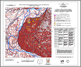 |
| IMS-5 | 2000 | PDF (5 MB) | Water-induced landslide hazards, eastern portion of the Eola Hills, Polk County, Oregon, by Andrew F. Harvey and Gary L. Peterson, 2000, 18 p., 1:24,000. |  |
| IMS-4 | 1997 | PDF (45 MB) | Map showing faults, bedrock geology, and sediment thickness of the western half of the Oregon City 1:100,000 quadrangle, Washington, Multnomah, Clackamas, and Marion Counties, Oregon, by Scott Burns, Lawrence Growney, Brett Brodersen, Robert S. Yeats, and Thomas A. Popowski, 1997, 1:100,000. |  |
| IMS-3 | 1998 | PDF (20 MB) | Tsunami hazard map of the Seaside-Gearhart area, Clatsop County, Oregon, by George R. Priest, Edward P. Myers III, Antonio M. Baptista, Robert A. Kamphaus, Brooke K. Fiedorowicz, Curt D. Peterson, and Thomas S. Horning, 1998, 1:12,000. Note: See Tsunami Inundation Map (TIM) series maps for more recent modeling. |  |
| IMS-2 | 1997 | PDF (2 MB) | Tsunami hazard map of the Yaquina Bay area, Lincoln County, Oregon, by George R. Priest, Edward P. Myers III, Antonio M. Baptista, Robert A. Kamphaus, Curt D. Peterson, and Mark E. Darienzo, 1997, 1:12,000. Note: See Tsunami Inundation Map (TIM) series maps for more recent modeling. |  |
| IMS-1 | 1997 | .zip (110 MB) | Relative earthquake hazard map of the Portland Metro Region, Clackamas, Multnomah, and Washington Counties, Oregon, by Matthew Mabey, Gerald L. Black, Ian P. Madin, Dan B. Meier, T. Leslie Youd, Celinda F. Jones, and J. Benjamin Rice, 1997, Relative Earthquake Hazard Map, 1:62,500 ; Amplification Map, 1:216,000; Liquefaction Map, 1:216,000; Slope Instability Map, 1:216,000. Includes GIS files. |  |
(last updated 06/10/2021)
