
Geologic Map Series (GMS)
Detailed maps generally prepared at 1:24,000 or smaller scales, showing bedrock, surficial, or engineering geology.
Click the up/down arrow in the table heading to sort by that column.| No. | Year | Format | Details | Thumbnail |
|---|---|---|---|---|
| GMS-129 | 2023 | preview/ download | GMS-129, Geologic map of the Athena 7.5′ Quadrangle, Umatilla County, Oregon, by Jason D. McClaughry, and Carlie J.M. Azzopardi; 2 map plates, scale 1:24,000; Esri format geodatabase; shapefiles; metadata. |   |
| GMS-127 | 2021 | preview/ download | GMS-127, Geologic map of the Dufur area, Wasco County, Oregon, by Jason D. McClaughry, Heather H. Herinckx, Clark A. Niewendorp, Carlie J.M. Azzopardi, and Joshua A. Hackett; 209 p. report; 3 map pl., scale 1:24,000; Esri format geodatabase; shapefiles; metadata; spreadsheets |   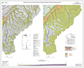 |
| GMS-122 | 2021 | preview/ download | GMS-122, Geologic Map of the Harney 7.5′ Quadrangle, Harney County, Oregon, by Robert A. Houston, Jason D. McClaughry, Carlie J.M. Azzopardi, and Mark L. Ferns; 83 p. report; 3 map pl., scale 1:24,000; Esri format geodatabase; shapefiles; metadata; spreadsheets | 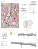 |
| GMS-126 | 2020 | preview/ download | Geologic map of the Dog River and northern part of the Badger Lake 7.5' quadrangles, Hood River County, Oregon, by Jason D. McClaughry, William E. Scott, Carlie J.M. Duda, and Richard M. Conrey; 154 p. report; 1 map plate (48 x 52 inches), scale 1:24,000; Esri format geodatabase; shapefiles; metadata; spreadsheets |  |
| GMS-125 | 2020 | preview/ download | Geologic map of the Burns Butte 7.5' quadrangle, Harney County, Oregon, by Jason D. McClaughry, Carlie J. M. Duda, and Mark L. Ferns; 163 p. report; 1 map plate (35 x 47 inches), scale 1:24,000; Esri format geodatabase; shapefiles; metadata; spreadsheets |  |
| GMS-124 | 2019 | preview/ download | Geologic map of the Biggs Junction and Rufus 7.5ʹ quadrangles, Sherman and Gilliam Counties, Oregon, by Ian P. Madin and Jason D. McClaughry; 126 p.; 1 pl., scale 1:24,000. Includes data spreadsheets, GIS data. |  |
| GMS-123 | 2019 | preview/ download | Geologic map of the Poison Creek and Burns 7.5' quadrangles, Harney County, Oregon, by Jason D. McClaughry, Carlie J. M. Duda, and Mark L. Ferns; 127 p., 2 pl., scale 1:24,000. Includes data spreadsheets, GIS data. | 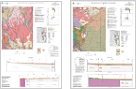 |
| GMS-122 | — | — | — | |
| GMS-121 | 2018 | Geologic map of the Devine Ridge North 7.5' quadrangle, Harney County, Oregon, by Robert A. Houston, Jason D. McClaughry, Carlie J. M. Duda, and Clark A. Niewendorp, 2018, 110 p., 1:24,000. Includes GIS data. |  |
|
| GMS-120 | 2018 | Geologic map of the Devine Ridge South 7.5' quadrangle, Harney County, Oregon, by Clark A. Niewendorp, Carlie J. M. Duda, Robert A. Houston, and Jason D. McClaughry, 2018, 65 p., 1:24,000. Includes GIS data. | 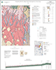 |
|
| GMS-119 | 2009 | .zip (364 MB) |
Geologic map of the Oregon City 7.5' quadrangle, Clackamas County, Oregon, by Ian P. Madin, 2009, 46 p. plus appendices, 1:24,000. Includes GIS data. |  |
| GMS-118 | 2008 | .zip | Geologic map of the Klamath Falls area, Klamath County, Oregon, by George R. Priest, Frank R. Hladky, and Robert B. Murray, 2008, 53 p., 1:24,000. Includes GIS data. |  |
| GMS-117 | 2004 | .zip | Geologic map of the Bryant Mountain and Langrell Valley quadrangles, Klamath County, Oregon, by Margaret D. Jenks, 2004, 33 p., 1:24,000. Includes GIS data. |  |
| GMS-116 | 2003 | .zip | Geologic map of the Bonanza quadrangle, Klamath County, Oregon, by Frank R. Hladky, 2003, 19 p., 1:24,000. Includes GIS data. |  |
| GMS-115 | 2003 | .zip | Geologic map of the Mt. Fanny and Little Catherine Creek quadrangles, Union and Wallowa Counties, Oregon, by Vicki S. McConnell, Ian P. Betteridge, and Mark L. Ferns, 2003, 25 p., 1:24,000. Includes GIS data. |  |
| GMS-114 | 2002 | Geologic map of the Imbler quadrangle, Union County, Oregon, by Mark L. Ferns, Ian P. Madin, Vicki S. McConnell, and J. Van Tassell, 2002, 21 p., 1:24,000. |  |
|
| GMS-113 | 1998 | Geologic map of the Fly Valley quadrangle, Union County, Oregon, by Mark L. Ferns, 1998, 11 p., 1:24,000. |  |
|
| GMS-112 | 2003 | Geologic map of the Dairy quadrangle, Klamath County, Oregon, by Frank R. Hladky, 2003, 17 p., 1:24,000. |  |
|
| GMS-111 | 1999 | Geologic map of the Summerville quadrangle, Union County, Oregon, by Mark L. Ferns and Ian P. Madin, 1999, 23 p., 1:24,000. |  |
|
| GMS-110 | 1997 | Geologic map of the Tucker Flat quadrangle, Union and Baker Counties, Oregon, by Ian P. Madin, 1997, 9 p., 1:24,000. |  |
|
| GMS-109 | 1999 | Geology and mineral resources of the Brownsboro quadrangle, Jackson County, Oregon, by Frank R. Hladky, 1999, 12 p., 1:24,000. |  |
|
| GMS-108 | 1998 | Geology and mineral resources of the Rio Canyon quadrangle, Jackson County, Oregon, by Frank R. Hladky, 1998, 12 p., 1:24,000. |  |
|
| GMS-107 | n/a | n/a | never published | |
| GMS-106 | 1996 | .zip | Geology and mineral resources map of the Grizzly Peak quadrangle, Jackson County, Oregon, by Frank R. Hladky, 1996, 17 p., 1:24,000. |  |
| GMS-105 | 1996 | .zip | Relative earthquake hazard maps of the Salem East and Salem West quadrangles, Marion and Polk Counties, Oregon, by Yumei Wang and William J. Leonard, 1996, 10 p., 1:24,000. |  |
| GMS-104 | 1996 | .zip | Relative earthquake hazard map of the Linnton quadrangle, Multnomah and Washington Counties, Oregon, by Matthew A. Mabey, Ian P. Madin, Gerald L. Black, and Dan B. Meier, 1996, 6 p., Earthquake Hazard Map, 1:24,000; Amplification Map, 1:55,000; Liquefaction Map, 1:55,000; Slope Instability Map, 1:55,000. Includes GIS files. |  |
| GMS-103 | 2002 | .zip | Geologic map of the Richter Mountain quadrangle, Douglas and Jackson Counties, Oregon, by Robert B. Murray and M. Allan Kays, 2002, 26 p., 1:24,000. Includes metadata. |  |
| GMS-102 | 2002 | .zip | Geologic map of the Keno quadrangle, Klamath County, Oregon, by Frank R. Hladky and Stanley A. Mertzman, 2002, 15 p., 1:24,000. Includes GIS files. |  |
| GMS-101 | 1996 | .zip | Geologic map of the Steelhead Falls quadrangle, Deschutes and Jefferson Counties, Oregon, by Mark L. Ferns, Donald A. Stensland, and Gary A. Smith, 1996, 10 p., 1:24,000. Includes GIS files. |  |
| GMS-100 | 1996 | Earthquake hazard maps for Oregon, by Ian P. Madin and Matthew A. Mabey, 1996, Earthquake Faults Map; Ground Shaking Map, 500 Years; Ground Shaking Map, 1000 Years; Ground Shaking Map, 2500 Years |  |
|
| GMS-99 | 1995 | Tsunami hazard map of the Siletz Bay area, Lincoln County, Oregon, by George R. Priest, Ming Qi, Antonio M. Baptista, Curt D. Peterson, and Mark E. Darienzo, 1995, 1:12,000. |  |
|
| GMS-98 | 1995 | .zip | Reconnaissance geologic map of the Dora and Sitkum quadrangles, Coos County, Oregon, by Thomas J. Wiley, 1995, 5 p., 1:24,000. |  |
| GMS-97 | 1995 | Geologic map of the Coos Bay quadrangle, Coos County, Oregon, by Gerald L. Black and Ian P. Madin, 1995, 6 p., 1:24,000. |  |
|
| GMS-96 | 2004 | .zip | Geologic map of the Fort Klamath quadrangle, Klamath County, Oregon, by Thomas J. Wiley, 2004, 24 p., 1:24,000. |  |
| GMS-95 | 1998 | Geology of the Henkle Butte quadrangle, Deschutes County, Oregon, by Edward M. Taylor, 1998, 5 p., 1:24,000. |  |
|
| GMS-94 | 1995 | Geologic map of the Charleston quadrangle, Coos County, Oregon, by Ian P. Madin, Galan W. McInelly, and Harvey M. Kelsey, 1995, 8 p., 1:24,000. |  |
|
| GMS-93 | 1995 | Relative earthquake hazard maps of the Siletz Bay area, coastal Lincoln County, Oregon, by Yumei Wang and George R. Priest, 1995, 13 p., 93-1, 1:24,000; 93-2, 1:24,000; 93-3, 1:12,000; 93-4, 1:12,000. Includes GIS files. |  |
|
| GMS-92 | 1995 | Relative earthquake hazard map of the Gladstone quadrangle, Clackamas and Multnomah Counties, Oregon, by Matthew A. Mabey, Ian P. Madin, and Dan B. Meier, 1995, 5 p., 1:24,000. |  |
|
| GMS-91 | 1995 | Relative earthquake hazard map of the Lake Oswego quadrangle, Clackamas, Multnomah, and Washington Counties, Oregon, by Matthew A. Mabey, Ian P. Madin, and Dan B. Meier, 1995, 6 p., 1:24,000. Includes GIS files. |  |
|
| GMS-90 | 1995 | .zip | Relative earthquake hazard map of the Beaverton quadrangle, Washington County, Oregon, by Matthew A. Mabey, Ian P. Madin, and Dan B. Meier, 1995, 6 p., 1:24,000. Includes GIS files. |  |
| GMS-89 | 1995 | Relative earthquake hazard map of the Mount Tabor quadrangle, Multnomah County, Oregon, and Clark County, Washington, by Matthew A. Mabey, Dan B. Meier, and Stephen P. Palmer, 1995, 5 p., 1:24,000. |  |
|
| GMS-88 | 1994 | .zip | Geologic map of the Lakecreek quadrangle, Jackson County, Oregon, by Frank R. Hladky, 1994, 9 p., 1:24,000. Includes GIS files. |  |
| GMS-87 | 1995 | .zip | Geologic map of the Three Creek Butte quadrangle, Deschutes County, Oregon, by Edward M. Taylor and Mark L. Ferns, 1995, 8 p., 1:24,000. Includes GIS files. |  |
| GMS-86 | 1994 | .zip | Geologic map of the Tenmile quadrangle, Douglas County, Oregon, by Thomas J. Wiley and Gerald L. Black, 1994, 5 p., 1:24,000. Includes GIS files. |  |
| GMS-85 | 1994 | Geologic map of the Mount Gurney quadrangle, Douglas and Coos Counties, Oregon, by Thomas J. Wiley, George R. Priest, and Gerald L. Black, 1994, 5 p., 1:24,000. |  |
|
| GMS-84 | 1994 | Geologic map of the Remote quadrangle, Coos County, Oregon, by Gerald L. Black, 1994, 8 p., 1:24,000. |  |
|
| GMS-83 | 1994 | .zip | Geologic map of the Kenyon Mountain quadrangle, Douglas County, Oregon, by Gerald L. Black, 1994, 9 p., 1:24,000. Includes GIS files. |  |
| GMS-82 | 1994 | .zip | Geology and mineral resources map of the Limber Jim Creek quadrangle, Union County, Oregon, by Mark L. Ferns and William H. Taubeneck, 1994, 6 p., 1:24,000. Includes GIS files. |  |
| GMS-81 | 1994 | Geology and Mineral Resource Map of the Tumalo Dam quadrangle, Deschutes County, Oregon, by Edward M. Taylor and Mark L. Ferns, 1994, 4 p., 1:24,000. |  |
|
| GMS-80 | 1993 | .zip | Geology and mineral resources map of the McLeod quadrangle: Jackson County, Oregon, by Frank R. Hladky, 1993, 8 p., 1:24,000. Includes GIS files. |  |
| GMS-79 | 1993 | PDF (117 MB) | Earthquake hazard maps of the Portland quadrangle, Multnomah and Washington Counties, Oregon, and Clark County, Washington, by Matthew A. Mabey, Ian P. Madin, T. Leslie Youd, and Celinda F. Jones, 1993, 98 p., 1:24,000. |  |
| GMS-78 | 1993 | .zip | Geologic map of the Mahogany Mountain 30 x 60 Minute quadrangle, Malheur County, Oregon, and Owyhee County, Idaho, by Mark L. Ferns, James G. Evans, and Michael L. Cummings, 1993, 12 p., 1:100,000. Includes GIS files. |  |
| GMS-77 | 1993 | Geologic map of the Vale 30 x 60 minute quadrangle, Malheur County, Oregon, and Owyhee County, Idaho, by Mark L. Ferns, Howard C. Brooks, James G. Evans, and Michael L. Cummings, 1993, 12 p., 1:100,000. |  |
|
| GMS-76 | 1993 | Geologic map of the Camas Valley quadrangle, Douglas and Coos Counties, Oregon, by Gerald L. Black and George R. Priest, 1993, 4 p., 1:24,000. |  |
|
| GMS-75 | 1991 | Geologic map of the Portland quadrangle, Multnomah and Washington Counties, Oregon, and Clark County, Washington, by Marvin H. Beeson, Terry L. Tolan, and Ian P. Madin, 1991, 1:24,000. |  |
|
| GMS-74 | 1992 | Geology and mineral resources map of the Namorf quadrangle, Malheur County, Oregon, by Mark L. Ferns and James P. O'Brien, 1992, 1:24,000. |  |
|
| GMS-73 | 1993 | Geology and mineral resources map of the Cleveland Ridge quadrangle, Jackson County, Oregon, by Thomas J. Wiley, 1993, 5 p., 1:24,000. |  |
|
| GMS-72 | 1992 | Geology and mineral resources map of the Little Valley quadrangle, Malheur County, Oregon, by Howard C. Brooks and James P. O'Brien, 1992, 1:24,000. |  |
|
| GMS-71 | 1992 | Geology and mineral resources map of the Westfall quadrangle, Malheur County, Oregon, by Howard C. Brooks and James P. O'Brien, 1992, 1:24,000. |  |
|
| GMS-70 | 1992 | Geology and mineral resources map of the Boswell Mountain quadrangle, Jackson County, Oregon, by Thomas J. Wiley and Frank R. Hladky, 1992, 1:24,000. |  |
|
| GMS-69 | 1992 | Geology and mineral resources map of the Harper quadrangle, Malheur County, Oregon, by Mark L. Ferns and James P. O'Brien, 1992, 1:24,000. |  |
|
| GMS-68 | 1990 | Geologic map of the Reston quadrangle, Douglas County, Oregon, by Gerald L. Black, 1990, 4 p., 1:24,000. |  |
|
| GMS-67 | 1990 | Geology and mineral resources map of the South Mountain quadrangle, Malheur County, Oregon, by James G. Evans, 1990, 1:24,000. |  |
|
| GMS-66 | 1990 | Geology and mineral resources map of the Jonesboro quadrangle, Malheur County, Oregon, by James G. Evans, 1990, 1:24,000. |  |
|
| GMS-65 | 1990 | Geology and mineral resources map of the Mahogany Gap quadrangle, Malheur County, Oregon, by Norman S. MacLeod, 1990, 1:24,000. |  |
|
| GMS-64 | 1990 | Geology and Mineral Resource Map of the Sheaville quadrangle, Malheur County, Oregon and Owyhee County, Idaho, by Norman S. MacLeod, 1990, 1:24,000. |  |
|
| GMS-63 | 1991 | Geology and mineral resources map of the Vines Hill quadrangle, Malheur County, Oregon, by Howard C. Brooks, 1991, 1:24,000. |  |
|
| GMS-62 | 1992 | Geology and mineral resources map of the Elbow quadrangle, Malheur County, Oregon, by Mark L. Ferns and Michael L. Cummings, 1992, 1:24,000. |  |
|
| GMS-61 | 1990 | Geology and mineral resources map of the Mitchell Butte quadrangle, Malheur County, Oregon, by Mark L. Ferns and Kevin M. Urbanczyk, 1990, 1:24,000. |  |
|
| GMS-60 | 1994 | Geologic map of the Damascus quadrangle, Clackamas, and Multnomah Counties, Oregon, by Ian P. Madin, 1994, 9 p., 1:24,000. |  |
|
| GMS-59 | 1989 | Geologic map of the Lake Oswego quadrangle, Clackamas, Multnomah, and Washington Counties, Oregon, by Marvin H. Beeson, Terry L. Tolan, and Ian P. Madin, 1989, 1:24,000. |  |
|
| GMS-58 | 1989 | Geology and mineral resources map of the Double quadrangle, Malheur County, Oregon, by Len Ramp and Mark L. Ferns, 1989, 1:24,000. |  |
|
| GMS-57 | 1989 | Geology and mineral resources map of the Grassy Mountain quadrangle, Malheur County, Oregon, by Mark L. Ferns and Len Ramp, 1989, 1:24,000. |  |
|
| GMS-56 | 1989 | Geology and mineral resources map of the Adrian quadrangle, Malheur County, Oregon, and Canyon and Owyhee Counties, Idaho, by Mark L. Ferns, 1989, 1:24,000. |  |
|
| GMS-55 | 1989 | Geology and mineral resources map of the Owyhee Dam quadrangle, Malheur County, Oregon, by Mark L. Ferns, 1989, 1:24,000. |  |
|
| GMS-54 | 1989 | Geology and mineral resources map of the Graveyard Point quadrangle, Malheur County, Oregon, and Owyhee County, Idaho, by Mark L. Ferns, 1989, 1:24,000. |  |
|
| GMS-53 | 1998 | Geology and mineral resources map of the Owyhee Ridge quadrangle, Malheur County, Oregon, by Mark L. Ferns, 1988, 1:24,000. |  |
|
| GMS-52 | 1992 | Geology and Mineral Resource Map of the Shady Cove quadrangle, Jackson County, Oregon, by Frank R. Hladky, 1992, 1:24,000. |  |
|
| GMS-51 | 1986 | Geologic map of the Elk Prairie quadrangle, Marion and Clackamas Counties, Oregon, by William N. Orr and Paul R. Miller, 1986, 1:24,000. |  |
|
| GMS-50 | 1986 | Geologic map of the Drake Crossing quadrangle, Marion County, Oregon, by William N. Orr and Paul R. Miller, 1986, 1:24,000. |  |
|
| GMS-49 | 1986 | Map of Oregon seismicity, 1841-1986, by Randall S. Jacobson, 1986, 1:1,000,000. |  |
|
| GMS-48 | 1988 | Geologic map of the McKenzie Bridge quadrangle, Lane County, Oregon, by George R. Priest, Gerald L. Black, Neil M. Woller, and Edward M. Taylor, 1988, 5 p., Plate 1, 1:62,500; Plate 2, 1:250,000. | 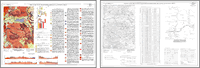 |
|
| GMS-47 | 1987 | Geologic map of the Crescent Mountain area, Linn County, Oregon, by Gerald L. Black, Neil M. Woller, and Mark L. Ferns, 1987, 1:62,500. | 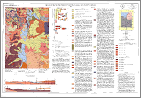 |
|
| GMS-46 | 1987 | Geologic map of the Breitenbush River area, Linn and Marion Counties, Oregon, by George R. Priest, Neil M. Woller, and Mark L. Ferns, 1987, 4 p., 1:62,500. | 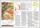 |
|
| GMS-45 | 1987 |
Geologic map of the Madras West and Madras East quadrangles, Jefferson County, Oregon, by Gary A. Smith, 1987, 1:24,000. | 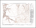 |
|
| GMS-44 | 1987 | Geologic map of the Seekseequa Junction and a portion of the Metolius Bench quadrangles, Jefferson County, Oregon, by Gary A. Smith, 1987, 1:24,000. |  |
|
| GMS-43 | 1987 | Geologic map of the Eagle Butte and Gateway quadrangles, Jefferson and Wasco Counties, Oregon, by Gary A. Smith and Glenn A. Hayman, 1987, 1:24,000. |  |
|
| GMS-42 | 1986 | Geologic map of the ocean floor off Oregon and the adjacent continental margin, by Carolyn P. Peterson, LaVerne D. Kulm, and Jerry J. Gray, 1986, 4 p., 1:500,000. |  |
|
| GMS-41 | 1987 | Geology and mineral resources map of the Elkhorn Peak quadrangle, Baker County, Oregon, by Mark L. Ferns, Howard C. Brooks, Dan G. Avery, and Charles D. Blome, 1987, 1:24,000. |  |
|
| GMS-40 | 1985 | Total field aeromagnetic anomaly maps: Cascade Mountain Range, northern Oregon, by Richard W. Couch, M. Gemperle, and R. Peterson, 1985, 1:250,000. | 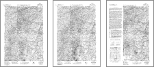 |
|
| GMS-39 | 1985 | Geologic bibliography and index maps of the ocean floor off Oregon and the adjacent continental margin, by Carolyn P. Peterson, LaVerne D. Kulm, and Jerry J. Gray, 1985, Geologic Map Series 39-A, 1:1,000,000; Geologic Map Series 39-B, 1:2,000,000. |  |
|
| GMS-38 | 1986 | .zip | Geologic map of the northwest quarter of the Cave Junction quadrangle, Josephine County, Oregon, by Len Ramp, 1986, 1:24,000. Includes GIS files. |  |
| GMS-37 | 1985 | Mineral resources map, offshore Oregon, by Jerry J. Gray and LaVerne D. Kulm, 1985, 1:500,000. |  |
|
| GMS-36 | 1984 | Mineral resources map of Oregon, by Mark L. Ferns and Donald F. Huber, 1984, 1:500,000. |  |
|
| GMS-35 | 1984 | Geology and gold deposits map of the southwest quarter of the Bates quadrangle, Grant County, Oregon, by Howard C. Brooks, Mark L. Ferns, and Dan G. Avery, 1984, 1:24,000. |  |
|
| GMS-34 | 1984 | Geologic map of the Stayton NE quadrangle, Oregon, by Paul R. Miller and William N. Orr, 1984, 1:24,000. |  |
|
| GMS-33 | 1984 | Geologic map of the Scotts Mills quadrangle, Oregon, by Paul R. Miller and William N. Orr, 1984, 1:24,000. |  |
|
| GMS-32 | 1984 | Geologic map of the Wilhoit quadrangle, Oregon, by Paul R. Miller and William N. Orr, 1984, 1:24,000. |  |
|
| GMS-31 | 1984 | Geology and gold deposits map of the northwest quarter of the Bates quadrangle, Grant County, Oregon, by Mark L. Ferns, Howard C. Brooks, and G. R. Wheeler, 1984, 1:24,000. |  |
|
| GMS-30 | 1984 | Geologic map of the southeast quarter of the Pearsoll Peak quadrangle, Curry and Josephine Counties, Oregon, by Len Ramp, 1984, 1:24,000. |  |
|
| GMS-29 | 1983 | Geology and gold deposits map of the northeast quarter of the Bates quadrangle, Baker and Grant Counties, Oregon, by Howard C. Brooks, Mark L. Ferns, G. R Wheeler, and Dan G. Avery, 1983, 1:24,000. | 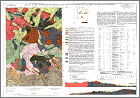 |
|
| GMS-28 | 1983 | Geology and gold deposits map of the Greenhorn quadrangle, Baker and Grant Counties, Oregon, by Mark L. Ferns, Howard C. Brooks, and Dan G. Avery, 1983, 1:24,000. | 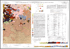 |
|
| GMS-27 | 1982 | Geologic and neotectonic evaluation of north-central Oregon: The Dalles 1 degree by 2 degree quadrangle, by James L. Bela, 1982, 1:250,000. |  |
|
| GMS-26 | 1982 | PDF (133 MB) | Residual gravity maps of the northern, central, and southern Cascade Range, Oregon, 121°00' to 122°30'W. by 42°00' to 45°45'N., by Richard W. Couch, G. Stephen Pitts, M. Gemperle, C. A. Veen, and David E. Braman, 1982, 1:250,000. |  |
| GMS-25 | 1982 | Geology and gold deposits of the Granite quadrangle, Grant County, Oregon, by Howard C. Brooks, Mark L. Ferns, and E. D. Mullen, 1982, 1:24,000. |  |
|
| GMS-24 | 1982 | Geologic map of the Grand Ronde quadrangle, Polk and Yamhill Counties, Oregon, by Michael E. Brownfield, 1982, 1:24,000. |  |
|
| GMS-23 | 1982 | .zip | Geologic map of the Sheridan quadrangle, Polk and Yamhill Counties, Oregon, by Michael E. Brownfield, 1982, 1:24,000. Includes GIS files. |  |
| GMS-22 | 1982 | Geology and mineral resources map of the Mt. Ireland quadrangle, Baker and Grant Counties, Oregon, by Mark L. Ferns, Howard C. Brooks, and J. Ducette, 1982, 1:24,000. |  |
|
| GMS-21 | 1982 | Map showing geology and geothermal resources of the Vale East 7 1/2 minute quadrangle, Oregon, by David E. Brown, 1982, 1:24,000. |  |
|
| GMS-20 | 1982 | Map showing geology and geothermal resources of the southern half of the Burns 15 minute quadrangle, Oregon, by David E. Brown, 1982, 1:24,000. |  |
|
| GMS-19 | 1982 | Geology and gold deposits of the Bourne quadrangle, Baker and Grant Counties, Oregon, by Howard C. Brooks, Mark L. Ferns, R. I. Coward, E. K. Paul, and M. Nunlist, 1982, 1:24,000. |  |
|
| GMS-18 | 1981 | Geology of the Rickreall, Salem West, Monmouth, and Sidney 7 1/2 minute quadrangles, Marion, Polk, and Linn Counties, Oregon, by James L. Bela, 1981, 1:24,000. |  |
|
| GMS-17 | 1981 | Total field aeromagnetic anomaly map: Cascade Mountain Range, southern Oregon, by Richard W. Couch, M. Gemperle, W. H. McLain, and G. G. Connard, 1981, 1:250,000. |  |
|
| GMS-16 | 1981 | Free-air gravity anomaly map and complete Bouguer gravity anomaly map: Cascade Mountain Range, southern Oregon, by Richard W. Couch, G. Stephen Pitts, C. A. Veen, and M. Gemp, 1981, 1:250,000. |  |
|
| GMS-15 | 1981 | Free-air anomaly map and complete Bouguer gravity anomaly map: Cascade Mountain Range, northern Oregon, by Richard W. Couch, G. Stephen Pitts, David E. Braman, and M. Gemperle, 1981, 1:250,000. |  |
|
| GMS-14 | 1981 | preview / download | Index to published geologic mapping in Oregon, 1898-1979, by C. A. Schumacher, 1981, 1:100,000. |  |
| GMS-13 | 1979 | Geologic map of Huntington and part of Olds Ferry quadrangles, Oregon, by Howard C. Brooks, 1979, 11 p., 1:62,500. |  |
|
| GMS-12 | 1979 | Geologic map of the Oregon part of the Mineral quadrangle, by Howard C. Brooks, 1979, 1:62,500. |  |
|
| GMS-11 | 1978 | Preliminary geothermal resource map of Oregon, by Joseph F. Riccio, 1978, 1:500,000. |  |
|
| GMS-10 | 1978 | Low- to intermediate-temperature thermal springs and wells in Oregon, by Richard G. Bowen, Norman V. Peterson, and Joseph F. Riccio, 1978, 1:1,013,760. |  |
|
| GMS-9 | 1978 | Total field aeromagnetic anomaly map: Cascade Mountain Range, central Oregon, by Richard W. Couch, M. Gemperle, and G. Connard, 1978, 1:125,000. |  |
|
| GMS-8 | 1976 | Complete Bouguer gravity anomaly map, Cascade Mountain Range, central Oregon, by G. Stephen Pitts, and Richard W. Couch, 1976, 1:125,000. |  |
|
| GMS-7 | 1976 | Geology of the Oregon part of the Baker 1 degree by 2 degree quadrangle, by Howard C. Brooks, James R. McIntyre, and George W. Walker, 1976, 25 p., 1:250,000. |  |
|
| GMS-6 | 1974 | A preliminary report on the geology of part of the Snake River Canyon, Oregon and Idaho, by Tracy L. Vallier, 1974, 15 p., 1:125,000. |  |
|
| GMS-5 | 1971 | Geology of the Powers quadrangle, Oregon, by Ewart M. Baldwin and Paul D. Hess, 1971, 1:62,500. |  |
|
| GMS-4 | 1967 | (a) Free-air gravity anomaly map of Oregon, by Joseph W. Berg, Jr. and John V. Thiruvathukal, 1967, 1:500,000. (b) Complete Bouguer gravity anomaly map of Oregon, by Joseph W. Berg, Jr. and John V. Thiruvathukal, 1967, 1:500,000. (c) Free-air gravity anomaly map west of Oregon, by P. Dehlinger, W. A. Rinehart, Richard W. Couch, and M. Gemperle, 1967, 1:500,000. |
 |
|
| GMS-3 | 1967 | Preliminary geologic map of the Durkee quadrangle, Oregon, by Harold J. Prostka, 1967, 2 p., 1:62,500. |  |
|
| GMS-2 | 1962 | Geology of the Mitchell Butte quadrangle, Oregon, by Raymond E. Corcoran, R. A. Doak, P. W. Porter, F. I. Pritchett, and N. C. Privrasky, 1962, 14 p., 1:126,720. |  |
|
| GMS-1 | 1962 | Geology of the Sparta quadrangle, Oregon, by Harold J. Prostka, 1962, 2 p., 1:62,500. |  |
(last updated 03/31/2023)
